Spring Loop
- 4.5 mi
- loop
- 382 ft
- climb
- 7,610 ft
- high point
- Loop
- route
- Apr–Oct
- best months
Is SPRING LOOP open right now?
Closure in the area
There's a closure order in Apache-Sitgreaves National Forests. It doesn't name SPRING LOOP, so check the source for the area it covers (2 listed).
Temporary Emergency Closure
Agency closure covering Apache-Sitgreaves National Forests · Order 03-01-26-004 · USFS · Apache-Sitgreaves National Forests
Benny Creek Campground/Southfork Day Use Area Closure Order - Springerville Ranger District
Agency closure covering Apache-Sitgreaves National Forests · Order 03-01-25-06-004 · USFS · Apache-Sitgreaves National Forests
Forest Road Conditions Alert
Agency alert covering Apache-Sitgreaves National Forests · USFS · Apache-Sitgreaves National Forests
No Fire Restrictions
Agency alert covering Apache-Sitgreaves National Forests · USFS · Apache-Sitgreaves National Forests
As of · Source: USFS · Apache-Sitgreaves National Forests. Agencies don't list every closure — check before you go.
Spring Loop is a 4.5-mile loop hike in the Black Mesa Ranger District of the Apache-Sitgreaves National Forests in eastern Arizona, managed by the Forest Service. The trail is rated easy, with a total elevation gain of 382 feet and a steady climb that reaches a high point of 7610 feet. The route starts at about 7552 feet and returns to a similar elevation, so the total gain and loss are each about 382 feet. The steepest stretch comes at about 2.4 miles in, with a grade of about 7 percent. For comfortable weather, aim for late spring or early fall. Typical averages from a nearby weather station at Heber put May highs around 71°F and September highs around 75°F, while winter highs sit in the mid-40s. The trail sits close to other outdoor options. The Dare Me mountain biking trailhead is about 0.1 mile away, and the Rim Run cross-country ski route is about 0.4 mile away. Canyon Point campground is about 1.2 miles off, and Willow Springs Lake Fishing and Boating Site is about 4.7 miles away.
 Dare MeMountain bikingPhoto: cogdogblog, CC BY 2.0 (via Wikimedia Commons)0.1 mi
- MellowMountain biking0.3 mi
- Rim RunCross-country skiing0.4 mi
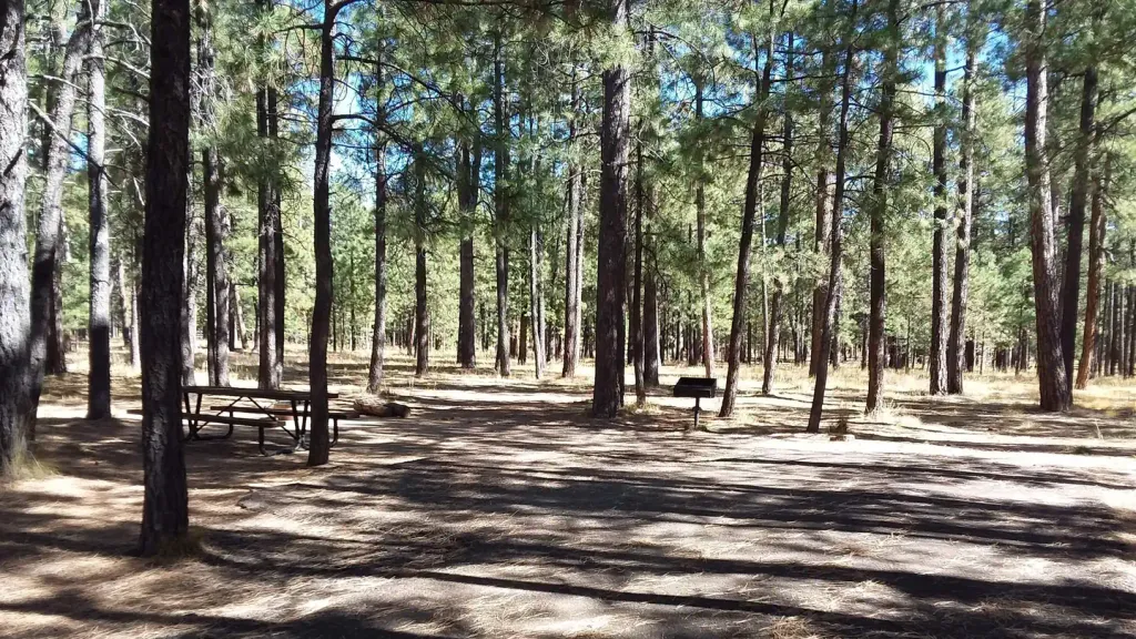 Canyon PointCampingPhoto: Recreation.gov (RIDB) / public domain1.2 mi
- Larson Ridge CgCamping1.7 mi
- Upper Canyon CreekCamping2.4 mi
- Willow Springs Lake Fishing and Boating SiteLake fishing4.7 mi
- Black Canyon Lake Fishing and Boating SiteLake fishing5.9 mi
Source: Roamze catalog (indexable pages within 10 miles, PostGIS distance)
 Fisherman Trail #501Hiking · ~8 min drivePhoto: cogdogblog, Public Domain Dedication (CC0) (via Flickr)
 Rim Lakes Vista Trail #622Hiking · ~13 min drivePhoto: Ktr101, CC BY-SA 2.0 (via Flickr)
 Military Sinkhole Trail #179Hiking · ~14 min drivePhoto: Ktr101, CC BY-SA 2.0 (via Flickr)
 Gray WolfHiking · ~9 min drivePhoto: Šarūnas Burdulis, CC BY-SA 2.0 (via Flickr)
 Woods Canyon LakeHiking · ~14 min drivePhoto: cogdogblog, CC BY 2.0 (via Flickr)
 General George Crook National Recreation TrailHiking · ~9 min drivePhoto: Šarūnas Burdulis from USA, CC BY-SA 2.0 (via Wikimedia Commons)
- 235 RoadHiking · ~9 min drivePhoto: Šarūnas Burdulis, CC BY-SA 2.0 (via Flickr)
 Aspen Trail 411Hiking · ~17 min drivePhoto: cogdogblog, CC BY 2.0 (via Flickr)
- DansHiking · ~14 min drive
 Rocky BluffHiking · ~10 min drivePhoto: USDAgov, Public Domain Mark (via Flickr)
Best time to visit SPRING LOOP
Best months: April–October. Best months have typical highs of 55–85 °F, lows of 30 °F or warmer (32 °F where the station doesn't record snow), at most one snowy day and no more than 12 wet days.
Jan
46° / 20°
Feb
50° / 23°
Mar
57° / 28°
Apr
64° / 32°
May
71° / 39°
Jun
82° / 48°
Jul
83° / 56°
Aug
81° / 55°
Sep
75° / 47°
Oct
67° / 36°
Nov
55° / 27°
Dec
46° / 20°
Typical high / low (°F) and days with rain or snow, 1991–2020. Measured at Heber (Black Mesa) Rs, AZ, 14.9 mi away at 6,590 ft. The station sits about 1,000 ft lower than this place, so expect it a little cooler here. This station doesn't record snowfall. Source: NOAA NCEI U.S. Climate Normals 1991–2020.
