Crescent Moon Ranch Cabin
Campground
Sites open the weekend of Nov 27 on Recreation.gov
Closure in the area
There's a closure order in Red Rock Ranger District. It doesn't name Kaibab #172A, so check the source for the area it covers (2 listed).
Red Rock Ranger District affected by severe flooding; many closures in effect
Agency closure covering Red Rock Ranger District · USFS · Red Rock Ranger District
Banjo Bill Picnic Area Closure
Agency closure covering Red Rock Ranger District · Order 03-04-06-25-01 · USFS · Red Rock Ranger District
West Fork Temporary Area Closure - Extension to 2/27/27
Agency alert covering Coconino National Forest · Order 03-04-00-26-09 · USFS · Coconino National Forest
West Sedona Camping and Campfire Restrictions
Agency alert covering Red Rock Ranger District · Order 03-04-06-26-04 · USFS · Red Rock Ranger District
Sedona/ Oak Creek Canyon Camping and Campfire Restrictions
Agency alert covering Red Rock Ranger District · Order 03-04-06-23-03 · USFS · Red Rock Ranger District
As of · Source: USFS · Red Rock Ranger District. Agencies don't list every closure — check before you go.
Kaibab #172A is a short, easy hike in the Red Rock Ranger District of Coconino National Forest in northern Arizona, about 0.29 miles long with a total elevation gain of just 2 feet. The Forest Service manages the land, and the trail is an out-and-back that starts and ends at nearly the same elevation, with the high point at about 4,418 feet. Spring and fall are the most comfortable times to go. Typical averages from a nearby weather station in Sedona show October highs around 79°F with lows near 51°F, and April highs around 75°F with lows near 44°F. Summer highs there typically reach the mid-90s. The trail is a convenient stop for riders and hikers heading to the Kaibab Trail and Slim Shady Trail, both about 0.1 miles away. Climbers can find Bell Rock / Courthouse Butte about 0.6 miles off, and Crescent Moon Ramada offers camping about 2.5 miles away.
Crescent Moon Ranch Cabin
Campground
Red Chopstick
Restaurant
Stan Rose Images
Gallery
Places © OpenStreetMap contributors
More in Kachina VillageNot on Roamze yet. Their page has how to reach them.
 KaibabMountain bikingPhoto: Bernard Spragg. NZ from Christchurch, New Zealand, Public domain (via Wikimedia Commons)0.1 mi
 Bell Rock / Courthouse ButteRock climbingPhoto: Brady Smith; Coconino National Forest, CC BY-SA 2.0 (via Wikimedia Commons)0.6 mi
 Castle TowersRock climbingPhoto: Qygen, CC BY-SA 3.0 (via Wikimedia Commons)1 mi
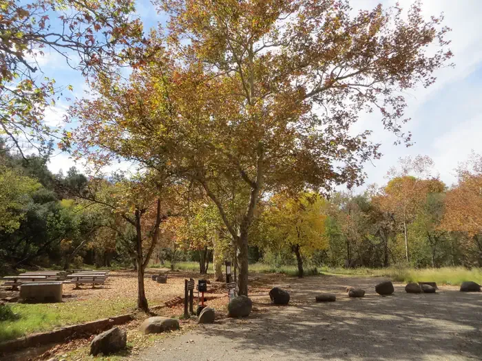 Chavez CrossingCampingPhoto: Recreation.gov (RIDB) / public domain2.5 mi
Source: Roamze catalog (indexable pages within 10 miles, PostGIS distance)
 Basalt #172DHiking · Next doorPhoto: dconvertini, CC BY-SA 2.0 (via Flickr)
 Hiline #193Hiking · Next doorPhoto: dconvertini, CC BY-SA 2.0 (via Flickr)
 Coconino Spur #172CHiking · Next doorPhoto: dconvertini, CC BY-SA 2.0 (via Flickr)Taint trailHiking · Next doorPhoto: dconvertini, CC BY-SA 2.0 (via Flickr)Coconino #172BHiking · Next doorPhoto: dconvertini, CC BY-SA 2.0 (via Flickr)
 Castle Rock Social TrailHiking · ~2 min drivePhoto: Michal Huniewicz, CC BY 3.0 (via Wikimedia Commons)
 Phone #96AHiking · Next doorPhoto: dconvertini, CC BY-SA 2.0 (via Flickr)
 Belt Rock Pathway #96Hiking · ~2 min drivePhoto: Coconino National Forest, CC BY-SA 2.0 (via Wikimedia Commons)
 Hermit #172EHiking · Next doorPhoto: dconvertini, CC BY-SA 2.0 (via Flickr)Templeton #156Hiking · Next doorPhoto: dconvertini, CC BY-SA 2.0 (via Flickr)
Also worth it near here
KaibabMountain biking · Next doorPhoto: Bernard Spragg. NZ from Christchurch, New Zealand, Public domain (via Wikimedia Commons)Bell Rock / Courthouse ButteRock climbing · ~1 min drivePhoto: Brady Smith; Coconino National Forest, CC BY-SA 2.0 (via Wikimedia Commons) Bell RockSummit · ~1 min drivePhoto: Josep Renalias, CC BY-SA 3.0 (via Wikimedia Commons)
Best months: October–May. Best months have typical highs of 55–85 °F, lows of 30 °F or warmer (32 °F where the station doesn't record snow), at most one snowy day and no more than 12 wet days.
Jan
58° / 34°
5 wet
Feb
61° / 36°
6 wet
Mar
67° / 40°
6 wet
Apr
75° / 44°
3 wet
May
84° / 53°
3 wet
Jun
94° / 61°
2 wet
Jul
97° / 68°
6 wet
Aug
94° / 67°
9 wet
Sep
89° / 61°
5 wet
Oct
79° / 51°
3 wet
Nov
67° / 41°
4 wet
Dec
58° / 33°
4 wet
Typical high / low (°F) and days with rain or snow, 1991–2020. Measured at Sedona, AZ, 6.1 mi away at 4,220 ft. This station doesn't record snowfall. Source: NOAA NCEI U.S. Climate Normals 1991–2020.
Map and trail data © OpenStreetMap contributors
