Paiute Wilderness Area
- Mar–May, Sep–Nov
- best months
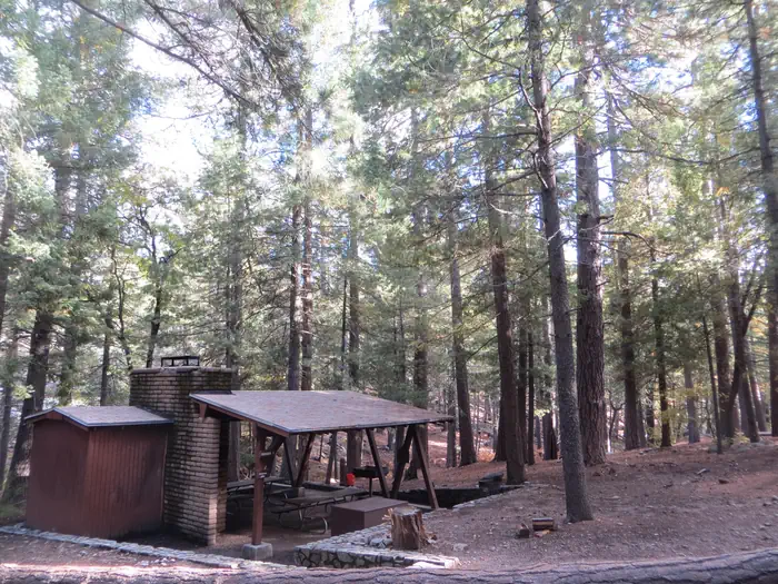
The 87,900-acre Paiute Wilderness, several miles southwest of St. George, Utah, dominates the northwest portion of the Arizona Strip. It is separated from the Beaver Dam Mountains Wilderness to the north by Interstate 15.The Virgin Mountains form the backbone of this area rising over 5,600 feet from the desert floor. Mt. Bangs, the highest peak in the area at 8,012 feet, provides a commanding view of the area and the Basin and Range country to the west. Part of the wilderness is in the Arizona Strip Field Office and part in the Grand Canyon-Parashant National Monument.The area's vegetation varies, ranging from ponderosa on top of Mt. Bangs, through pinyon forests, to scrub oak and sagebrush, and at the area's perimeter, Joshua trees, yucca and barrel cactus. These ecotypes host over 250 animal species including mule deer, mountain lion, desert bighorn sheep and desert tortoise. The deep canyons have several beautiful and secret places with water which attract campers and backpackers.Motorized equipment and equipment used for mechanical transport are generally prohibited on all federal lands designated as wilderness. This includes the use of motor vehicles (including OHVs), motorboats, bicycles, hang gliders, wagons, carts, portage wheels, and the landing of aircraft including helicopters and drones. Contact the agency for more information about regulations.
Local outfitters
- Hillside Palms RV Park25 mi away
- St George RV Park & Campgrounds27 mi away
Not on Roamze yet. Their page has how to reach them.
 Warm-up WallRock climbingPhoto: randomduck, CC BY-SA 2.0 (via Flickr)7.5 mi
- Blasphemy WallRock climbingPhoto: randomduck, CC BY-SA 2.0 (via Flickr)7.5 mi
- Sun CaveRock climbingPhoto: randomduck, CC BY-SA 2.0 (via Flickr)7.5 mi
 Virgin RiverCanoeingPhoto: Stan Shebs, CC BY-SA 3.0 (via Wikimedia Commons)7.8 mi
- Mentor CaveRock climbing8.2 mi
- Planet Earth WallRock climbing8.2 mi
- Sun WallRock climbing8.2 mi
 Black Rock TrailHikingPhoto: Ken Lund from Reno, Nevada, USA, CC BY-SA 2.0 (via Wikimedia Commons)8.8 mi
Source: Roamze catalog (indexable pages within 10 miles, PostGIS distance)
- Ivins ReservoirLake fishing · ~45 min drive
- Black Knolls ReservoirLake fishing · ~48 min drive
- Sand Hollow ReservoirLake fishing · ~56 min drive
- Bowman ReservoirLake fishing · ~1h 6m drive
- Baker ReservoirLake fishing · ~1h 10m drive
- Lake MeadLake fishing · ~1h 11m drive
- Death Valley LakeLake fishing · ~1h 16m drive
- Mount Trumbull Wilderness AreaLake fishing · ~1h 21m drive
- Mount Logan Wilderness AreaLake fishing · ~1h 22m drive
- Pine Valley Ranger DistrictLake fishing · ~1h 24m drive
Also worth it near here
- Black Rock Fire LookoutHut camping · ~7 min drive
- Blasphemy WallRock climbing · ~13 min drivePhoto: randomduck, CC BY-SA 2.0 (via Flickr)
- Virgin RiverCanoeing · ~13 min drivePhoto: Stan Shebs, CC BY-SA 3.0 (via Wikimedia Commons)
- Black Rock TrailHiking · ~15 min drivePhoto: Ken Lund from Reno, Nevada, USA, CC BY-SA 2.0 (via Wikimedia Commons)
- Orchard RV ParkCamping · ~17 min drive
Best time to visit Paiute Wilderness Area
Best months: March–May and September–November. Best months have typical highs of 55–85 °F, lows of 30 °F or warmer (32 °F where the station doesn't record snow), at most one snowy day and no more than 12 wet days.
Jan
48° / 28°
5 wet
Feb
52° / 31°
6 wet
Mar
59° / 36°
5 wet
Apr
65° / 41°
4 wet
May
75° / 49°
3 wet
Jun
87° / 57°
2 wet
Jul
92° / 64°
3 wet
Aug
90° / 63°
4 wet
Sep
83° / 56°
3 wet
Oct
71° / 45°
3 wet
Nov
58° / 34°
3 wet
Dec
47° / 28°
4 wet
Typical high / low (°F) and days with rain or snow, 1991–2020. Measured at Veyo Powerhouse, UT, 38.5 mi away at 4,600 ft. The station sits about 800 ft lower than this place, so expect it a little cooler here. This station doesn't record snowfall. Source: NOAA NCEI U.S. Climate Normals 1991–2020.