Mont Rider
 Photo: Richard Coté, CC BY-SA 4.0 (via Wikimedia Commons)
- 2,165 ft
- summit
- Aug–Sep
- best months
Mont Rider is a mountain in Quebec, Canada, with its summit at about 2,170 ft (660 m) above sea level. No mapped trail reaches the top in OpenStreetMap, so plan the approach with local maps or a guide. The nearest town is Frontenac, about 3.7 miles southeast of the summit. Peaks within about 3 miles include Mont Bilodeau. It is part of the White Mountains. These details come from Wikidata. The location and elevation come from OpenStreetMap and the Copernicus 90 m elevation model. Check local access rules and conditions before you go.
- Summit elevation
- 2,165 ft
We don't know of a mapped trail or route to the summit of Mont Rider. Plan the approach with local maps, a guidebook or a local guide, and check conditions before you go.
Questions about Mont Rider
How tall is Mont Rider?
2,165 ft (660 m).
Is there a trail to the top of Mont Rider?
We don't know of a mapped trail or route to the summit. Plan the approach with local maps, a guidebook or a local guide.
- Number Five Mountain3,181 ft · Maine1 route19 mi away
- Flagstaff Mountain2,498 ft · Maine1 route31 mi away
- Deer Mountain2,995 ft · New Hampshire1 route31 mi away
- Coburn Mountain3,719 ft · Maine1 route32 mi away
- Boundary Bald Mountain3,635 ft · Maine1 route32 mi away
 Magalloway Mountain3,379 ft · New Hampshire2 routes37 mi awayPhoto: User:Magicpiano, CC BY-SA 4.0 (via Wikimedia Commons)
 Van Dyke MountainSummit · ~10 min drivePhoto: Richard Coté, CC BY-SA 4.0 (via Wikimedia Commons)
 Mont Round TopSummit · ~11 min drivePhoto: Richard Coté, CC BY-SA 4.0 (via Wikimedia Commons)
 Mont LouiseSummit · ~12 min drivePhoto: Richard Coté, CC BY-SA 4.0 (via Wikimedia Commons)
 Mont DostieSummit · ~13 min drivePhoto: Richard Coté, CC BY-SA 4.0 (via Wikimedia Commons)
 Montagne du Porc-ÉpicSummit · ~13 min drivePhoto: Richard Coté, CC BY-SA 4.0 (via Wikimedia Commons)
 Mont Scotch CapSummit · ~14 min drivePhoto: Richard Coté, CC BY-SA 4.0 (via Wikimedia Commons)
 Caribou MountainSummit · ~18 min drivePhoto: Richard Coté, CC BY-SA 3.0 (via Wikimedia Commons)
 Mont ScotchSummit · ~20 min drivePhoto: Richard Coté, CC BY-SA 4.0 (via Wikimedia Commons)
 Mount PisgahSummit · ~21 min drivePhoto: Richard Coté, CC BY-SA 4.0 (via Wikimedia Commons)
 Mont Sainte-CécileSummit · ~24 min drivePhoto: Maxianos, CC BY-SA 3.0 (via Wikimedia Commons)
Also worth it near here
- Lac DubucLake fishing · ~7 min drive
 Plage de PiopolisBeach · ~11 min drivePhoto: Clemypatate, CC BY 4.0 (via Wikimedia Commons)
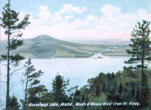 Moose RiverCanoeing · ~13 min drivePhoto: Unknown author, Public domain (via Wikimedia Commons)
- Around Pond TrailHiking · ~20 min drive
- Natanis PerchRock climbing · ~22 min drive
Best time to visit Mont Rider
Best months: August–September. Best months have typical highs of 55–85 °F, lows of 30 °F or warmer (32 °F where the station doesn't record snow), at most one snowy day and no more than 12 wet days.
Jan
22° / 2°
11 wet
Feb
25° / 3°
9 wet
Mar
34° / 13°
11 wet
Apr
47° / 26°
12 wet
May
62° / 37°
13 wet
Jun
71° / 48°
14 wet
Jul
76° / 53°
13 wet
Aug
74° / 50°
12 wet
Sep
67° / 42°
10 wet
Oct
52° / 33°
13 wet
Nov
39° / 23°
13 wet
Dec
28° / 11°
13 wet
Typical high / low (°F) and days with rain or snow, 1991–2020. Measured at Eustis, ME, 26.8 mi away at 1,260 ft. The station sits about 900 ft lower than this place, so expect it a little cooler here. This station doesn't record snowfall. Source: NOAA NCEI U.S. Climate Normals 1991–2020.
Conditions and forecast
Daily highs and lows, wind and the chance of precipitation at the summit for the next 7 days, from the Open-Meteo model.
Map and trail data © OpenStreetMap contributors
