
Mountain · No mapped trail
Van Dyke Mountain
3,193 ft · Maine
Photo: Richard Coté, CC BY-SA 4.0 (via Wikimedia Commons)
- Summit
- 3,193 ft
- Routes
- No mapped trail
Getting up Van Dyke Mountain
No mapped trail reaches the top
We don't know of a mapped trail or route to the summit of Van Dyke Mountain. Plan the approach with local maps, a guidebook or a local guide, and check conditions before you go.
About Van Dyke Mountain
Van Dyke Mountain is a summit in Franklin County, Maine, rising to about 3,193 feet. The nearest town is Lowelltown, about 2 miles away. Summer is the most comfortable time to visit. Typical July highs reach about 75°F with lows near 53°F, based on averages from a nearby weather station. That station sits well below the summit, so temperatures up top run cooler. Winter is cold and frequent with rain, with typical January highs around 22°F and lows near 2°F. The Moose River, a canoeing route, lies about 3 miles away. Natanis Perch, a climbing area, is roughly 9.5 miles off.
Forecast on Van Dyke Mountain
Daily highs and lows, wind and the chance of precipitation at the summit for the next 7 days, from the Open-Meteo model.
Questions about Van Dyke Mountain
How tall is Van Dyke Mountain?
3,193 ft (973 m).
Is there a trail to the top of Van Dyke Mountain?
We don't know of a mapped trail or route to the summit. Plan the approach with local maps, a guidebook or a local guide.
Mountains nearby
- Number Five Mountain3,181 ft · Maine1 route14 mi away
- Flagstaff Mountain2,498 ft · Maine1 route25 mi away
- Coburn Mountain3,719 ft · Maine1 route27 mi away
- Boundary Bald Mountain3,635 ft · Maine1 route30 mi away
- Deer Mountain2,995 ft · New Hampshire1 route33 mi away
 Sugarloaf Mountain4,233 ft · Maine1 route36 mi awayPhoto: petersent, Public domain (via Wikimedia Commons)
Elevation from USGS 3D Elevation Program terrain data (about 10 m resolution).
Name and location: U.S. Geological Survey, Geographic Names Information System (GNIS). Elevation: USGS 3D Elevation Program. View the GNIS record.
Facts about this place
When to go
Best time to go: May–Sep. The mildest months here, with typical highs of 61–75°F and lows of 38–53°F.
Typical monthly averages (not a forecast) from the Rangeley 2 Nw, ME weather station, 35 mi away. High / low in °F.
- Jan22° high2° low
- Feb25° high3° low
- Mar33° high12° low
- Apr46° high26° low
- May61° high38° low
- Jun70° high48° low
- Jul75° high53° low
- Aug73° high51° low
- Sep66° high43° low
- Oct52° high33° low
- Nov39° high23° low
- Dec28° high11° low
The station sits about 1,400 ft lower than this spot, so expect it to run cooler up here.
Nearby
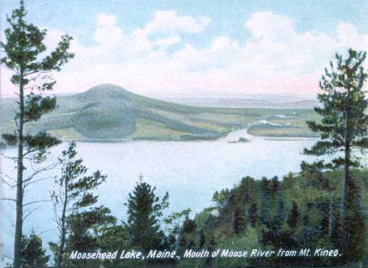 Moose RiverCanoeingPhoto: Unknown author, Public domain (via Wikimedia Commons)3.3 mi
- Natanis PerchRock climbing9.5 mi
Source: Roamze catalog (indexable pages within 10 miles, PostGIS distance)
Ask about this place
Questions about Van Dyke Mountain: conditions, access, timing. Answers say when something isn't known.
Best time to visit Van Dyke Mountain
No month here meets our mild-weather rule. Best months have typical highs of 55–85 °F, lows of 30 °F or warmer (32 °F where the station doesn't record snow), at most one snowy day and no more than 12 wet days.
Jan
22° / 2°
16 wet
Feb
25° / 3°
13 wet
Mar
33° / 12°
13 wet
Apr
46° / 26°
13 wet
May
61° / 38°
15 wet
Jun
70° / 48°
16 wet
Jul
75° / 53°
15 wet
Aug
73° / 51°
13 wet
Sep
66° / 43°
13 wet
Oct
52° / 33°
14 wet
Nov
39° / 23°
15 wet
Dec
28° / 11°
18 wet
Typical high / low (°F) and days with rain or snow, 1991–2020. Measured at Rangeley 2 Nw, ME, 34.8 mi away at 1,780 ft. The station sits about 1,400 ft lower than this place, so expect it a little cooler here. This station doesn't record snowfall. Source: NOAA NCEI U.S. Climate Normals 1991–2020.
Plan this with Roamze
Tell Roamze when you're going and who's coming. It plans the days, gear and food around this place.
