Wolf Pen Gap 6 East
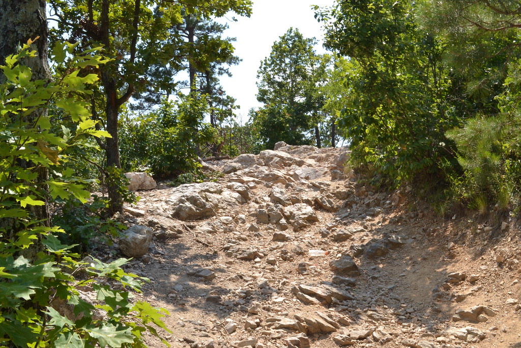 Photo: thigpen.robert, CC BY-SA 2.0 (via Flickr)
At a glance
Wolf Pen Gap 6 East is an easy hike in the Mena Ranger District of Ouachita National Forest in Arkansas, about 3 miles from Mena. The route is an out-and-back that covers roughly 6.6 miles round trip, with a total elevation gain of about 368 feet. That makes it a low-key walk for anyone looking to spend a few hours on foot in the forest. Spring and fall are the most comfortable seasons to go. Typical averages from a nearby weather station run to highs around 74°F in May and 69°F in October, while July highs average about 87°F. Several other Wolf Pen Gap hikes sit close by. Wolf Pen Gap 826 and Wolf Pen Gap 614 are each about 0.6 miles away, and Wolf Pen Gap 624 is about 0.8 miles off. For paddling, the Cossatot River is about 6 miles away, and Shady Lake Campground is about 7 miles away.
- round trip
- 3.3 mi
- climb
- 368 ft
- route
- Out and back
- difficulty
- Easy
- best months
- Early Sep–mid-Jun
Where it is: Mena Ranger District · Ouachita National Forest
Near: Mena
Best weeks to go
Early September to mid-June is usually best for hiking here.
Typical highs of 47–80°F and lows of 32°F or warmer in those weeks.
Typical weather: NOAA 1991–2020 normals at Big Fk 1 Sse, AR, 4 mi away. Not a forecast.
Typical weather by monthBest time to visit Wolf Pen Gap 6 East
Best months: September–June. Best months are the ones mostly made of the best weeks for hiking: typical temperatures in its comfortable range, few snowy days and not usually wet, judged with the same limits as our good-day forecasts.
Jan
47°
32°
9 wet
Feb
53°
35°
9 wet
Mar
61°
42°
10 wet
Apr
69°
50°
9 wet
May
74°
59°
10 wet
Jun
81°
66°
9 wet
Jul
87°
69°
8 wet
Aug
86°
69°
8 wet
Sep
79°
62°
7 wet
Oct
69°
52°
8 wet
Nov
58°
42°
8 wet
Dec
50°
34°
9 wet
Typical high / low (°F) and days with rain or snow, 1991–2020. Measured at Big Fk 1 Sse, AR, 4.4 mi away at 1,200 ft. We don't have this place's elevation, so higher spots nearby can run cooler. Source: NOAA NCEI U.S. Climate Normals 1991–2020.
Been here? Tell people how it was.
 Wolf Pen Gap 826HikingPhoto: thigpen.robert, CC BY-SA 2.0 (via Flickr)0.6 mi
- Wolf Pen Gap 614HikingPhoto: thigpen.robert, CC BY-SA 2.0 (via Flickr)0.6 mi
- Wolf Pen Gap 624HikingPhoto: thigpen.robert, CC BY-SA 2.0 (via Flickr)0.8 mi
- Wolf Pen Gap 836Hiking1 mi
- Wolf Pen Gap 510AHiking1.5 mi
 Cossatot RiverCanoeingPhoto: Jamie Camp, U.S. Army Corps of Engineers, Public domain (via Wikimedia Commons)5.8 mi
 Shady LakeCampingPhoto: Jerry Turner, CC BY-SA 3.0 (via Wikimedia Commons)6.8 mi
- Harris CreekCanoeing9.4 mi
- Wolf Pen Gap 826HikingPhoto: thigpen.robert, CC BY-SA 2.0 (via Flickr)Next door
- Wolf Pen Gap 8HikingPhoto: thigpen.robert, CC BY-SA 2.0 (via Flickr)~4 min drive
 Caney CreekHikingPhoto: thigpen.robert, CC BY-SA 2.0 (via Flickr)~10 min drive
- Viles BranchHiking~17 min drive
- Wolf Pen Gap 624HikingPhoto: thigpen.robert, CC BY-SA 2.0 (via Flickr)~1 min drive
 Wolf Pen Gap 8HikingPhoto: thigpen.robert, CC BY-SA 2.0 (via Flickr)~6 min drive
- Little Missouri NorthHiking~10 min drive
 Athens-Bigfork SouthHikingPhoto: azoeart, CC BY-SA 2.0 (via Flickr)~15 min drive
- Wolf Pen Gap 6 WestHikingPhoto: thigpen.robert, CC BY-SA 2.0 (via Flickr)~6 min drive
- C.Creek - Tall PeakHiking~11 min drive
Conditions and forecast
Caution todayAgency alerts are in effect for this areaUSFS · checked 11 h agoDaily highs and lows, wind and the chance of precipitation at Start for the next 7 days, from the Open-Meteo model.

Ask about this place
Questions about Wolf Pen Gap 6 East: conditions, access, timing. Answers say when something isn't known.
Local outfitters
- River View Cabins & Canoes20 mi away
- Beavers Bend Adventures41 mi away
Not on Roamze yet. Their page has how to reach them.
