Wilson Falls
At a glance
Wilson Falls is a waterfall in Great Smoky Mountains National Park in Tennessee, about 9.4 miles from Gatlinburg. It sits at roughly 5,200 feet, and the surrounding area is a hub of trails, with several routes starting within a mile or so. Summer and early fall are the most comfortable times to visit. Typical averages from the nearby Newfound Gap weather station, at a similar elevation, show July highs around 74°F and September highs near 68°F, with September also seeing the fewest wet days of the year. The closest trails are Sugarland Mountain Trail, about 0.6 miles away, and the Appalachian Trail and the Mountains-To-Sea Trail: Segment 1, each about 0.9 miles off. For an overnight stay, Twin Creeks Picnic Pavilion is about 6.8 miles away.
- elevation
- 5,207 ft
- best months
- Sep–Oct
Where it is: Great Smoky Mountains National Park
Near: Gatlinburg · 9.4 mi
Best time to visit Wilson Falls
Best months: September–October. Best months have typical highs of 55–85 °F, lows of 30 °F or warmer (32 °F where the station doesn't record snow), at most one snowy day and no more than 12 wet days.
Jan
39°
22°
13 wet
Feb
42°
25°
12 wet
Mar
49°
30°
13 wet
Apr
58°
38°
13 wet
May
66°
47°
15 wet
Jun
71°
54°
16 wet
Jul
74°
57°
16 wet
Aug
72°
56°
14 wet
Sep
68°
51°
11 wet
Oct
59°
41°
10 wet
Nov
50°
32°
10 wet
Dec
43°
27°
12 wet
Typical high / low (°F) and days with rain or snow, 1991–2020. Measured at Newfound Gap, TN, 3.5 mi away at 5,040 ft. This station doesn't record snowfall. Source: NOAA NCEI U.S. Climate Normals 1991–2020.
Been here? Tell people how it was.
 Sugarland Mountain TrailHikingPhoto: Michael Pellegrino, CC BY-SA 4.0 (via Wikimedia Commons)0.6 mi
- Appalachian TrailHikingPhoto: Michael Pellegrino, CC BY-SA 4.0 (via Wikimedia Commons)0.9 mi
- Mountains-To-Sea Trail: Segment 1HikingPhoto: Michael Pellegrino, CC BY-SA 4.0 (via Wikimedia Commons)0.9 mi
- Spruce Fir Nature TrailHiking1.5 mi
- Twin Creeks Picnic PavilionCamping6.8 mi
- Spence CabinCamping6.8 mi
- Little RiverRiver fishing7 mi
- Appalachian ClubhouseCamping7 mi
 Mingo FallsWaterfallPhoto: Kaldari, Public domain (via Wikimedia Commons)~21 min drive
 Cullasaja FallsWaterfallPhoto: Sdrtm at English Wikipedia, CC BY-SA 3.0 (via Wikimedia Commons)~60 min drive
 Bridal Veil FallsWaterfallPhoto: Washuotaku, CC BY-SA 4.0 (via Wikimedia Commons)~1h 6m drive
 Dry FallsWaterfallPhoto: Zhans33, CC BY-SA 3.0 (via Wikimedia Commons)~1h 6m drive
 Courthouse FallsWaterfallPhoto: Jrichar3, CC BY 3.0 (via Wikimedia Commons)~1h 8m drive
- Rainbow FallsWaterfall~9 min drive
- Grotto FallsWaterfall~11 min drive
- Little Creek FallsWaterfall~15 min drive
- Laurel FallsWaterfall~15 min drive
- Ramsey CascadesWaterfall~23 min drive
Also worth it near here
- Sugarland Mountain TrailHikingPhoto: Michael Pellegrino, CC BY-SA 4.0 (via Wikimedia Commons)~1 min drive
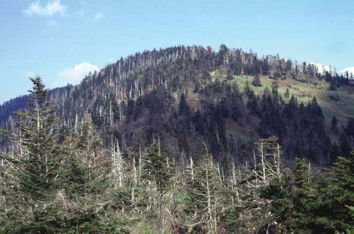 KuwohiSummitPhoto: C. Kenneth Dodd, Jr., Public domain (via Wikimedia Commons)~3 min drive
 LeConte LodgeCampingPhoto: daveynin — CC BY 2.0 (via Flickr)~9 min drive
- Little RiverRiver fishing~12 min drive
Conditions and forecast
Daily highs and lows, wind and the chance of precipitation at Wilson Falls for the next 7 days, from the Open-Meteo model.
Ask about this place
Questions about Wilson Falls: conditions, access, timing. Answers say when something isn't known.
