
Group Site D
Campground
0.2 mi from the trail
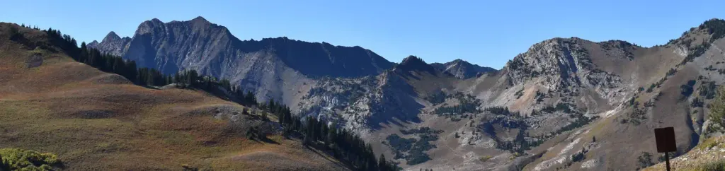
White Pine Chutes is a bouldering area in the Salt Lake Ranger District of the Uinta-Wasatch-Cache National Forest in Utah, managed by the Forest Service. It sits among a cluster of climbing spots, with South of Chutes about 0.2 miles away and Blunder Boulder about 0.3 miles away. Tanners Flat Campground is about 0.4 miles off, and the White Pine Trail is about 0.8 miles away. The area is a bouldering destination, with 24 routes all rated on the V scale. The easiest is Albino at V2, and the hardest is What We Do In The Shadows at V11. The median grade runs V7-8. The routes are all boulders, so there is no climbing on rock faces here. Summer is the most comfortable time to visit. Typical averages from the nearby Alta weather station, which sits about 1,200 feet lower, show July highs around 73°F with lows near 50°F. Winter is cold, with January highs around 31°F and lows around 15°F. Lake Lillian and Lake Florence are both about 2 miles away for fishing, and Albion Basin campground is about 4.4 miles off.
24 routes · V2 – V11 · Bouldering
Where it is: Salt Lake Ranger District · Uinta-Wasatch-Cache National Forest
Near: Sandy
Best months: June–September. Best months have typical highs of 55–85 °F, lows of 30 °F or warmer (32 °F where the station doesn't record snow), at most one snowy day and no more than 12 wet days.
Jan
31°
15°
14 wet
Feb
31°
15°
13 wet
Mar
37°
20°
13 wet
Apr
42°
25°
12 wet
May
53°
33°
10 wet
Jun
64°
42°
7 wet
Jul
73°
50°
7 wet
Aug
71°
49°
9 wet
Sep
62°
41°
9 wet
Oct
49°
31°
9 wet
Nov
37°
21°
11 wet
Dec
30°
15°
14 wet
Typical high / low (°F) and days with rain or snow, 1991–2020. Measured at Alta, UT, 3.2 mi away at 8,710 ft. The station sits about 1,200 ft higher than this place, so expect it a little warmer here. This station doesn't record snowfall. Source: NOAA NCEI U.S. Climate Normals 1991–2020.
Been here? Tell people how it was.
 Lisa Falls WestRock climbingPhoto: AndreyZharkikh, CC BY 2.0 (via Flickr)~3 min drive
 Red Pine CragRock climbingPhoto: Derrellwilliams, CC BY-SA 4.0 (via Wikimedia Commons)~3 min driveFreedom WallRock climbingPhoto: AndreyZharkikh, CC BY 2.0 (via Flickr)~3 min drive
Daily highs and lows, wind and the chance of precipitation at White Pine Chutes for the next 7 days, from the Open-Meteo model.
Questions about White Pine Chutes: conditions, access, timing. Answers say when something isn't known.
Group Site D
Campground
Creekside
Restaurant
 If it rainsAndrew Branch denae_andrew, CC0 · Wikimedia Commons
Alpine Art Center
Museum
Places © OpenStreetMap contributors · Photos: Andrew Branch denae_andrew, CC0 (commons)
More in Heber