Fry Creek Campground
Campground
Sites open the weekend of Nov 27 on Recreation.gov
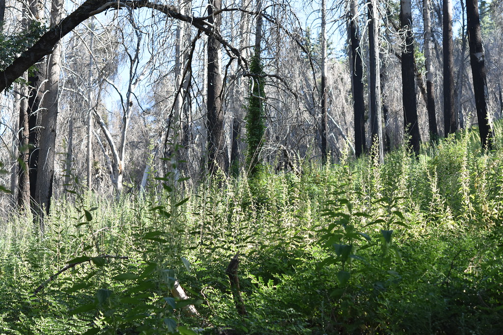 Photo: theforestprimeval, CC BY-SA 2.0 (via Flickr)
Fry Creek is a 1.7-mile loop hike in the Palomar Ranger District of Cleveland National Forest in California, managed by the Forest Service. The trail is rated easy, with a total elevation gain of 340 feet, and it sits at a natural surface, which makes it suitable for horses and bikes as well as hikers. Spring and fall are the most comfortable times to go. Typical averages from a nearby weather station at Palomar Mtn Obsy show May and October highs around 69°F, while July and August average about 84°F. Winter brings the most wet days, with snow on a few of them. Fry Creek Campground is just 0.1 mile away, and Observatory Campground and the Observatory hike are each about 0.2 mile off. The Upper Doane Valley Trail lies about a mile away.
Where it is: Palomar Ranger District · Cleveland National Forest
Near: Escondido
Best months: March–November. Best months have typical highs of 55–85 °F, lows of 30 °F or warmer (32 °F where the station doesn't record snow), at most one snowy day and no more than 12 wet days.
Jan
51°
37°
7 wet · 1 snow
Feb
51°
36°
7 wet · 2 snow
Mar
56°
39°
6 wet · 1 snow
Apr
61°
42°
4 wet · 1 snow
May
69°
48°
2 wet
Jun
79°
57°
1 wet
Jul
84°
64°
1 wet
Aug
84°
65°
1 wet
Sep
79°
60°
1 wet
Oct
69°
51°
2 wet
Nov
58°
43°
4 wet
Dec
51°
37°
6 wet · 1 snow
Typical high / low (°F) and days with rain or snow, 1991–2020. Measured at Palomar Mtn Obsy, CA, 3.4 mi away at 5,550 ft. Source: NOAA NCEI U.S. Climate Normals 1991–2020.
Been here? Tell people how it was.
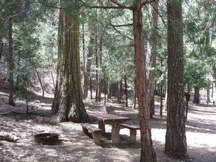 Fry Creek CampgroundCampingPhoto: Recreation.gov (RIDB) / public domain0.1 mi
 Observatory CampgroundCampingPhoto: Recreation.gov (RIDB) / public domain0.2 miUse Trail (To Fry Creek)HikingPhoto: theforestprimeval, CC BY-SA 2.0 (via Flickr)0.5 miUpper Doane Valley TrailHikingPhoto: theforestprimeval, CC BY-SA 2.0 (via Flickr)1 mi
 San Luis Rey RiverCanoeingPhoto: Michael Krehan, CC BY-SA 3.0 (via Wikimedia Commons)5 miUse Trail (To Fry Creek)HikingPhoto: theforestprimeval, CC BY-SA 2.0 (via Flickr)Next door
 Barker ValleyHikingPhoto: semsd, CC BY-SA 3.0 (via Wikimedia Commons)~9 min drive
 Chimney Flats TrailHikingPhoto: theforestprimeval, CC BY-SA 2.0 (via Flickr)~2 min driveUpper Doane Valley TrailHikingPhoto: theforestprimeval, CC BY-SA 2.0 (via Flickr)~2 min drive
Daily highs and lows, wind and the chance of precipitation at Start for the next 7 days, from the Open-Meteo model.
Questions about Fry Creek: conditions, access, timing. Answers say when something isn't known.
Fry Creek Campground
Campground
 If it rainsAlan Islas, CC BY-SA 4.0 · Wikimedia Commons
Living-history museum in Vista, California
Places © OpenStreetMap contributors · Photos: Alan Islas, CC BY-SA 4.0 (commons)
More in FallbrookNot on Roamze yet. Their page has how to reach them.
