Braun Bypass
At a glance
Braun Bypass is an easy out-and-back hike of about 2 miles in the West Elk Wilderness, part of the Gunnison Ranger District of the Grand Mesa, Uncompahgre and Gunnison National Forests in Colorado. The trail rises from a low point of about 9,250 feet to a high of about 9,560 feet, a climb of about 300 feet one way. The route is on natural surface and is open to horses. Bikes are not allowed. Summer is the most comfortable time to go. Typical averages from a nearby weather station in Crested Butte show July highs around 76°F with lows near 40°F, and the trail is open from July 1 to September 30. West Elk Peak lies about 0.7 miles away, and the Railroad Ski cross-country ski area is about 0.4 miles off. Kebler Pass Camping Area and Splains Gulch Camping Area are both about 4 miles away.
- round trip
- 2.0 mi
- climb
- 301 ft
- high point
- 9,562 ft
- route
- Out and back
- best months
- Jun–Aug
Where it is: West Elk Wilderness · Gunnison Ranger District
Near: Crested Butte
Best time to visit Braun Bypass
Best months: June–August. Best months have typical highs of 55–85 °F, lows of 30 °F or warmer (32 °F where the station doesn't record snow), at most one snowy day and no more than 12 wet days.
Jan
26°
-7°
12 wet
Feb
29°
-2°
11 wet
Mar
38°
7°
10 wet
Apr
47°
19°
9 wet
May
58°
28°
8 wet
Jun
70°
34°
7 wet
Jul
76°
40°
10 wet
Aug
74°
38°
12 wet
Sep
66°
31°
9 wet
Oct
54°
22°
8 wet
Nov
39°
9°
9 wet
Dec
27°
-4°
11 wet
Typical high / low (°F) and days with rain or snow, 1991–2020. Measured at Crested Butte, CO, 8.4 mi away at 8,867 ft. The station sits about 700 ft lower than this place, so expect it a little cooler here. This station doesn't record snowfall. Source: NOAA NCEI U.S. Climate Normals 1991–2020.
Been here? Tell people how it was.
 Railroad SkiCross-country skiingPhoto: John Sowell, CC BY-SA 4.0 (via Wikimedia Commons)0.4 mi
- West Elk PeakHikingPhoto: John Sowell, CC BY-SA 4.0 (via Wikimedia Commons)0.7 mi
- Kebler Pass Camping AreaCamping4 mi
- Splains Gulch Camping AreaCamping4.2 mi
- Ruby Anthracite CreekCanoeing7.4 mi
- Cliff CreekCanoeing8.3 mi
- The Hone StoneRock climbing9.4 mi
- The Joint BoulderRock climbing9.4 mi
- West Elk PeakHikingPhoto: John Sowell, CC BY-SA 4.0 (via Wikimedia Commons)~1 min drive
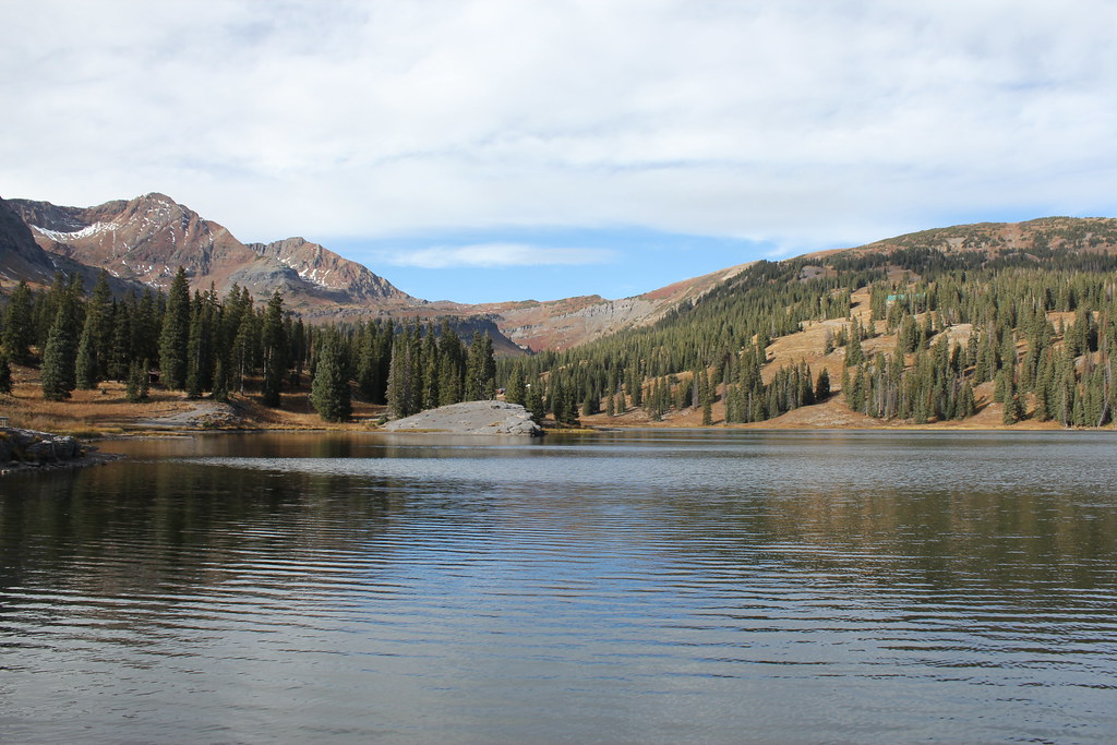 Irwin Lake TrailHikingPhoto: Jeffrey Beall, CC BY-SA 2.0 (via Flickr)~9 min drive
- Ridge 70HikingPhoto: Jeffrey Beall, CC BY-SA 2.0 (via Flickr)~11 min drive
 Cliff CreekHikingPhoto: indigoprime, CC BY 2.0 (via Flickr)~10 min drive
- Carbon Trail 436Hiking~9 min drive
 Upper Peeler LakesHikingPhoto: Kyle Watson Photography, CC BY-SA 2.0 (via Flickr)~13 min drive
- ScarpHikingPhoto: Jeffrey Beall, CC BY-SA 2.0 (via Flickr)~11 min drive
- Beckwith BenchHikingPhoto: indigoprime, CC BY 2.0 (via Flickr)~10 min drive
 Daisy Pass Blue LakeHikingPhoto: Kyle Watson Photography, CC BY-SA 2.0 (via Flickr)~14 min drive
 Budd TrailHikingPhoto: pixellaphoto, Public Domain Dedication (CC0) (via Flickr)~14 min drive
Also worth it near here
- Railroad SkiCross-country skiingPhoto: John Sowell, CC BY-SA 4.0 (via Wikimedia Commons)Next door
 Ohio Pass SnowmobileMountain bikingPhoto: Mshuang2, CC0 (via Wikimedia Commons)~2 min drive
 Carbon PeakSummitPhoto: John Sowell, CC BY-SA 4.0 (via Wikimedia Commons)~5 min drive
- Lake Irwin Fishing SiteLake fishing~10 min drive
Conditions and forecast
Caution todayAgency alerts are in effect for this areaUSFS · checked 21 min agoDaily highs and lows, wind and the chance of precipitation at Start for the next 7 days, from the Open-Meteo model.
Ask about this place
Questions about Braun Bypass: conditions, access, timing. Answers say when something isn't known.
Local outfitters
- Maroon Bells Guide and Outfitters28 mi away
- Taylor Park Trading Post29 mi away
Not on Roamze yet. Their page has how to reach them.
