
Spattercone Crest Trail
California
Free — you'll pick up right here.
2.4 mi
Distance
212 ft
Gain
Conditions: Blocked
for hike, todayAn agency closure order is in effect for this area; weather is good
2 factors · 2 sources
Newest 7 h ago · oldest 7 h
problem: Agency alerts
5 active alerts in Lassen National Forest; most severe: SAFETY ALERT - South Antelope Bridge out, Do Not Cross
USFSPosted Feb 2 · checked 7 h ago
clear: Weather
Clear, high 76°F / low 49°F, 0% precip — 99/100 for hike
OpenWeather7 h ago
Been out here in the last few days? One report keeps this current for everyone.
Why you'll love it
Here's your day, mapped
Spattercone Crest Trail
Suggested plan · check conditions before you go
Meals
Gear for the day
Elevation & route
- Distance
- 2.4 mi
- Elevation gain
- 212 ft
- Highest point
- 4,667 ft
- Lowest point
- 4,448 ft
Photos
Directions & GPX
Permits & access
- Managing agency
- Forest Service
- Bikes
- Allowed
- Surface
- Natural
- Accessibility
- Not an accessible trail (Forest Service accessibility status)
Source for bikes, surface, accessibility: USDA Forest Service National Forest System Trails (EDW)
About this trail
Spattercone Crest Trail is a 2.44-mile out-and-back route in California with 242 feet of elevation gain. The trail follows a crest path and is managed by the Forest Service.
Facts about this trail
The climb
- High point
- 4,667 ft
- Length (round trip)
- 2.4 mi
- Shape
- Out and back
Source: Roamze elevation profile and trail geometry (DEM samples along the mapped route)
When to go
Typical monthly averages (not a forecast) from the Manzanita Lake, CA weather station, 11 mi away. High / low in °F.
- Jan41° high22° low
- Feb42° high22° low
- Mar46° high24° low
- Apr50° high27° low
- May61° high35° low
- Jun70° high41° low
- Jul79° high46° low
- Aug78° high45° low
- Sep72° high41° low
- Oct59° high33° low
- Nov47° high26° low
- Dec39° high22° low
The station sits about 1,100 ft higher than this spot, so expect it to run a little warmer here.
Where it is
- Hat Creek Ranger District · Ranger district
- Lassen National Forest · National forest
- Managed by
- Forest Service
Conditions
Active alerts for Lassen National Forest as of Oct 9, 2026:
SAFETY ALERT - South Antelope Bridge out, Do Not Cross
critical · posted Aug 24, 2026
critical · posted Aug 24, 2026
Lassen National Forest Camping Restrictions
information · posted Aug 24, 2026
Lake Almanor Area Camping Restriction
information · posted Aug 24, 2026
Lake Almanor Recreational Trail Restriction
information · posted Aug 24, 2026
Source: USFS forest alerts
Nearby
- Hat CreekCamping0.2 mi
- Potato Butte 6Hiking0.8 mi
- Cave CampgroundCamping1.5 mi
- Subway Cave Interpretive TrailHiking1.7 mi
- Big PineCamping2.7 mi
- PARHAM'S POINT TRAILHiking3.2 mi
- Plum ValleyRock climbing4.3 mi
- Finger Rake AreaRock climbing9.9 mi
Source: Roamze catalog (indexable pages within 10 miles, PostGIS distance)
Add to a trip & share
Keep exploring — more trails worth the drive
 Photo: BoltSnypr, CC BY 3.0 (via Wikimedia Commons)
Subway Cave Interpretive Trail
~3 min drive
1.09-mile out-and-back hike to Subway Cave in California.
 Photo: BoltSnypr, CC BY 3.0 (via Wikimedia Commons)
PARHAM'S POINT TRAIL
~5 min drive
16.36-mile out-and-back trail in California with 2,898 ft elevation gain and loss.
 Photo: BoltSnypr, CC BY 3.0 (via Wikimedia Commons)
Hat Creek Fisherman's Trail
~7 min drive
8.03-mile out-and-back trail in California with 590 ft gain.
Sunflower Flat
~16 min drive
A commemorative plaque marks the Nobles Emigrant Trail which was listed on the National Register of Historic Places in 1975. Twenty-four miles of the 300-mile-long wagon route skirt through the northern edge of the park. Most of the original route in the park remains intact…
 Photo: Brück & Sohn Kunstverlag Meißen, CC0 (via Wikimedia Commons)
NORTH BATTLE CREEK
~17 min drive
6.44-mile out-and-back trail in California with 1,180 ft elevation gain and loss.
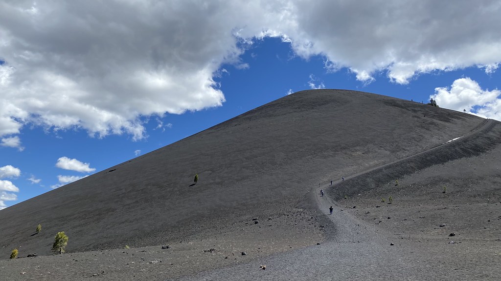 Photo: lamblukas, CC BY 2.0 (via Flickr)
Cinder Cone Trail
~18 min drive
0.66-mile out-and-back hike in California with 485 ft elevation gain.
BIG LAKE
~17 min drive
16.16-mile out-and-back trail in California with 2,520 ft elevation gain
Parham's Point Trail
~6 min drive
11.19-mile out-and-back hike in California with 1,339 ft elevation gain.
 Photo: theforestprimeval, CC BY-SA 2.0 (via Flickr)
Cypress
~17 min drive
22.3-mile out-and-back trail in California with 3,217 ft gain
 Photo: Vlad & Marina Butsky on Flickr, CC BY 2.0 (via Wikimedia Commons)
Butte Lake Trail
~18 min drive
4.5-mile out-and-back hike in California with 2,164 ft elevation gain and loss.


