Ward Loop I
At a glance
Ward Loop I is an easy, 1.4-mile out-and-back hike in Nevada's Humboldt-Toiyabe National Forest, within the Ely Ranger District. The trail rises about 44 feet from its low point of 7,303 feet to a high of 7,386 feet, a gentle climb that makes it a quick outing on a day spent exploring the Ward Mountain area. The route is natural-surfaced and open to both horses and bikes. It sits right beside Ward Mtn. Campground (Murray Summit), about 0.1 mile away, and Ward Loop K, a nearby loop trail. Ward Mountain Campground is roughly 0.3 mile off, and the Ward Loop J trail is about 0.2 mile away, so it's easy to pair this hike with another part of the Ward Loop system. Summer is the most comfortable time to go. Typical averages from the Ruth weather station, about 4.5 miles away, put July highs around 84°F with lows near 47°F, while winter brings highs in the upper 30s and regular snow days. The trail is open year-round. Other nearby options include Ward Loop F, a mountain biking route about 0.3 mile away, and the Birkibeiner Loop, about 0.7 mile from the trail.
- round trip
- 1.4 mi
- climb
- 44 ft
- high point
- 7,386 ft
- route
- Out and back
- time
- About 30 minutes
- best months
- Early May–early Jul, late Aug–late Sep
Where it is: Ely Ranger District · Humboldt-Toiyabe National Forest
Near: Ely
Best weeks to go
Early May to early July and late August to late September are usually best for hiking here.
Typical highs of 62–80°F and lows of 30°F or warmer in those weeks.
Typical weather: NOAA 1991–2020 normals at Ruth, NV, 5 mi away. Not a forecast.
Typical weather by monthBest time to visit Ward Loop I
Best months: May–June and September. Best months are the ones mostly made of the best weeks for hiking: typical temperatures in its comfortable range, few snowy days and not usually wet, judged with the same limits as our good-day forecasts.
Jan
38°
9°
6 wet · 6 snow
Feb
40°
12°
6 wet · 5 snow
Mar
47°
19°
7 wet · 5 snow
Apr
54°
24°
7 wet · 3 snow
May
64°
32°
7 wet · 1 snow
Jun
76°
40°
5 wet
Jul
84°
47°
5 wet
Aug
82°
46°
6 wet
Sep
75°
36°
5 wet
Oct
61°
25°
4 wet · 1 snow
Nov
47°
16°
5 wet · 3 snow
Dec
37°
7°
6 wet · 5 snow
Typical high / low (°F) and days with rain or snow, 1991–2020. Measured at Ruth, NV, 4.5 mi away at 6,858 ft. The station sits about 500 ft lower than this place, so expect it a little cooler here. Source: NOAA NCEI U.S. Climate Normals 1991–2020.
Been here? Tell people how it was.
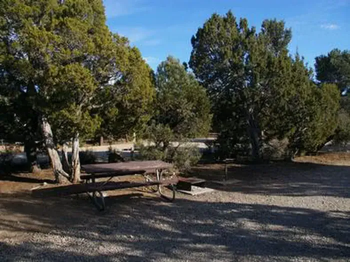 Ward Mtn. Campground (murray Summit)CampingPhoto: Recreation.gov (RIDB) / public domain0.1 mi
- Ward Loop KHiking0.1 mi
- Ward Loop AHiking0.2 mi
- Ward Loop JHiking0.2 mi
 Ward Loop FMountain bikingPhoto: Chris M Morris, CC BY 2.0 (via Wikimedia Commons)0.3 mi
- Ward Mountain CampgroundCamping0.3 mi
- Ward Loop GHiking0.5 mi
- Ward Mountain Recreation Area - BIRKIBEINER LOOPHiking0.7 mi
- Ward Loop KHikingNext door
- Ward Loop GHikingNext door
- Ice Plant CanyonHiking~7 min drive
- Ward Loop AHikingNext door
- Ward Mountain Recreation Area - BIRKIBEINER LOOPHiking~1 min drive
- Squaw Peak Hill ClimbHiking~9 min drive
- Ward Loop JHikingNext door
- Ward Loop L TrailHiking~2 min drive
- Cave Valley RoadHiking~15 min drive
- Ward Mountain Recreation Area - A (REVENUE) LOOPHiking~1 min drive
Also worth it near here
Conditions and forecast
Caution todayAgency alerts are in effect for this areaUSFS · checked 10 h agoDaily highs and lows, wind and the chance of precipitation at Start for the next 7 days, from the Open-Meteo model.

Ask about this place
Questions about Ward Loop I: conditions, access, timing. Answers say when something isn't known.
