Oht Sylamore Section
At a glance
The Oht Sylamore Section is a hard hike of about 66 miles in the Buffalo National River Wilderness, part of the Buffalo National River unit managed by the National Park Service. It crosses the Sylamore Ranger District of the Ozark-St. Francis National Forest and runs from a low point of about 356 feet to a high of about 1,399 feet, with a total climb of about 4,630 feet. Spring and fall are the most comfortable times to go. Typical averages from a nearby weather station in Marshall, Arkansas, show October highs around 72°F and April highs around 70°F, while July and August average highs near 89°F. The trail is on natural surface and is not accessible. Bikes and horses are not allowed. There is no fee to hike it. Big Creek, a canoeing spot, is about 5 miles away. The Campground Trail, Forest Trail and Buffalo Point campground are all within about 6 miles.
- one way
- 66.1 mi
- climb
- 4,630 ft
- high point
- 1,399 ft
- route
- Point to point
- time
- About 24 hours
- best months
- Mar–Jun, Sep–Nov
Where it is: Buffalo National River Wilderness · Sylamore Ranger District
Near: Mountain Home
Best time to visit Oht Sylamore Section
Best months: March–June and September–November. Best months have typical highs of 55–85 °F, lows of 30 °F or warmer (32 °F where the station doesn't record snow), at most one snowy day and no more than 12 wet days.
Jan
47°
26°
7 wet · 1 snow
Feb
52°
29°
7 wet · 1 snow
Mar
60°
37°
8 wet
Apr
70°
45°
8 wet
May
77°
55°
9 wet
Jun
85°
63°
7 wet
Jul
89°
68°
7 wet
Aug
89°
66°
7 wet
Sep
82°
58°
6 wet
Oct
72°
47°
7 wet
Nov
60°
38°
7 wet
Dec
50°
29°
7 wet
Typical high / low (°F) and days with rain or snow, 1991–2020. Measured at Marshall, AR, 15.4 mi away at 951 ft. Source: NOAA NCEI U.S. Climate Normals 1991–2020.
Been here? Tell people how it was.
- Big CreekCanoeing4.9 mi
- Campground TrailHiking5.6 mi
 Forest TrailHikingPhoto: Farther Along, CC BY 2.0 (via Flickr)6 mi
 Overlook TrailHikingPhoto: Farther Along, CC BY 2.0 (via Flickr)6.3 mi
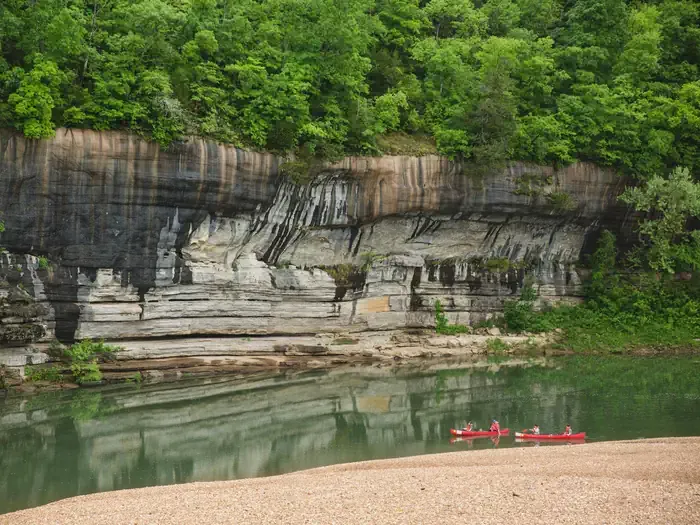 Buffalo PointCampingPhoto: Recreation.gov (RIDB) / public domain6.3 mi
- Indian Rockhouse TrailHikingPhoto: Farther Along, CC BY 2.0 (via Flickr)6.4 mi
- Return TrailHikingPhoto: Farther Along, CC BY 2.0 (via Flickr)7 mi
- Forest TrailHikingPhoto: Farther Along, CC BY 2.0 (via Flickr)~10 min drive
- South Lower Wilderness TrailsHiking~2 min drive
- North Lower Wilderness TrailsHiking~9 min drive
- Ozark Highlands TrailHiking~29 min drive
- Overlook TrailHikingPhoto: Farther Along, CC BY 2.0 (via Flickr)~11 min drive
- Cow Creek TrailHiking~11 min drive
- Ozarks Keystone TrailHiking~40 min drive
- Syllamo Bike Trail - Jacks BraHiking~30 min drive
- Indian Rockhouse TrailHikingPhoto: Farther Along, CC BY 2.0 (via Flickr)~11 min drive
- Syllamo Bike Trail-Jacks BrancHiking~32 min drive
Conditions and forecast
Caution todayAgency alerts are in effect for this areaUSFS · checked 17 min agoDaily highs and lows, wind and the chance of precipitation at Start for the next 7 days, from the Open-Meteo model.
Ask about this place
Questions about Oht Sylamore Section: conditions, access, timing. Answers say when something isn't known.
