

Tabor Campground
Campground
< 0.1 mi from the trail
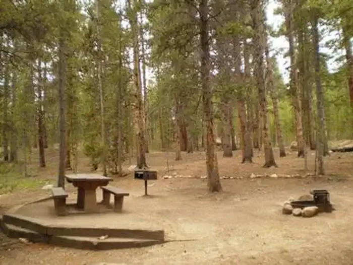
Tabor Campground sits at 9,900 feet on the north-eastern shore of Turquoise Lake in the Leadville Ranger District of the Pike and San Isabel National Forests, about 1.5 miles from Leadville Junction. It is a Forest Service campground named after Leadville's Silver King, Horace A. W. Tabor, and is set in a shaded lodgepole pine forest. The boat ramp that once served the lake is closed, so plan on driving in. The site is first-come, first-served, with no reservable sites. It works well for large recreational vehicles, and facilities include picnic tables, fire rings with grates, potable water and a vault toilet. A fee is charged. Summer is the most comfortable time to visit. Typical averages from a nearby weather station at a similar elevation show July highs around 73°F with lows near 39°F, while winter highs stay around 31°F. Father Dyer and Baby Doe campgrounds are each about half a mile away, and the Rift hike and the Mountain Bike Trail near Tennessee Creek are within a mile.
Where it is: Leadville Ranger District · Pike and San Isabel National Forests
Near: Leadville
You book with Recreation.gov. Roamze doesn't take a cut.
Sites open up when people cancel. We check Recreation.gov and email you when a site opens for your dates.
Best months: June–August. Best months have typical highs of 55–85 °F, lows of 30 °F or warmer (32 °F where the station doesn't record snow), at most one snowy day and no more than 12 wet days.
Jan
31°
3°
8 wet
Feb
33°
3°
8 wet
Mar
39°
9°
8 wet
Apr
44°
18°
8 wet
May
55°
27°
9 wet
Jun
68°
34°
9 wet
Jul
73°
39°
12 wet
Aug
70°
38°
12 wet
Sep
62°
31°
8 wet
Oct
51°
23°
6 wet
Nov
39°
14°
7 wet
Dec
31°
6°
7 wet
Typical high / low (°F) and days with rain or snow, 1991–2020. Measured at Sugarloaf Rsvr, CO, 2 mi away at 9,738 ft. This station doesn't record snowfall. Source: NOAA NCEI U.S. Climate Normals 1991–2020.
Been here? Tell people how it was.
 Father DyerCampingPhoto: Recreation.gov (RIDB) / public domain0.5 mi
 Baby DoeCampingPhoto: Recreation.gov (RIDB) / public domain0.5 mi
 Tennessee CreekCanoeingPhoto: Jeffrey Beall, CC BY 3.0 (via Wikimedia Commons)2.4 mi
 Tiger CliffRock climbingPhoto: foto3116, CC BY 2.0 (via Flickr)7.1 mi
Daily highs and lows, wind and the chance of precipitation at Tabor Campground for the next 7 days, from the Open-Meteo model.
Questions about Tabor Campground: conditions, access, timing. Answers say when something isn't known.
Tabor Campground
Campground
La Mina Tacos Y Mariscos
Restaurant
 If it rainsCraig Talbert, CC BY 3.0 · Wikimedia Commons
Places © OpenStreetMap contributors · Photos: Craig Talbert, CC BY 3.0 (commons)
More in LeadvilleNot on Roamze yet. Their page has how to reach them.
Tabor Campground
Book on Recreation.gov
