Sutton Bluff
At a glance
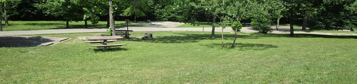
Roomy campsites surrounded by open lawn and natural shading, cool breezes, abundant songbirds, and scenic views all await visitors at the Sutton Bluff Recreation Area. The Sutton Bluff Campground is set alongside the West Fork of the Black River in a forested hardwood bottom. Sutton Bluff is located 13 miles outside Centerville, Missouri. It is nestled among a variety of short-leaf pine trees and shrubs, and a number of campsites sit alongside the West Fork of the Black River. This campground serves the nearby Sutton Bluff ATV and Motorcycle Trail System. A 45-mile off-road vehicle trail. Permits are required for off-road vehicle use in the area. The Karkaghne section of the Ozark Trail, which is popular among backpackers, hikers and mountain bikers, is accessible from a trailhead less than a mile from the campground. The West Fork of Black River provides access to a serene, slow-moving mountain stream and a natural gravel beach. Visitors enjoy wading in the waters, however the current is not strong enough to enable floating the river. Anglers can enjoy a variety of bass and bluegill.
- sites
- 34
- best months
- Mid-Apr–late Oct
Where it is: Salem Ranger District · Mark Twain National Forest
Near: Ironton
Reserve a site
34 sites
You book with Recreation.gov. Roamze doesn't take a cut.
Sutton Bluff cancellation alert
Sites open up when people cancel. We check Recreation.gov and email you when a site opens for your dates.
Best weeks to go
Mid-April to late October is usually best for camping here.
Typical highs of 70–90°F and lows of 40°F or warmer in those weeks. Rain falls on about 40% of days at the wettest of them, so plan around showers.
Typical weather: NOAA 1991–2020 normals at Round Spring 2sw, MO, 28 mi away. Not a forecast.
Typical weather by monthBest time to visit Sutton Bluff
Best months: April–October. Best months are the ones mostly made of the best weeks for camping: typical temperatures in its comfortable range, few snowy days and not usually wet, judged with the same limits as our good-day forecasts.
Jan
45°
20°
8 wet · 1 snow
Feb
50°
23°
8 wet · 2 snow
Mar
60°
32°
9 wet · 1 snow
Apr
71°
40°
10 wet
May
78°
51°
12 wet
Jun
85°
60°
10 wet
Jul
90°
65°
9 wet
Aug
88°
63°
9 wet
Sep
81°
54°
8 wet
Oct
71°
41°
8 wet
Nov
59°
32°
8 wet
Dec
47°
24°
8 wet
Typical high / low (°F) and days with rain or snow, 1991–2020. Measured at Round Spring 2sw, MO, 27.6 mi away at 829 ft. Source: NOAA NCEI U.S. Climate Normals 1991–2020.
Been here? Tell people how it was.
 Alley SpringCampingPhoto: pasa47 — CC BY 2.0 (via Flickr)~57 min drive
- Highway KCamping~29 min drive
- Council Bluff (Wbr) CgCamping~30 min drive
- Powder Mill CampgroundCamping~38 min drive
- Bluff View(Clearwater Lake)Camping~40 min drive
- Webb Creek ParkCamping~43 min drive
- Sinking Creek CampgroundCamping~44 min drive
- Marble Creek CampgroundCamping~44 min drive
- Round SpringCamping~44 min drive
- Piedmont ParkCamping~45 min drive
Conditions and forecast
Caution at last checkAgency alerts are in effect for this areaUSFS · checked 12 h agoDaily highs and lows, wind and the chance of precipitation at Sutton Bluff for the next 7 days, from the Open-Meteo model.

Ask about this place
Questions about Sutton Bluff: conditions, access, timing. Answers say when something isn't known.
- 34 sitesReservable on Recreation.gov
- At 815 ft
- Salem Ranger DistrictMark Twain National Forest
Local outfitters
- Two Rivers Canoe Rental25 mi away
Not on Roamze yet. Their page has how to reach them.
Sutton Bluff
34 sites
