West Fork Black River
- 4.3 mi
- distance
- 1,045 ft
- high point
- Mar–Jun, Sep–Nov
- best months
Is West Fork Black River open right now?
Alert in the area
The Forest Service lists 10 alerts for Mark Twain National Forest.
Crane Lake Dam
Agency alert covering Mark Twain National Forest · USFS · Mark Twain National Forest
Delays on Forest Road 557
Agency alert covering Mark Twain National Forest · USFS · Mark Twain National Forest
Forest Order - Trail 119 Closure Extended (Chadwick Motorized Trail System)
Agency alert covering Mark Twain National Forest · USFS · Mark Twain National Forest
Weather Conditions
Agency alert covering Mark Twain National Forest · USFS · Mark Twain National Forest
Red Bridge Road - Bridge Closure
Agency alert covering Mark Twain National Forest · USFS · Mark Twain National Forest
As of · Source: USFS · Mark Twain National Forest. Agencies don't list every closure — check before you go.
West Fork Black River is a 4.3-mile paddling stretch near Bunker, Missouri, within the Salem Ranger District of Mark Twain National Forest. The river flows year-round, with typical averages from a nearby weather station in Salem showing an average flow of about 179 cubic feet per second and a gradient of about 20.1 feet per mile. Spring and fall are the most comfortable times to paddle. Typical averages from the Salem station put May highs around 75°F and October highs near 69°F, while July and August average in the upper 80s. Cook Spring campground sits about 7.4 miles away, and Sutton Bluff Recreation Area and Sutton Bluff campground are both about 8.9 miles off. Grasshopper Hollow Spur, a hike about 6.9 miles away, rounds out the nearby options.
Local outfitters
- Two Rivers Canoe Rental23 mi away
- Windy's Floats27 mi away
Not on Roamze yet. Their page has how to reach them.
- Grasshopper Hollow SpurHiking6.9 mi
- Brushy Creek - Connector FHiking7.1 mi
- Brushy Creek - Green 3Hiking7.2 mi
- Brushy Creek - Connector GHiking7.2 mi
- Cook SpringCamping7.4 mi
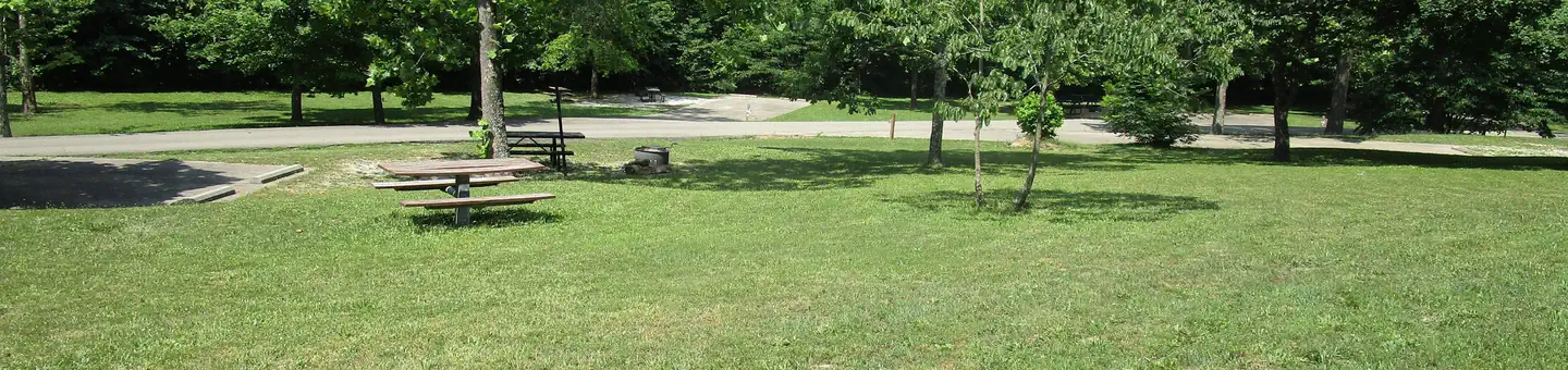 Sutton Bluff Recreation AreaRiver fishing8.9 mi
- Sutton BluffCamping8.9 mi
- Loggers LakeCamping10 mi
Source: Roamze catalog (indexable pages within 10 miles, PostGIS distance)
- Sinking CreekCanoeing · ~22 min drive
- Loggers LakeBoat launch · ~17 min drive
- Round SpringTubing · ~35 min drive
- Blair CreekCanoeing · ~29 min drive
- Centerville AccessBoat launch · ~20 min drive
- PulltiteTubing · ~37 min drive
- Logan CreekCanoeing · ~33 min drive
- Dillards AccessBoat launch · ~28 min drive
- Two RiversTubing · ~39 min drive
- Sinking CreekCanoeing · ~35 min drive
Best time to visit West Fork Black River
Best months: March–June and September–November. Best months have typical highs of 55–85 °F, lows of 30 °F or warmer (32 °F where the station doesn't record snow), at most one snowy day and no more than 12 wet days.
Jan
43° / 22°
9 wet
Feb
48° / 26°
9 wet
Mar
57° / 34°
10 wet
Apr
68° / 44°
11 wet
May
75° / 53°
12 wet
Jun
83° / 61°
10 wet
Jul
88° / 65°
9 wet
Aug
87° / 63°
8 wet
Sep
79° / 56°
7 wet
Oct
69° / 45°
9 wet
Nov
56° / 35°
9 wet
Dec
45° / 26°
9 wet
Typical high / low (°F) and days with rain or snow, 1991–2020. Measured at Salem, MO, 22.2 mi away at 1,205 ft. Source: NOAA NCEI U.S. Climate Normals 1991–2020.
