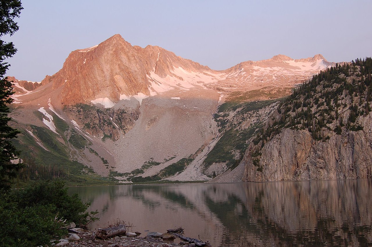
Snowmass Peak
 Photo: Mike D Lewis, CC BY-SA 3.0 (via Wikimedia Commons)
At a glance
Snowmass Peak is a summit of about 13,584 feet in Gunnison County, Colorado, inside the Maroon Bells-Snowmass Wilderness. The peak lies within the Aspen Ranger District of White River National Forest, which the Forest Service manages, and the nearest town is Marble, about 8 miles away. The closest trails are the North Fork Cutoff Trail, about 1.6 miles away, and the Snowmass Lake Connector, about 1.7 miles away. Farther out, Maroon Lake Scenic offers lake fishing about 6.4 miles away, and the Crystal River, a canoeing route, is about 7.3 miles away.
- summit
- 13,584 ft
- managed by
- Forest Service
Where it is: Maroon Bells-Snowmass Wilderness · Aspen Ranger District
Near: Snowmass Village
Been here? Tell people how it was.
We don't know of a mapped trail or route to the summit of Snowmass Peak. Plan the approach with local maps, a guidebook or a local guide, and check conditions before you go.
 Hagerman Peak13,830 ft · Colorado1 route0.2 mi awayPhoto: Nelsestu at English Wikipedia, Public domain (via Wikimedia Commons)
- Snowmass Mountain14,090 ft · Colorado1 route0.7 mi awayPhoto: Nelsestu at English Wikipedia, Public domain (via Wikimedia Commons)
- Clark Peak13,564 ft · Colorado1 route2.9 mi away
 Capitol Peak14,121 ft · Colorado1 route3.0 mi awayPhoto: Xpda, CC BY 3.0 (via Wikimedia Commons)
- Willoughby Mountain13,139 ft · Colorado1 route3.9 mi away
- North Maroon Peak14,012 ft · Colorado1 route4.4 mi away
- Hagerman PeakSummitPhoto: Nelsestu at English Wikipedia, Public domain (via Wikimedia Commons)Next door
- Capitol PeakSummitPhoto: Xpda, CC BY 3.0 (via Wikimedia Commons)~5 min drive
 Mount DalySummitPhoto: lamblukas, CC BY 2.0 (via Wikimedia Commons)~7 min drive
 Sievers MountainSummitPhoto: Robert Tadlock, CC BY 2.0 (via Wikimedia Commons)~10 min drive
 Purple MountainSummitPhoto: Jonathan Fox, CC BY-SA 2.0 (via Wikimedia Commons)~15 min drive
 Hunter PeakSummitPhoto: Jeremiah LaRocco, CC BY-SA 2.0 (via Wikimedia Commons)~16 min drive
 Keefe PeakSummitPhoto: Jeremiah LaRocco, CC BY-SA 2.0 (via Wikimedia Commons)~17 min drive
 Gothic MountainSummitPhoto: Jeffrey Beall from Denver, Colorado, USA, CC BY-SA 2.0 (via Wikimedia Commons)~19 min drive
 Hayden PeakSummitPhoto: Wolfgang Moroder, CC BY-SA 3.0 (via Wikimedia Commons)~20 min drive
 Cathedral PeakSummitPhoto: John Sowell, CC BY-SA 4.0 (via Wikimedia Commons)~20 min drive
Conditions and forecast
Caution todayAgency alerts are in effect for this areaUSFS · checked 9 min agoDaily highs and lows, wind and the chance of precipitation at the summit for the next 7 days, from the Open-Meteo model.
Questions about Snowmass Peak
How tall is Snowmass Peak?
13,584 ft (4,140 m).
Is there a trail to the top of Snowmass Peak?
We don't know of a mapped trail or route to the summit. Plan the approach with local maps, a guidebook or a local guide.


Ask about this place
Questions about Snowmass Peak: conditions, access, timing. Answers say when something isn't known.
