San Antonio Falls
At a glance
San Antonio Falls is a waterfall in the San Gabriel Mountains National Monument Ranger District of Angeles National Forest, managed by the Forest Service. The nearest town is Wrightwood, about 5 miles away, and the falls sit at roughly 6,600 feet. Late spring and early fall are the most comfortable times to visit. Typical averages from a nearby weather station in Wrightwood show May highs around 69°F and September highs around 75°F, with lows in the upper 30s to mid 40s. Winter is much colder, with January highs near 48°F and lows around 26°F. Several other destinations are close by. Register Ridge is about 0.3 miles away, and Manker Flat campground is about half a mile off. The Baldy Bowl Trail and Mt. Baldy Resort are each about 0.6 miles away.
- elevation
- 6,596 ft
- managed by
- Forest Service
- best months
- Apr–Oct
Where it is: San Gabriel Mountains National Monument Ranger District · Angeles National Forest
Near: Rancho Cucamonga
Best time to visit San Antonio Falls
Best months: April–October. Best months have typical highs of 55–85 °F, lows of 30 °F or warmer (32 °F where the station doesn't record snow), at most one snowy day and no more than 12 wet days.
Jan
48°
26°
5 wet
Feb
48°
25°
8 wet
Mar
54°
29°
6 wet
Apr
60°
32°
4 wet
May
69°
39°
2 wet
Jun
78°
44°
1 wet
Jul
83°
53°
2 wet
Aug
82°
51°
2 wet
Sep
75°
46°
2 wet
Oct
64°
37°
3 wet
Nov
55°
29°
4 wet
Dec
47°
25°
5 wet
Typical high / low (°F) and days with rain or snow, 1991–2020. Measured at Wrightwood, CA, 6.2 mi away at 6,000 ft. The station sits about 600 ft lower than this place, so expect it a little cooler here. This station doesn't record snowfall. Source: NOAA NCEI U.S. Climate Normals 1991–2020.
Been here? Tell people how it was.
 Register RidgeHikingPhoto: inkknife_2000 (7.5 million views +), CC BY-SA 2.0 (via Wikimedia Commons)0.3 mi
- Manker FlatCamping0.5 mi
 Baldy Bowl TrailHikingPhoto: feverblue, CC BY-SA 2.0 (via Flickr)0.6 mi
- Mt. Baldy ResortDownhill skiing0.6 mi
- Other RoutesRock climbing0.7 mi
- Rock GardenRock climbing0.7 mi
- LupineCamping4.4 mi
- Lytle Creek - Cajon Pass Recreation AreaRiver fishing9.2 mi
 Bonita FallsWaterfallPhoto: San Bernardino Nat'l Forest, Public domain (via Wikimedia Commons)~14 min drive
- Wolfskill FallsWaterfall~16 min drive
- Middleman FallsWaterfall~21 min drive
- Sturtevant FallsWaterfall~38 min drive
- Monkeyface FallsWaterfall~1h 10m drive
- Silverwood FallsWaterfall~1h 24m drive
- Big FallsWaterfall~1h 16m drive
Also worth it near here
- Register RidgeHikingPhoto: inkknife_2000 (7.5 million views +), CC BY-SA 2.0 (via Wikimedia Commons)Next door
- Other RoutesRock climbing~1 min drive
 Chapman TrailMountain bikingPhoto: Bri Weldon, CC BY 2.0 (via Wikimedia Commons)~3 min drive
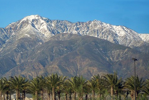 Cucamonga PeakSummitPhoto: Cliff Hutson; later cropping and color editing by Daniel Case., CC BY 2.0 (via Wikimedia Commons)~8 min drive
Conditions and forecast
Caution todayAgency alerts are in effect for this areaUSFS · checked 4 min agoDaily highs and lows, wind and the chance of precipitation at San Antonio Falls for the next 7 days, from the Open-Meteo model.
Ask about this place
Questions about San Antonio Falls: conditions, access, timing. Answers say when something isn't known.
