Sugarpine Creek
At a glance
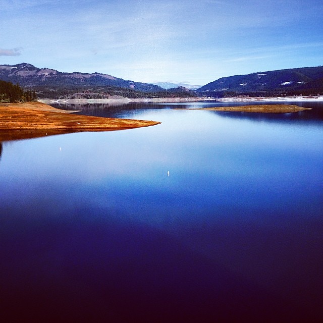
Sugarpine Creek is a canoeing destination in southern Oregon's High Cascades Ranger District, part of the Rogue River-Siskiyou National Forests. The Forest Service manages the land, and the nearest town is Chiloquin, about 36 miles away. Paddling season runs from late spring through early fall. Typical averages from a nearby weather station show highs around 66°F in May and 77°F in September, with July and August peaking near 85°F. Winter brings frequent snow days from December through February. The Sugar Pine Trail 1080 is about a mile away. Elk Creek, another paddling route, is roughly 3 miles off, and Butler Butte Cabin offers a place to camp about 4 miles out. Donegan Prairie is a hike roughly 8 miles from the creek.
- distance
- 8.9 mi
- high point
- 4,481 ft
- best months
- May–Sep
Where it is: High Cascades Ranger District · Rogue River-Siskiyou National Forests
Near: Eagle Point
Best time to visit Sugarpine Creek
Best months: May–September. Best months have typical highs of 55–85 °F, lows of 30 °F or warmer (32 °F where the station doesn't record snow), at most one snowy day and no more than 12 wet days.
Jan
39°
19°
13 wet · 6 snow
Feb
44°
22°
11 wet · 5 snow
Mar
50°
25°
11 wet · 4 snow
Apr
57°
28°
10 wet · 2 snow
May
66°
33°
8 wet
Jun
75°
37°
4 wet
Jul
85°
42°
3 wet
Aug
84°
41°
2 wet
Sep
77°
34°
4 wet
Oct
64°
27°
7 wet
Nov
48°
24°
12 wet · 3 snow
Dec
39°
19°
14 wet · 7 snow
Typical high / low (°F) and days with rain or snow, 1991–2020. Measured at Chiloquin 12 Nw (Fort Klamath), OR, 35.7 mi away at 4,180 ft. Source: NOAA NCEI U.S. Climate Normals 1991–2020.
Closures we've recorded since August 2026
Stage 2 Public Use Fire Restrictions (Forest-wide)
Rogue River-Siskiyou National Forests · Order dated September 4, 2026; seen Sep 3, 2026 → lifted Oct 28, 2026 · Forest Service
Stage 3 Public Use Fire Restrictions (Forest-wide)
Rogue River-Siskiyou National Forests · Order dated July 17, 2026; seen Aug 23, 2026 → lifted Sep 3, 2026 · Forest Service
Been here? Tell people how it was.
- Sugar Pine Trail 1080Hiking1.2 mi
 Elk CreekCanoeingPhoto: Little Mountain 5, CC BY-SA 3.0 (via Wikimedia Commons)2.9 mi
- Bitterlick TrailHiking4.1 mi
- Butler Butte CabinCamping4.2 mi
- Whisky Camp Guard StationCamping6.5 mi
- Beaver CreekCanoeing7.6 mi
- Donegan PrairieHiking7.6 mi
- Big Serviceberry CreekCanoeing8.5 mi
- Elk CreekCanoeingPhoto: Little Mountain 5, CC BY-SA 3.0 (via Wikimedia Commons)~5 min drive
- Cole Rivers Hatchery Boat RampBoat launch~19 min drive
 Rogue RiverCanoeingPhoto: Bob Heims, U.S. Army Corps of Engineers, Public domain (via Wikimedia Commons)~33 min drive
- Casey Park Boat RampBoat launch~20 min drive
 Little Butte CreekCanoeingPhoto: An employee of the USDA Forest Service, Public domain (via Wikimedia Commons)~42 min drive
- Rogue Elk Boat RampBoat launch~21 min drive
 Cavitt CreekCanoeingPhoto: Bureau of Land Management Oregon and Washington, Public domain (via Wikimedia Commons)~44 min drive
- Takelma Boat RampBoat launch~33 min drive
 South Umpqua RiverCanoeingPhoto: McD22, CC BY 2.0 (via Wikimedia Commons)~29 min drive
- Shady Cove Boat RampBoat launch~28 min drive
Conditions and forecast
Caution todayAgency alerts are in effect for this areaUSFS · checked 7 min agoDaily highs and lows, wind and the chance of precipitation at Start for the next 7 days, from the Open-Meteo model.
Ask about this place
Questions about Sugarpine Creek: conditions, access, timing. Answers say when something isn't known.
Local outfitters
- The Fishin Hole Fly Shop16 mi away
- Rogue Rafting Company33 mi away
Not on Roamze yet. Their page has how to reach them.
