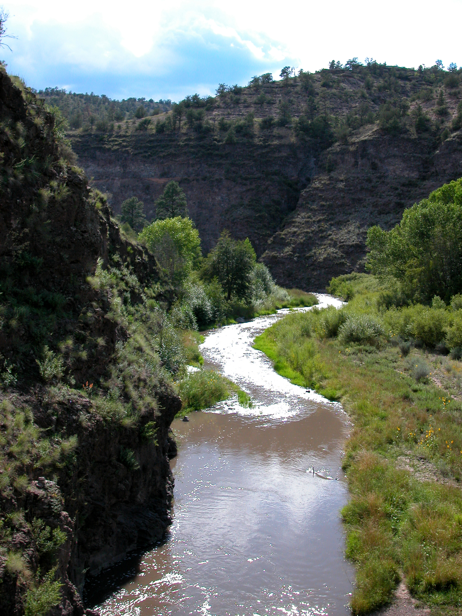
West Fork Gila River
 Photo: Chris M Morris, CC BY 2.0 (via Wikimedia Commons)
At a glance
West Fork Gila River is a paddling route in the Gila Wilderness, part of the Wilderness Ranger District of Gila National Forest in New Mexico. The Forest Service manages the land, and the river runs through designated wilderness, which makes it a remote, backcountry destination. Spring and fall are the most comfortable times to paddle. Typical averages from a nearby weather station in Winston, NM, show May highs around 79°F and October highs around 71°F, while July and August bring the most wet days, about nine and ten a month. That station sits roughly 1,600 feet lower than the river, so temperatures on the water run cooler. Several trails lie within a few miles of the river. Woodland Park Trail #12 is about 1.5 miles away, Hells Hole Trail #268 is about 1.9 miles away, and Ring Canyon Trail is about 2 miles away. For more paddling, the Middle Fork Gila River is about 4.5 miles away.
- distance
- 32.7 mi
- high point
- 7,833 ft
- best months
- Apr–May, Aug–Oct
Where it is: Gila Wilderness · Wilderness Ranger District
Near: Little Walnut Village
Best time to visit West Fork Gila River
Best months: April–May and August–October. Best months have typical highs of 55–85 °F, lows of 30 °F or warmer (32 °F where the station doesn't record snow), at most one snowy day and no more than 12 wet days.
Jan
53°
20°
2 wet · 1 snow
Feb
57°
23°
2 wet · 1 snow
Mar
64°
27°
2 wet
Apr
71°
34°
1 wet
May
79°
41°
2 wet
Jun
89°
50°
4 wet
Jul
87°
56°
9 wet
Aug
84°
54°
10 wet
Sep
79°
47°
6 wet
Oct
71°
35°
3 wet
Nov
60°
25°
2 wet
Dec
52°
19°
3 wet · 1 snow
Typical high / low (°F) and days with rain or snow, 1991–2020. Measured at Winston, NM, 42 mi away at 6,196 ft. The station sits about 1,600 ft lower than this place, so expect it a little cooler here. Source: NOAA NCEI U.S. Climate Normals 1991–2020.
Been here? Tell people how it was.
- Woodland Park Trail #12Hiking1.5 mi
- Hells Hole Trail #268Hiking1.9 mi
- Ring Canyon TrailHiking2 mi
- Hells Hole BypassHiking2.3 mi
- Little Creek CutoffHiking2.7 mi
- Prior Creek Trail #156Hiking3 mi
- Woodland Park Trail #164Hiking3.3 mi
 Middle Fork Gila RiverCanoeingPhoto: Joe Burgess, Public domain (via Wikimedia Commons)4.5 mi
 Mimbres RiverCanoeingPhoto: Rafael Moreno (Flikr user moreno415), CC BY 2.0 (via Wikimedia Commons)~1h 9m drive
- Middle Fork Gila RiverCanoeingPhoto: Joe Burgess, Public domain (via Wikimedia Commons)~8 min drive
- East Fork Gila RiverCanoeing~21 min drive
- Beaver CreekCanoeing~29 min drive
- Lake Roberts Boat LaunchBoat launch~34 min drive
- Mogollon CreekCanoeing~25 min drive
- Tularosa RiverCanoeing~1h 9m drive
- San Francisco RiverCanoeing~1h 9m drive
- Blue RiverCanoeing~1h 23m drive
- Boat Ramp at Snow Lake Boat LaunchBoat launch~23 min drive
Conditions and forecast
Caution at last checkAgency alerts are in effect for this areaUSFS, usgs_nwis · checked 19 h agoDaily highs and lows, wind and the chance of precipitation at Start for the next 7 days, from the Open-Meteo model.

Ask about this place
Questions about West Fork Gila River: conditions, access, timing. Answers say when something isn't known.
