Tularosa River
- 38.5 mi
- distance
- 7,029 ft
- high point
- May–Jun, Sep
- best months
Caution today
Agency alerts are in effect for this area; weather is good · USFS, OpenWeather · checked just now
Is Tularosa River open right now?
Closure in the area
There's a closure order in Gila National Forest. It doesn't name Tularosa River, so check the source for the area it covers (2 listed).
Beaverhead Water Non-Potable
Agency closure covering Gila National Forest · USFS · Gila National Forest
Ben Lilly and Willow Creek Campground Closure
Agency closure covering Reserve Ranger District · Order 03-06-06-26-001 · USFS · Reserve Ranger District
Harmful algae detected in Lake Roberts
Agency alert covering Gila National Forest · USFS · Gila National Forest
Potentially Dangerous Animal Encounters
Agency alert covering Gila National Forest · USFS · Gila National Forest
As of · Source: USFS · Gila National Forest. Agencies don't list every closure — check before you go.
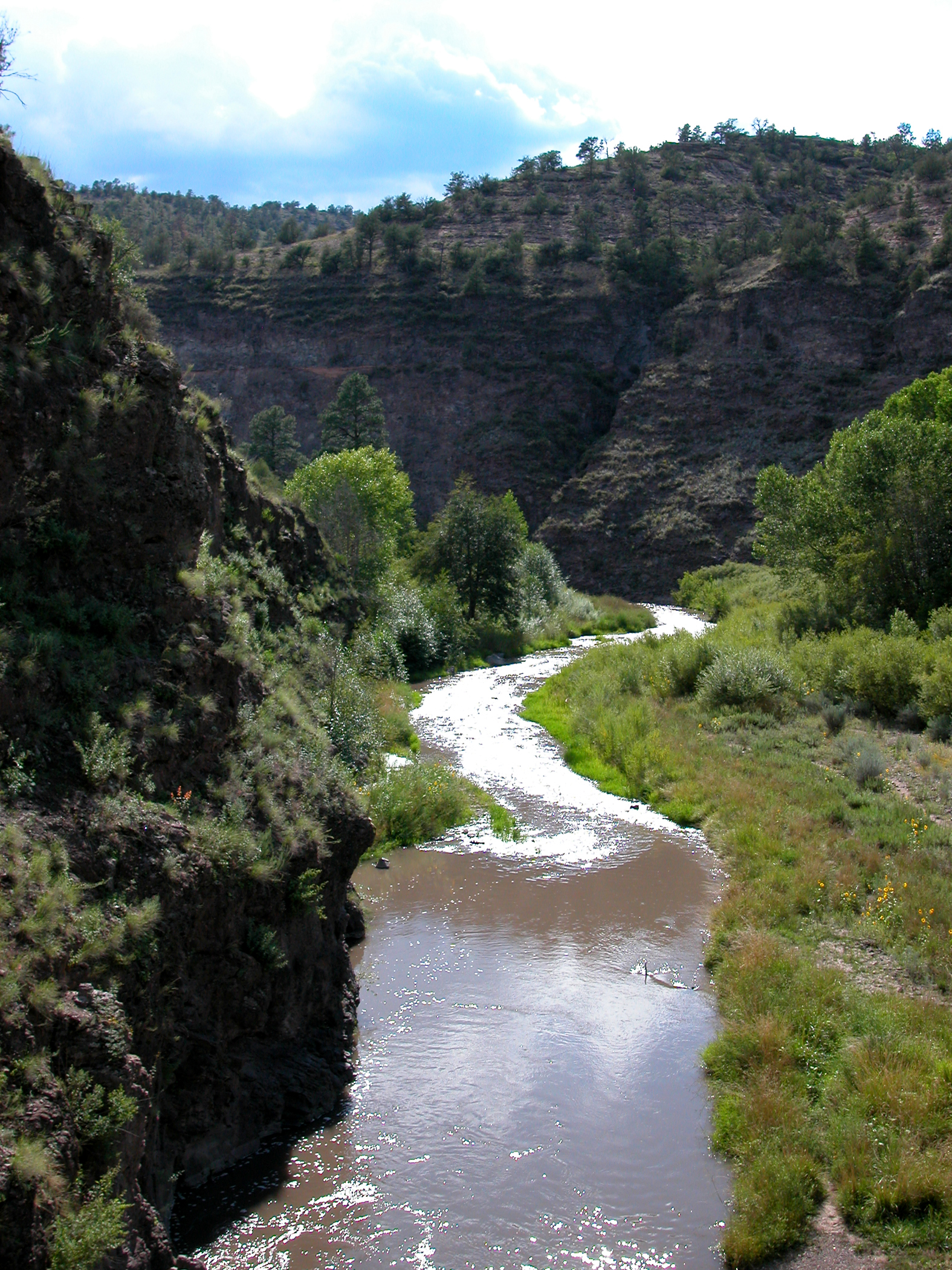
Tularosa River is a 38-mile paddling stretch near Reserve, New Mexico, in the Reserve Ranger District of Gila National Forest. The U.S. Forest Service manages the land along the river. It is an ephemeral waterway, and it may run dry in some seasons. The river's average flow is about 42 cubic feet per second, and its gradient is about 35.1 feet per mile. Spring and fall are the most comfortable times to paddle. Typical averages from a nearby weather station show May highs around 75°F and October highs around 71°F, with summer bringing more frequent rain, peaking at about 14 to 15 wet days in July and August. Apache Cr. Interp. is about 2 miles away, and Walk in the Past Trail #616 is about 2.3 miles off. Wilson Canyon lies roughly 7 miles away, and Frisco Box Trail #762 is about 8 miles out.
- Apache Cr. Interp.Hiking2.1 mi
- Walk in the Past Trail #616Hiking2.3 mi
- WALK IN THE PASTHiking2.3 mi
- Wilson CanyonHiking7.1 mi
- Frisco Box Trail #762Hiking7.8 mi
- Frisco BoxHiking8.8 mi
- MilliganHiking9.1 mi
Source: Roamze catalog (indexable pages within 10 miles, PostGIS distance)
 Middle Fork Gila RiverCanoeing · ~1h 3m drivePhoto: Joe Burgess, Public domain (via Wikimedia Commons)
- Boat Ramp at Snow Lake Boat LaunchBoat launch · ~46 min drive
 West Fork Gila RiverCanoeing · ~1h 9m drivePhoto: Chris M Morris, CC BY 2.0 (via Wikimedia Commons)
- Nelson Reservoir North Boating SiteBoat launch · ~1h 3m drive
- San Francisco RiverCanoeing · ~32 min drive
- Big Lake South Cove Boating SiteBoat launch · ~1h 19m drive
- Blue RiverCanoeing · ~1h 2m drive
- Crescent Lake West Side (Store Area) Boating SiteBoat launch · ~1h 19m drive
- North Fork East Fork Black RiverCanoeing · ~1h 10m drive
- Big Lake Railroad Cove Boating SiteBoat launch · ~1h 19m drive
Best time to visit Tularosa River
Best months: May–June and September. Best months have typical highs of 55–85 °F, lows of 30 °F or warmer (32 °F where the station doesn't record snow), at most one snowy day and no more than 12 wet days.
Jan
52° / 13°
5 wet · 2 snow
Feb
55° / 16°
5 wet · 2 snow
Mar
61° / 19°
5 wet · 1 snow
Apr
67° / 25°
3 wet · 1 snow
May
75° / 30°
4 wet
Jun
85° / 37°
5 wet
Jul
85° / 48°
14 wet
Aug
82° / 47°
15 wet
Sep
79° / 39°
9 wet
Oct
71° / 27°
5 wet
Nov
61° / 18°
4 wet · 1 snow
Dec
52° / 13°
5 wet · 2 snow
Typical high / low (°F) and days with rain or snow, 1991–2020. Measured at Luna Rs, NM, 17.8 mi away at 7,050 ft. Source: NOAA NCEI U.S. Climate Normals 1991–2020.
