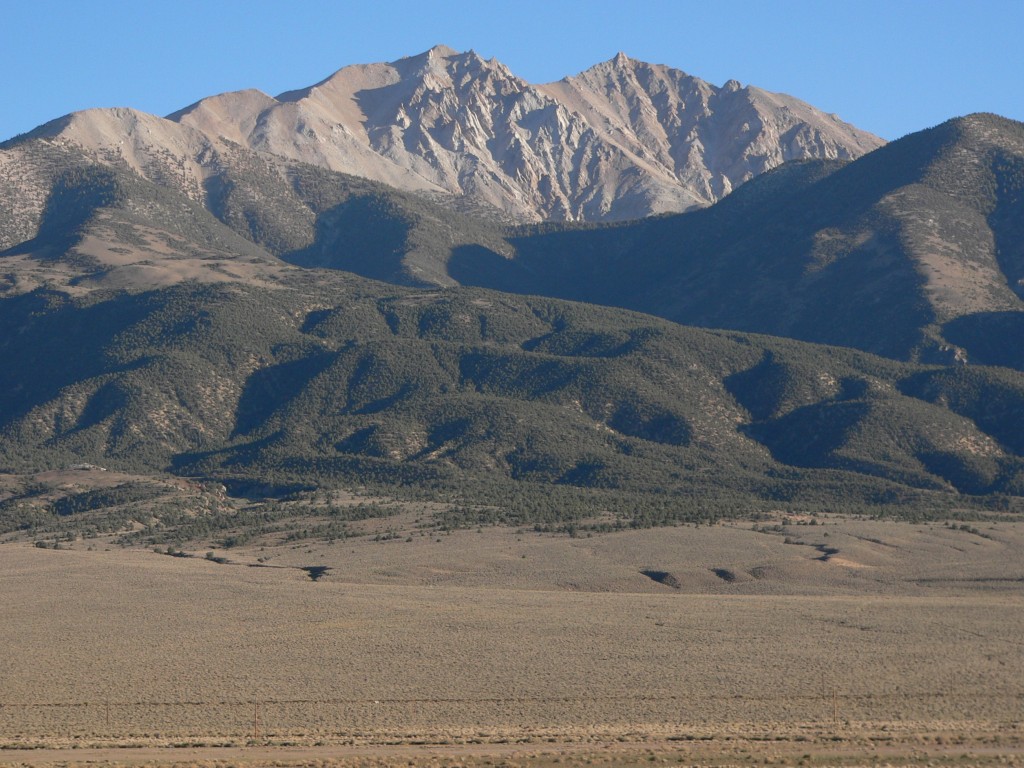
Montgomery Peak
 Photo: Johndheathcote at English Wikipedia, Public domain (via Wikimedia Commons)
At a glance
Montgomery Peak is a summit of about 13,420 feet in Mono County, California, inside the White Mountains Wilderness. The peak lies within the White Mountain Ranger District of Inyo National Forest, which the Forest Service manages, and the nearest town is Benton, about 7 miles away. Boundary Peak Trail is about 2 miles away, and Boundary Peak is about 3 miles away. Indian Creek Stock and Spring Source Path are both within about 10 miles.
- summit
- 13,420 ft
- managed by
- Forest Service
Where it is: White Mountains Wilderness · White Mountain Ranger District
Near: Sunny Slopes
Been here? Tell people how it was.
We don't know of a mapped trail or route to the summit of Montgomery Peak. Plan the approach with local maps, a guidebook or a local guide, and check conditions before you go.
 Boundary Peak13,132 ft · Nevada1 route0.6 mi awayPhoto: An63ca (talk · contribs), Public domain (via Wikimedia Commons)
 White Mountain Peak14,243 ft · California2 routes15 mi awayPhoto: JonathanLamb (talk · contribs), CC BY 3.0 (via Wikimedia Commons)
- Broken Finger Peak13,087 ft · California1 route36 mi away
 Red Slate Mountain13,164 ft · California1 route36 mi awayPhoto: Poppy (talk · contribs), CC BY-SA 3.0 (via Wikimedia Commons)
 Mount Tom13,643 ft · California1 route38 mi awayPhoto: Eeekster, CC BY-SA 4.0 (via Wikimedia Commons)
- Panorama Dome8,898 ft · California2 routes38 mi away
- Boundary PeakSummitPhoto: An63ca (talk · contribs), Public domain (via Wikimedia Commons)~1 min drive
 Mount DuboisSummitPhoto: Martin Stiburek, CC BY-SA 4.0 (via Wikimedia Commons)~7 min drive
- White Mountain PeakSummitPhoto: JonathanLamb (talk · contribs), CC BY 3.0 (via Wikimedia Commons)~26 min drive
 Glass MountainSummitPhoto: Eeekster, CC BY 3.0 (via Wikimedia Commons)~34 min drive
 Mount MorrisonSummitPhoto: The original uploader was Geographer at English Wikipedia., CC BY 1.0 (via Wikimedia Commons)~57 min drive
 Laurel MountainSummitPhoto: Frank Kovalchek from Anchorage, Alaska, USA, CC BY 2.0 (via Wikimedia Commons)~59 min drive
 Mount BaldwinSummitPhoto: Channel City Camera Club from Santa Barbara, US, CC BY 2.0 (via Wikimedia Commons)~59 min drive
 Bloody MountainSummitPhoto: Adorabutton, CC BY-SA 3.0 (via Wikimedia Commons)~1h 1m drive
 Mount HopkinsSummitPhoto: Fred Hsu from San Jose, United States, CC BY 2.0 (via Wikimedia Commons)~1h 2m drive
- Red Slate MountainSummitPhoto: Poppy (talk · contribs), CC BY-SA 3.0 (via Wikimedia Commons)~1h 2m drive
Conditions and forecast
Caution at last checkAgency alerts are in effect for this areaUSFS · checked 16 h agoDaily highs and lows, wind and the chance of precipitation at the summit for the next 7 days, from the Open-Meteo model.
Questions about Montgomery Peak
How tall is Montgomery Peak?
13,420 ft (4,090 m).
Is there a trail to the top of Montgomery Peak?
We don't know of a mapped trail or route to the summit. Plan the approach with local maps, a guidebook or a local guide.


Ask about this place
Questions about Montgomery Peak: conditions, access, timing. Answers say when something isn't known.
