Middle Knob
At a glance
Middle Knob is a summit of 4,200 feet in Virginia's Mount Rogers National Recreation Area, part of the George Washington and Jefferson National Forest. The nearest town is Lebanon, about 6 miles away. September is the most comfortable time to go. Typical averages from a nearby weather station show highs around 75°F and lows near 58°F, with fewer wet days than most of the year. That station sits well below the summit, so temperatures up high run cooler. Channels Trail lies about 3 miles away, and Brumley Creek and Wolf Creek offer canoeing within about 4 miles. Brumley Mountain Trail is roughly 6 miles off.
- summit
- 4,200 ft
- way up
- 1
- best months
- Apr, Sep–Oct
Where it is: Mount Rogers National Recreation Area · George Washington and Jefferson National Forest
Near: Lebanon · 5.9 mi
Best time to visit Middle Knob
Best months: April and September–October. Best months have typical highs of 55–85 °F, lows of 30 °F or warmer (32 °F where the station doesn't record snow), at most one snowy day and no more than 12 wet days.
Jan
40°
24°
16 wet
Feb
44°
27°
14 wet
Mar
52°
34°
14 wet
Apr
63°
44°
12 wet
May
71°
52°
14 wet
Jun
77°
61°
13 wet
Jul
80°
64°
14 wet
Aug
80°
63°
13 wet
Sep
75°
58°
10 wet
Oct
64°
47°
11 wet
Nov
52°
36°
12 wet
Dec
44°
29°
15 wet
Typical high / low (°F) and days with rain or snow, 1991–2020. Measured at Nora 4 Sse, VA, 21.3 mi away at 2,658 ft. The station sits about 1,500 ft lower than this place, so expect it a little cooler here. This station doesn't record snowfall. Source: NOAA NCEI U.S. Climate Normals 1991–2020.
Been here? Tell people how it was.
Map © Mapbox © OpenStreetMap contributors - Channels TrailHiking3.1 mi
- Brumley CreekCanoeing3.5 mi
- Wolf CreekCanoeing4.2 mi
- Brumley Mountain TrailHiking6.4 mi
- Big Cedar Creek TrailHiking7.1 mi
 Grapevine Hill TrailHikingPhoto: vastateparksstaff, CC BY 2.0 (via Wikimedia Commons)7.4 mi
- Pinnacle View TrailHikingPhoto: vastateparksstaff, CC BY 2.0 (via Wikimedia Commons)7.5 mi
 Three Top MountainSummitPhoto: James St. John, CC BY 2.0 (via Wikimedia Commons)~1h 5m drive
 Mount JeffersonSummitPhoto: Matthew Applewood, CC BY-SA 3.0 (via Wikimedia Commons)~1h 14m drive
 Howard KnobSummitPhoto: Bigmacthealmanac, CC BY-SA 4.0 (via Wikimedia Commons)~1h 21m drive
 Beech MountainSummitPhoto: Thomson200, CC0 (via Wikimedia Commons)~1h 22m drive
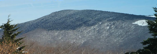 Mount RogersSummitPhoto: USDA-FS, Public domain (via Wikimedia Commons)~48 min drive
- Turkey KnobSummit~6 min drive
- The ButtSummit~12 min drive
- McQueen KnobSummit~36 min drive
- Grosses MountainSummit~38 min drive
- Locust Pole KnobSummit~39 min drive
Conditions and forecast
Caution todayAgency alerts are in effect for this areaUSFS · checked 11 h agoDaily highs and lows, wind and the chance of precipitation at the summit and route start for the next 7 days, from the Open-Meteo model.
Questions about Middle Knob
How tall is Middle Knob?
4,200 ft (1,280 m).
How many routes go to the summit of Middle Knob?
One: Brumley Mountain Trail.
Ask about this place
Questions about Middle Knob: conditions, access, timing. Answers say when something isn't known.
