Manker Flat
At a glance
6,000-foot elevation21 campsites Piped water and flush toilets RV 's to 16 '- No Hookups Camping - $20 per night per site, $5 for extra vehicle. Day use - $5 per vehicle. Adventure Pass will be honored for day use. Campsites are first-come-first-served. Adventure Pass required for vehicles parked outside the campground. Treat stream water before using, if available. What to Expect Camp high in the clouds at Manker Flats Campground. This campground sits at 6000-feet and offers 21 campsites open year-round. However, piped-water is turned once temperatures reach freezing. Each site comes with a spacious spot for all your family camping needs and includes a picnic bench, fire ring, and vault toilets. It 's located within a short drive to historic Mt. Baldy Schoolhouse and Visitor Center where visitors can discover the land 's Native American roots. Close by, hikers have several options to begin their day 's adventure including, Mt. Baldy Bowl trailhead. This trailhead can be combined with another major route, Devil 's Backbone, to reach the summit (10,069 ') to form an impressive 11.3-mile loop hike. For the more casual hiker, a 1.4 mile round trip to the 75-foot San Antonio Falls is available. Bears are very active in this area, so it is recommended that all campers use provided bear boxes, personal bear canisters, or seal all food as to eliminate scent.
- best months
- Apr–Oct
Where it is: San Gabriel Mountains National Monument Ranger District · Angeles National Forest
Near: Rancho Cucamonga
Best time to visit Manker Flat
Best months: April–October. Best months have typical highs of 55–85 °F, lows of 30 °F or warmer (32 °F where the station doesn't record snow), at most one snowy day and no more than 12 wet days.
Jan
48°
26°
5 wet
Feb
48°
25°
8 wet
Mar
54°
29°
6 wet
Apr
60°
32°
4 wet
May
69°
39°
2 wet
Jun
78°
44°
1 wet
Jul
83°
53°
2 wet
Aug
82°
51°
2 wet
Sep
75°
46°
2 wet
Oct
64°
37°
3 wet
Nov
55°
29°
4 wet
Dec
47°
25°
5 wet
Typical high / low (°F) and days with rain or snow, 1991–2020. Measured at Wrightwood, CA, 6.7 mi away at 6,000 ft. This station doesn't record snowfall. Source: NOAA NCEI U.S. Climate Normals 1991–2020.
Been here? Tell people how it was.
 Register RidgeHikingPhoto: inkknife_2000 (7.5 million views +), CC BY-SA 2.0 (via Wikimedia Commons)0.2 mi
- Mt. Baldy ResortDownhill skiing0.4 mi
- Mount Baldy RoadRock climbing0.7 mi
 Baldy Bowl TrailHikingPhoto: feverblue, CC BY-SA 2.0 (via Flickr)1.1 mi
- Icehouse CanyonRock climbing1.2 mi
- LupineCamping4.9 mi
- GuffyCamping5.5 mi
- Lytle Creek - Cajon Pass Recreation AreaRiver fishing8.9 mi
- Table Mountain (angeles)Camping~15 min drive
- Mountain OakCamping~18 min drive
- Coldwater Canyon Yellow Post SitesCamping~4 min drive
- Kelly CampCamping~4 min drive
- Stockton Flats Yellow Post SitesCamping~5 min drive
- CommancheCamping~6 min drive
- Third Stream CrossingCamping~6 min drive
- Paiute Canyon Yellow Post SitesCamping~6 min drive
- Little Fish ForkCamping~7 min drive
- Gobbler's Knob Yellow Post SitesCamping~7 min drive
Also worth it near here
- Register RidgeHikingPhoto: inkknife_2000 (7.5 million views +), CC BY-SA 2.0 (via Wikimedia Commons)Next door
 Chapman TrailMountain bikingPhoto: Bri Weldon, CC BY 2.0 (via Wikimedia Commons)~2 min drive
- Icehouse CanyonRock climbing~2 min drive
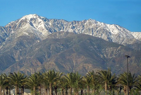 Cucamonga PeakSummitPhoto: Cliff Hutson; later cropping and color editing by Daniel Case., CC BY 2.0 (via Wikimedia Commons)~7 min drive
Conditions and forecast
Caution todayAgency alerts are in effect for this areaUSFS · checked 6 min agoDaily highs and lows, wind and the chance of precipitation at Manker Flat for the next 7 days, from the Open-Meteo model.
Ask about this place
Questions about Manker Flat: conditions, access, timing. Answers say when something isn't known.
- At 6,014 ft
- San Gabriel Mountains National Monument Ranger DistrictAngeles National Forest
