Windy Gap - A Young Life Camp
Campground
4.5 mi from the trail
Little Snowball Mountain is a summit of 4,713 feet in the Appalachian Ranger District of the National Forests in North Carolina, about 4.5 miles from the town of Barnardsville. Summer and early fall are the most comfortable times to go. Typical averages from a nearby weather station show July highs around 76°F and September highs near 70°F with lows in the mid-50s. That station sits a few hundred feet lower than the summit, so temperatures up top run a little cooler. The closest outing is the Snowball hike, about 2.3 miles away. Douglas Falls and Craggy Pinnacle Trail are both within about 3.5 miles, and the Snake's Den climbing area is roughly 4.8 miles off.
Where it is: Appalachian Ranger District · National Forests in North Carolina
Near: Asheville
Late July to early December and early April to early July are usually best for the summit here.
Typical highs of 47–75°F and lows of 31°F or warmer in those weeks. Rain falls on about 45% of days at the wettest of them, so plan around showers.
Typical weather: NOAA 1991–2020 normals at Swannanoa 2 Sse, NC, 11 mi away. Not a forecast.
Typical weather by monthBest months: April–June and August–November. Best months are the ones mostly made of the best weeks for the summit: typical temperatures in its comfortable range, few snowy days and not usually wet, judged with the same limits as our good-day forecasts.
Jan
41°
25°
13 wet · 6 snow
Feb
44°
27°
12 wet · 5 snow
Mar
52°
33°
13 wet · 5 snow
Apr
62°
42°
12 wet · 2 snow
May
69°
50°
12 wet
Jun
73°
57°
14 wet
Jul
76°
61°
14 wet
Aug
75°
59°
13 wet
Sep
70°
54°
10 wet
Oct
61°
44°
9 wet
Nov
52°
34°
10 wet · 2 snow
Dec
44°
28°
12 wet · 5 snow
Typical high / low (°F) and days with rain or snow, 1991–2020. Measured at Swannanoa 2 Sse, NC, 10.5 mi away at 4,320 ft. Source: NOAA NCEI U.S. Climate Normals 1991–2020.
Been here? Tell people how it was.
We don't know of a mapped trail or route to the summit of Little Snowball Mountain. Plan the approach with local maps, a guidebook or a local guide, and check conditions before you go.

 SnowballHikingPhoto: A. Duarte, CC BY-SA 2.0 (via Flickr)2.3 mi
 Craggy Pinnacle TrailHikingPhoto: A. Duarte, CC BY-SA 2.0 (via Flickr)3.4 mi
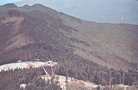 Mount MitchellSummitPhoto: Public domain (via Wikimedia Commons)~17 min drive
 Balsam ConeSummitPhoto: Thomson200, CC0 (via Wikimedia Commons)~19 min driveCraggy PinnacleSummitPhoto: Thomson200, CC0 (via Wikimedia Commons)~6 min drive
 Big TomSummitPhoto: Brian Stansberry (photographer), CC BY 3.0 (via Wikimedia Commons)~18 min drive
 Celo KnobSummitPhoto: Thomson200, CC0 (via Wikimedia Commons)~23 min drive
Daily highs and lows, wind and the chance of precipitation at the summit for the next 7 days, from the Open-Meteo model.
4,713 ft (1,437 m).
We don't know of a mapped trail or route to the summit. Plan the approach with local maps, a guidebook or a local guide.
Questions about Little Snowball Mountain: conditions, access, timing. Answers say when something isn't known.
Windy Gap - A Young Life Camp
Campground
 If it rainsDavidhuffcreative, CC BY-SA 4.0 · Wikimedia Commons
Places © OpenStreetMap contributors, Places © Overture Maps Foundation · Photos: Davidhuffcreative, CC BY-SA 4.0 (commons)
More in Spruce Pine