Mountain · 1 route
Hawkbill Rock
4,955 ft · North Carolina
- Summit
- 4,955 ft
- Routes
- 1 way up
- Season
- Year-round
Route up Hawkbill Rock
About Hawkbill Rock
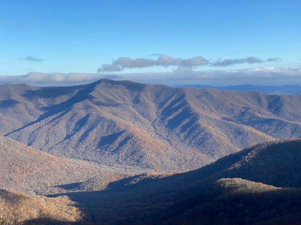
Hawkbill Rock is a summit of 4,955 feet in the Appalachian Ranger District of the National Forests in North Carolina, about 6 miles from the town of Barnardsville. Summer and early fall are the most comfortable times to go. Typical averages from a nearby weather station show July highs around 76°F and September highs near 70°F with lows in the mid-50s. That station sits about 600 feet lower than the summit, so temperatures up top run cooler. Several trails start close by. Snowball is about a mile away, and Craggy Pinnacle Trail and Reese Trail are both within 3 miles. For time on the water, Reems Creek offers canoeing about 4 miles off.
Forecast on Hawkbill Rock
Daily highs and lows, wind and the chance of precipitation at the summit and bee tree gap at mp 367.6 trailhead for the next 7 days, from the Open-Meteo model.
Questions about Hawkbill Rock
How tall is Hawkbill Rock?
4,955 ft (1,510 m).
How many routes go to the summit of Hawkbill Rock?
One: Snowball.
Where do the routes up Hawkbill Rock start?
Snowball starts at Bee Tree Gap at MP 367.6 Trailhead (about 4,882 ft).
When is the best time to climb Hawkbill Rock?
Year-round.
Mountains nearby
- Snowball Mountain5,384 ft · North Carolina1 route0.5 mi away
 Craggy Pinnacle5,886 ft · North Carolina1 route2.1 mi awayPhoto: Thomson200, CC0 (via Wikimedia Commons)
- Craggy Dome6,060 ft · North Carolina1 route2.7 mi away
- Point Misery5,717 ft · North Carolina1 route6.0 mi away
- Little Butt5,639 ft · North Carolina1 route6.2 mi away
- Middle Mountain4,877 ft · North Carolina1 route6.5 mi away
Facts about this place
When to go
Best time to go: Apr–Oct. The mildest months here, with typical highs of 61–76°F and lows of 42–61°F.
Typical monthly averages (not a forecast) from the Swannanoa 2 Sse, NC weather station, 9.3 mi away. High / low in °F, and days with snow.
- Jan41° high25° low6 days with snow
- Feb44° high27° low5 days with snow
- Mar52° high33° low5 days with snow
- Apr62° high42° low2 days with snow
- May69° high50° low
- Jun73° high57° low
- Jul76° high61° low
- Aug75° high59° low
- Sep70° high54° low
- Oct61° high44° low
- Nov52° high34° low2 days with snow
- Dec44° high28° low5 days with snow
Where it is
- Appalachian Ranger District · Ranger district
- National Forests in North Carolina · National forest
- Nearest town
- Barnardsville, North Carolina · 5.7 mi
Conditions
Active alerts for Appalachian Ranger District as of Oct 9, 2026:
Closure order prohibiting protected areas pertaining to Paint Rock
information · posted Aug 24, 2026
Appalachian Ranger District Office Hours
information · posted Aug 24, 2026
Max Patch Restrictions- Appalachian Ranger District
information · posted Aug 24, 2026
Source: USFS forest alerts
Nearby
 SnowballHikingPhoto: A. Duarte, CC BY-SA 2.0 (via Flickr)1 mi
 Craggy Pinnacle TrailHikingPhoto: A. Duarte, CC BY-SA 2.0 (via Flickr)2.3 mi
 Reese TrailHikingPhoto: daveynin, CC BY 2.0 (via Flickr)2.7 mi
- Reems CreekCanoeing4.3 mi
- North Fork Swannanoa RiverCanoeing4.5 mi
- Snake's DenRock climbing4.7 mi
- Pisgah National ForestRiver fishing5 mi
- Corner RockRock climbing5.4 mi
Source: Roamze catalog (indexable pages within 10 miles, PostGIS distance)
Is Hawkbill Rock open right now?
Closure in the area
There's a closure order in National Forests in North Carolina. It doesn't name Hawkbill Rock, so check the source for the area it covers (2 listed).
Rainbow Springs Road closed for reconstruction
Agency closure covering National Forests in North Carolina · USFS · National Forests in North Carolina
Closures in anticipation of Hurricane Isaias
Agency closure covering National Forests in North Carolina · USFS · National Forests in North Carolina
Siddie Fields Day Use Area closed for improvements
Agency alert covering National Forests in North Carolina · USFS · National Forests in North Carolina
Pisgah National Forest Driving Safety Alert
Agency alert covering National Forests in North Carolina · USFS · National Forests in North Carolina
As of · Source: USFS · National Forests in North Carolina. Agencies don't list every closure — check before you go.
Best time to visit Hawkbill Rock
Best months: May and September–October. Best months have typical highs of 55–85 °F, lows of 30 °F or warmer (32 °F where the station doesn't record snow), at most one snowy day and no more than 12 wet days.
Jan
41° / 25°
13 wet · 6 snow
Feb
44° / 27°
12 wet · 5 snow
Mar
52° / 33°
13 wet · 5 snow
Apr
62° / 42°
12 wet · 2 snow
May
69° / 50°
12 wet
Jun
73° / 57°
14 wet
Jul
76° / 61°
14 wet
Aug
75° / 59°
13 wet
Sep
70° / 54°
10 wet
Oct
61° / 44°
9 wet
Nov
52° / 34°
10 wet · 2 snow
Dec
44° / 28°
12 wet · 5 snow
Typical high / low (°F) and days with rain or snow, 1991–2020. Measured at Swannanoa 2 Sse, NC, 9.3 mi away at 4,320 ft. The station sits about 600 ft lower than this place, so expect it a little cooler here. Source: NOAA NCEI U.S. Climate Normals 1991–2020.
