Impasse Falls
At a glance
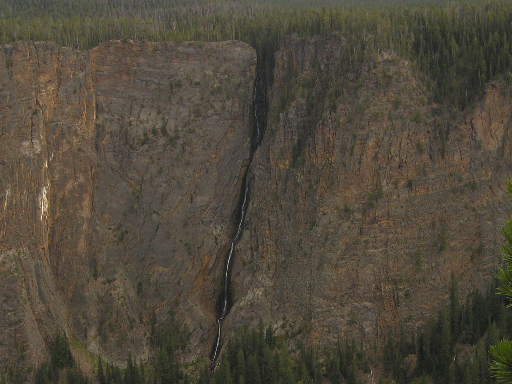
Impasse Falls is a waterfall in the Absaroka-Beartooth Wilderness, within the Beartooth Ranger District of Custer Gallatin National Forest in Montana. It sits at about 9,000 feet, roughly 11 miles from Cooke City, the nearest town. Summer is the most comfortable time to visit. Typical averages from a nearby weather station at Silver Gate show July highs around 74°F with lows near 40°F, while temperatures at the falls run cooler because the station sits about 1,500 feet lower. Mariane Lake is about 4 miles away, and the Russell Creek hike and the Beartooth Mountains climbing area are each about 6 miles off. East Rosebud Campground, about 8 miles away, is the closest place to camp.
- elevation
- 9,006 ft
- best months
- Jun–Aug
Where it is: Absaroka-Beartooth Wilderness · Beartooth Ranger District
Near: Cooke City · 10.7 mi
Best time to visit Impasse Falls
Best months: June–August. Best months have typical highs of 55–85 °F, lows of 30 °F or warmer (32 °F where the station doesn't record snow), at most one snowy day and no more than 12 wet days.
Jan
27°
3°
Feb
30°
5°
Mar
39°
12°
Apr
44°
20°
May
55°
29°
Jun
65°
35°
Jul
74°
40°
Aug
73°
37°
Sep
64°
30°
Oct
50°
23°
Nov
33°
12°
Dec
24°
2°
Typical high / low (°F) and days with rain or snow, 1991–2020. Measured at Silver Gate, MT, 13.1 mi away at 7,495 ft. The station sits about 1,500 ft lower than this place, so expect it a little cooler here. This station doesn't record snowfall. Source: NOAA NCEI U.S. Climate Normals 1991–2020.
Been here? Tell people how it was.
Route to Impasse Falls
- Mariane LakeHiking4.3 mi
- Russell CreekHiking5.7 mi
 Beartooth MountainsRock climbingPhoto: Forest Service - Northern Region, Public domain (via Wikimedia Commons)5.7 mi
- East Rosebud CampgroundCamping7.7 mi
- East Rosebud LakeCamping7.8 mi
- South Central RegionRock climbing8.2 mi
- West Rosebud Lake Fishing AccessPier fishing9.5 mi
- Beartooth RDRiver fishing9.9 mi
 Tower FallWaterfallPhoto: Daniel Mayer, CC BY-SA 3.0 (via Wikimedia Commons)~1h drive
 Silver Cord CascadeWaterfallPhoto: Alex1961, CC BY-SA 2.0 (via Wikimedia Commons)~1h 16m drive
 Lower Falls of the Yellowstone RiverWaterfallPhoto: Miguel Hermoso Cuesta, CC BY-SA 4.0 (via Wikimedia Commons)~1h 19m drive
 Upper Falls of the Yellowstone RiverWaterfallPhoto: Tony Hisgett from Birmingham, UK, CC BY 2.0 (via Wikimedia Commons)~1h 20m drive
 Rustic FallsWaterfallPhoto: James St. John, CC BY 2.0 (via Wikimedia Commons)~1h 25m drive
 Osprey FallsWaterfallPhoto: Unknown authorUnknown author, Public domain (via Wikimedia Commons)~1h 22m drive
- Charlie FallsWaterfall~2 min drive
- Beartooth FallsWaterfall~24 min drive
- Woodbine FallsWaterfall~30 min drive
- Lost Creek FallsWaterfall~1h 2m drive
Also worth it near here
- Skull LakeLake fishing~6 min drive
 Mount VillardSummitPhoto: Whubsch, CC0 (via Wikimedia Commons)~8 min drive
- Beartooth MountainsRock climbingPhoto: Forest Service - Northern Region, Public domain (via Wikimedia Commons)~10 min drive
- East Rosebud LakeCamping~13 min drive
 West RosebudHikingPhoto: Matt Lavin, CC BY-SA 2.0 (via Flickr)~14 min drive
Conditions and forecast
Caution todayAgency alerts are in effect for this areaUSFS · checked 24 min agoDaily highs and lows, wind and the chance of precipitation at Impasse Falls for the next 7 days, from the Open-Meteo model.
Ask about this place
Questions about Impasse Falls: conditions, access, timing. Answers say when something isn't known.
