Charlie Falls
- 8,438 ft
- elevation
- Jun–Aug
- best months
Caution at last check
Agency alerts are in effect for this area; weather is marginal · USFS, OpenWeather · checked 14 h ago
Is Charlie Falls open right now?
Closure in the area
There's a closure order in Custer Gallatin National Forest. It doesn't name Charlie Falls, so check the source for the area it covers (13 listed).
NFSR #1700 South Plateau Road Closure
Agency closure covering Custer Gallatin National Forest · USFS · Custer Gallatin National Forest
Pine Grove Campground Closure
Agency closure covering Beartooth Ranger District · Order 01-11-82-26-04 · USFS · Beartooth Ranger District
Hyalite Porcupine Buffalo Horn Summer Interim Travel Order and Map and Order # 01-11-00-26-02
Agency closure covering Custer Gallatin National Forest · Order 01-11-00-26-02 · USFS · Custer Gallatin National Forest
Hyalite Porcupine Buffalo Horn Winter Interim Travel Order and Map Order Number: #01-11-00-26-01
Agency closure covering Custer Gallatin National Forest · USFS · Custer Gallatin National Forest
Glacier Lake Road #2421 Closure Order Number: # 01-11-82-26- 01
Agency closure covering Custer Gallatin National Forest · Order 01-11-82-26- · USFS · Custer Gallatin National Forest
As of · Source: USFS · Custer Gallatin National Forest. Agencies don't list every closure — check before you go.
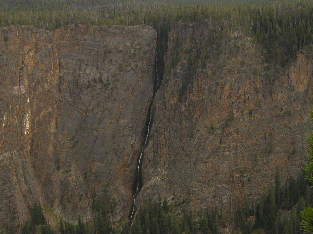
Charlie Falls is a waterfall in the Absaroka-Beartooth Wilderness, within the Beartooth Ranger District of Custer Gallatin National Forest in Montana. It sits at about 8,400 feet, roughly 12 miles from Cooke City, the nearest town. Summer is the most comfortable time to visit. Typical averages from the nearby Silver Gate weather station, which sits about 900 feet lower, show July highs around 74°F with lows near 40°F. Winters there are severe, with January highs in the mid-20s and lows near 3°F. The surrounding area offers plenty to pair with a visit. The Beartooth Mountains climbing area is about 5 miles away, and Mariane Lake and the Phantom Lake Trail are both within 6 miles. East Rosebud Campground, about 7 miles off, is the closest place to camp.
- Elevation
- 8,438 ft
Elevation from USGS 3D Elevation Program terrain data (about 10 m resolution).
 Beartooth MountainsRock climbingPhoto: Forest Service - Northern Region, Public domain (via Wikimedia Commons)4.8 mi
- Mariane LakeHiking5 mi
- Phantom Lake TrailHiking5.9 mi
- East Rosebud CampgroundCamping6.9 mi
- East Rosebud LakeCamping7 mi
- South Central RegionRock climbing8.6 mi
- Beartooth RDRiver fishing9 mi
- West Rosebud Lake Fishing AccessPier fishing9 mi
Source: Roamze catalog (indexable pages within 10 miles, PostGIS distance)
 Silver Cord CascadeWaterfall · ~1h 17m drivePhoto: Alex1961, CC BY-SA 2.0 (via Wikimedia Commons)
 Lower Falls of the Yellowstone RiverWaterfall · ~1h 21m drivePhoto: Miguel Hermoso Cuesta, CC BY-SA 4.0 (via Wikimedia Commons)
 Osprey FallsWaterfall · ~1h 24m drivePhoto: Unknown authorUnknown author, Public domain (via Wikimedia Commons)
 Tower FallWaterfall · ~1h 2m drivePhoto: Daniel Mayer, CC BY-SA 3.0 (via Wikimedia Commons)
 Upper Falls of the Yellowstone RiverWaterfall · ~1h 21m drivePhoto: Tony Hisgett from Birmingham, UK, CC BY 2.0 (via Wikimedia Commons)
- Impasse FallsWaterfall · ~2 min drive
- Calamity FallsWaterfall · ~18 min drive
- Beartooth FallsWaterfall · ~24 min drive
- Woodbine FallsWaterfall · ~31 min drive
- Bridal Veil FallsWaterfall · ~46 min drive
Also worth it near here
- Medicine LakeLake fishing · ~4 min drive
 Castle MountainSummit · ~8 min drivePhoto: Lpangelrob, CC BY-SA 3.0 (via Wikimedia Commons)
- Beartooth MountainsRock climbing · ~8 min drivePhoto: Forest Service - Northern Region, Public domain (via Wikimedia Commons)
- Brd2177-003Camping · ~12 min drive
 Spread CreekHiking · ~12 min drivePhoto: Forest Service - Northern Region, Public Domain Mark (via Flickr)
Best time to visit Charlie Falls
Best months: June–August. Best months have typical highs of 55–85 °F, lows of 30 °F or warmer (32 °F where the station doesn't record snow), at most one snowy day and no more than 12 wet days.
Jan
27° / 3°
Feb
30° / 5°
Mar
39° / 12°
Apr
44° / 20°
May
55° / 29°
Jun
65° / 35°
Jul
74° / 40°
Aug
73° / 37°
Sep
64° / 30°
Oct
50° / 23°
Nov
33° / 12°
Dec
24° / 2°
Typical high / low (°F) and days with rain or snow, 1991–2020. Measured at Silver Gate, MT, 14 mi away at 7,495 ft. The station sits about 900 ft lower than this place, so expect it a little cooler here. This station doesn't record snowfall. Source: NOAA NCEI U.S. Climate Normals 1991–2020.
