Gilman Peak
At a glance
Gilman Peak is a summit of 1,681 feet in California, within the San Bernardino Unit about 2.4 miles from Yorba Linda. The peak sits close to several trails, with the Gilman Trail starting just 0.1 mile away and the North Ridge Trail about 0.2 mile off, so it works well as a destination for a short outing or as a high point to pair with a longer walk in the area. Spring and fall are the most comfortable times to go. Typical averages from a nearby weather station in Pomona show April highs around 76°F and October highs around 80°F, while July and August average in the low 90s. That station sits roughly 700 feet lower than the peak, so temperatures on top run cooler. Other trails within a mile include the Little Canyon Trail and the Sycamore Trail. For time on the water, Chino Creek is about 6.6 miles away.
- summit
- 1,681 ft
- ways up
- 2
- best months
- Oct–Jun
Where it is: San Bernardino Unit
Near: Anaheim
Best time to visit Gilman Peak
Best months: October–June. Best months have typical highs of 55–85 °F, lows of 30 °F or warmer (32 °F where the station doesn't record snow), at most one snowy day and no more than 12 wet days.
Jan
68°
43°
5 wet
Feb
67°
45°
6 wet
Mar
72°
47°
4 wet
Apr
76°
50°
2 wet
May
78°
54°
1 wet
Jun
84°
57°
0 wet
Jul
90°
62°
0 wet
Aug
92°
63°
0 wet
Sep
89°
60°
1 wet
Oct
80°
54°
3 wet
Nov
73°
47°
4 wet
Dec
67°
42°
5 wet
Typical high / low (°F) and days with rain or snow, 1991–2020. Measured at Pomona/Fairplex, CA, 10.9 mi away at 999 ft. The station sits about 700 ft lower than this place, so expect it a little cooler here. Source: NOAA NCEI U.S. Climate Normals 1991–2020.
Been here? Tell people how it was.
- Gilman TrailModerateabout 955 ft of climbing2.2 mi round trip
- North Ridge TrailExpertabout 2,802 ft of climbing9.6 mi round trip
Compare the routes Gilman Trail North Ridge Trail Climbing About 955 ft About 2,802 ft Round trip 2.2 mi 9.6 mi Difficulty Moderate Expert Terrain Hike Hike Map © Mapbox © OpenStreetMap contributors - San Juan Hill1,780 ft · California2 routes2.3 mi away
- Robbers Peak1,130 ft · California1 route6.7 mi away
- Buzzard Peak1,377 ft · California1 route10 mi away
- Indian Hill1,388 ft · California1 route14 mi away
 Workman Hill1,388 ft · California2 routes14 mi awayPhoto: Sergei Gussev, CC BY 2.0 (via Wikimedia Commons)
- Johnstone Peak3,198 ft · California1 route16 mi away
- Gilman TrailHiking0.1 mi
- North Ridge TrailHiking0.2 mi
- Little Canyon TrailHiking0.7 mi
- Sycamore TrailHiking0.9 mi
 Soquel Canyon TrailHikingPhoto: sergei.gussev, CC BY 2.0 (via Flickr)1.3 mi
- Casino Ridge Staging TrailHiking1.5 mi
- Telegraph Canyon TrailHikingPhoto: sergei.gussev, CC BY 2.0 (via Flickr)1.7 mi
- Chino CreekCanoeing6.6 mi
 Pleasants PeakSummitPhoto: Northwalker, CC0 (via Wikimedia Commons)~23 min drive
- Workman HillSummitPhoto: Sergei Gussev, CC BY 2.0 (via Wikimedia Commons)~24 min drive
 Flores PeakSummitPhoto: Uncabunca, CC BY-SA 4.0 (via Wikimedia Commons)~29 min drive
 Modjeska PeakSummitPhoto: Justin Johnsen (Justin.Johnsen), CC BY-SA 3.0 (via Wikimedia Commons)~33 min drive
 Santiago PeakSummitPhoto: Nandaro, CC BY-SA 3.0 (via Wikimedia Commons)~35 min drive
 Mount JurupaSummitPhoto: Scottthezombie, CC BY-SA 4.0 (via Wikimedia Commons)~35 min drive
 Mount RubidouxSummitPhoto: No machine-readable author provided. Takwish assumed (based on copyright claims)., CC BY-SA 2.5 (via Wikimedia Commons)~38 min drive
 Trabuco PeakSummitPhoto: Don Ramey Logan, CC BY-SA 4.0 (via Wikimedia Commons)~40 min drive
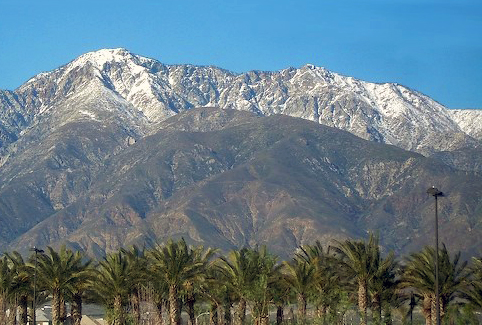 Cucamonga PeakSummitPhoto: Cliff Hutson; later cropping and color editing by Daniel Case., CC BY 2.0 (via Wikimedia Commons)~40 min drive
 Los Pinos PeakSummitPhoto: Shannon1, CC BY-SA 4.0 (via Wikimedia Commons)~43 min drive
Conditions and forecast
Daily highs and lows, wind and the chance of precipitation at the summit and route start for the next 7 days, from the Open-Meteo model.
Questions about Gilman Peak
How tall is Gilman Peak?
1,681 ft (512 m).
How many routes go to the summit of Gilman Peak?
2: Gilman Trail and North Ridge Trail.
What is the shortest route up Gilman Peak?
Gilman Trail, about 2.2 mi round trip.
Ask about this place
Questions about Gilman Peak: conditions, access, timing. Answers say when something isn't known.
