Culebra Peak
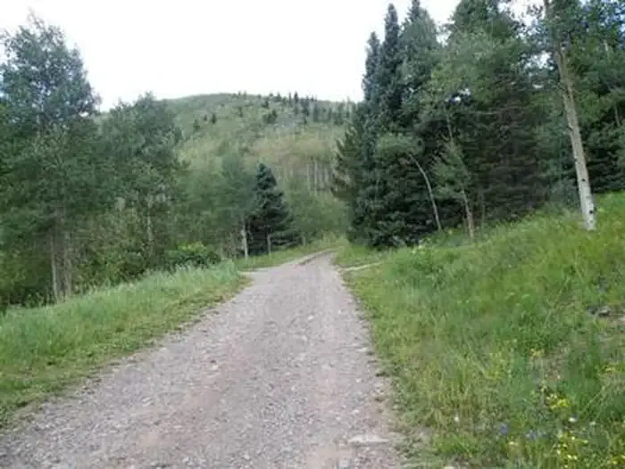
 Photo: David Herrera from Albuquerque, NM, Bernalillo, CC BY 2.0 (via Wikimedia Commons)
At a glance
Culebra Peak is a summit in Colorado at 14,049 ft. It is reached by the Culebra Peak trail, a 5-mile public trail with 2,700 ft of elevation gain.
- summit
- 14,049 ft
- ways up
- 2
Near: La Veta
Been here? Tell people how it was.
- Culebra PeakHardFrom Culebra Peak Trailhead · about 2,700 ft of climbing5.0 mi round trip
- Red MountainHardabout 2,850 ft of climbing6.1 mi round trip
Compare the routes Culebra Peak Red Mountain Starts at Culebra Peak Trailhead — Climbing About 2,700 ft About 2,850 ft Round trip 5.0 mi 6.1 mi Difficulty Hard Hard Terrain Hike Hike Map © Mapbox © OpenStreetMap contributors Permits and fees
Private land: Cielo Vista Ranch. Paid reservation required ($150/person as of 2025; Fridays-Sundays, January-July only; signed waiver per climber). Book at cielo-vista-ranch.info. Sources: https://www.cielo-vista-ranch.info/activities/climbing-hiking/ , https://www.14ers.com/route.php?route=cule1
 Red Mountain13,908 ft · Colorado1 route0.7 mi awayPhoto: David Herrera from Albuquerque, NM, Bernalillo, CC BY 2.0 (via Wikimedia Commons)
 Trinchera Peak13,519 ft · Colorado1 route12 mi awayPhoto: David Herrera from Albuquerque, NM, Bernalillo, CC BY 2.0 (via Wikimedia Commons)
- Raspberry Mountain11,245 ft · Colorado1 route20 mi away
 West Spanish Peak13,580 ft · Colorado1 route20 mi awayPhoto: Alethe88, CC BY-SA 3.0 (via Wikimedia Commons)
- Latir Peak12,708 ft · New Mexico1 route27 mi away
- Latir Mesa12,705 ft · New Mexico2 routes28 mi away
- Red MountainSummitPhoto: David Herrera from Albuquerque, NM, Bernalillo, CC BY 2.0 (via Wikimedia Commons)~1 min drive
- Trinchera PeakSummitPhoto: David Herrera from Albuquerque, NM, Bernalillo, CC BY 2.0 (via Wikimedia Commons)~20 min drive
- West Spanish PeakSummitPhoto: Alethe88, CC BY-SA 3.0 (via Wikimedia Commons)~35 min drive
 East Spanish PeakSummitPhoto: Footwarrior, CC BY-SA 3.0 (via Wikimedia Commons)~41 min drive
 Mount MestasSummitPhoto: Jeffrey Beall, CC BY-SA 3.0 (via Wikimedia Commons)~55 min drive
 Silver MountainSummitPhoto: Jeffrey Beall, CC BY 4.0 (via Wikimedia Commons)~59 min drive
 Mount LindseySummitPhoto: David Herrera from Albuquerque, NM, Bernalillo, CC BY 2.0 (via Wikimedia Commons)~60 min drive
 Little Bear PeakSummitPhoto: Stargazer7121, CC BY-SA 3.0 (via Wikimedia Commons)~1h drive
 Blanca PeakSummitPhoto: No machine-readable author provided. Meniscus~commonswiki assumed (based on copyright claims)., CC BY-SA 3.0 (via Wikimedia Commons)~1h 1m drive
 Iron MountainSummitPhoto: Jeffrey Beall, CC BY 4.0 (via Wikimedia Commons)~1h 1m drive
Conditions and forecast
Daily highs and lows, wind and the chance of precipitation at the summit and culebra peak trailhead for the next 7 days, from the Open-Meteo model.
Questions about Culebra Peak
How tall is Culebra Peak?
14,049 ft (4,282 m).
How many routes go to the summit of Culebra Peak?
2: Culebra Peak and Red Mountain.
What is the shortest route up Culebra Peak?
Culebra Peak, about 5.0 mi round trip.
Where do the routes up Culebra Peak start?
Culebra Peak starts at Culebra Peak Trailhead.
Do you need a permit to climb Culebra Peak?
Private land: Cielo Vista Ranch. Paid reservation required ($150/person as of 2025; Fridays-Sundays, January-July only; signed waiver per climber). Book at cielo-vista-ranch.info. Sources: https://www.cielo-vista-ranch.info/activities/climbing-hiking/ , https://www.14ers.com/route.php?route=cule1

Ask about this place
Questions about Culebra Peak: conditions, access, timing. Answers say when something isn't known.
