Chamisal Mesa
At a glance
Chamisal Mesa is a summit of 3,154 feet in the San Gabriel Mountains National Monument Ranger District of Angeles National Forest in California, about 9 miles from Glendora. It sits in a cluster of trails and climbing areas, with Bichota Canyon Trail starting just 0.1 mile away. Spring and fall are the most comfortable times to visit. Typical averages from the Pearblossom weather station, about 16 miles away at a similar elevation, show April highs near 75°F and October highs near 80°F, while July and August average around 98 to 99°F. Nearby, Bear Creek Trail is about a mile off and Coldbrook Campground is about 1.3 miles away. Climbers can head to Crystal Lake Boulders, about 3 miles out, and paddlers to the San Gabriel River, about 3.4 miles away.
- summit
- 3,154 ft
- best months
- Oct–May
Where it is: San Gabriel Mountains National Monument Ranger District · Angeles National Forest
Near: Glendora · 8.8 mi
Best time to visit Chamisal Mesa
Best months: October–May. Best months have typical highs of 55–85 °F, lows of 30 °F or warmer (32 °F where the station doesn't record snow), at most one snowy day and no more than 12 wet days.
Jan
60°
38°
4 wet
Feb
63°
39°
4 wet
Mar
69°
42°
3 wet
Apr
75°
45°
2 wet
May
84°
53°
1 wet
Jun
93°
61°
0 wet
Jul
99°
67°
1 wet
Aug
98°
67°
1 wet
Sep
91°
62°
1 wet
Oct
80°
53°
1 wet
Nov
67°
43°
2 wet
Dec
58°
36°
4 wet
Typical high / low (°F) and days with rain or snow, 1991–2020. Measured at Pearblossom, CA, 16.2 mi away at 3,101 ft. Source: NOAA NCEI U.S. Climate Normals 1991–2020.
Been here? Tell people how it was.
We don't know of a mapped trail or route to the summit of Chamisal Mesa. Plan the approach with local maps, a guidebook or a local guide, and check conditions before you go.
- South Mount Hawkins7,786 ft · California1 route3.2 mi away
- Rattlesnake Peak5,817 ft · California1 route3.5 mi away
 Mount Islip8,252 ft · California2 routes5.0 mi awayPhoto: Eeekster, CC BY 3.0 (via Wikimedia Commons)
- Mount Williamson8,214 ft · California1 route6.9 mi away
- Waterman Mountain8,033 ft · California1 route7.1 mi away
 Iron Mountain8,009 ft · California1 route7.3 mi awayPhoto: Self, CC BY 3.0 (via Wikimedia Commons)
- Bichota Canyon TrailHiking0.1 mi
 Bear Creek TrailHikingPhoto: Eeekster, CC BY-SA 3.0 (via Wikimedia Commons)1.1 mi
- Coldbrook CampgroundCamping1.3 mi
- Crystal Lake BouldersRock climbing3.1 mi
- Crystal Lake CragRock climbing3.2 mi
 San Gabriel RiverCanoeingPhoto: Emarateyya, Muna Al Zaabi, CC BY-SA 3.0 (via Wikimedia Commons)3.4 mi
- Crystal Lake Rec AreaCamping3.6 mi
 West Fork San Gabriel RiverCanoeingPhoto: Eeekster, CC BY 3.0 (via Wikimedia Commons)7.5 mi
- Mount IslipSummitPhoto: Eeekster, CC BY 3.0 (via Wikimedia Commons)~9 min drive
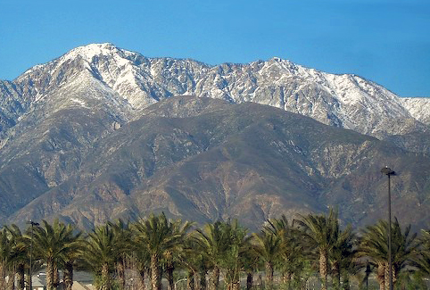 Cucamonga PeakSummitPhoto: Cliff Hutson; later cropping and color editing by Daniel Case., CC BY 2.0 (via Wikimedia Commons)~26 min drive
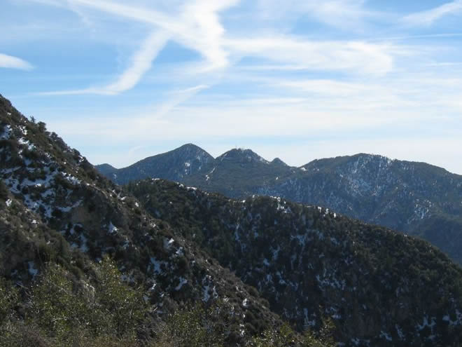 San Gabriel PeakSummitPhoto: Justin.Johnsen, CC BY 3.0 (via Wikimedia Commons)~26 min drive
 Mount DisappointmentSummitPhoto: Justin, CC BY-SA 2.0 (via Wikimedia Commons)~26 min drive
 Mount LoweSummitPhoto: The original uploader was Magi Media at English Wikipedia., CC BY-SA 3.0 (via Wikimedia Commons)~27 min drive
 Strawberry PeakSummitPhoto: Justin, CC BY-SA 2.0 (via Wikimedia Commons)~28 min drive
 Throop PeakSummitPhoto: Eeekster, CC BY 3.0 (via Wikimedia Commons)~10 min drive
 Mount BurnhamSummitPhoto: Ctatkinson, Public domain (via Wikimedia Commons)~12 min drive
- Iron MountainSummitPhoto: Self, CC BY 3.0 (via Wikimedia Commons)~13 min drive
 Mount Baden-PowellSummitPhoto: The original uploader was Jakerome at English Wikipedia./ Simonov, CC BY-SA 2.0 (via Wikimedia Commons)~13 min drive
Also worth it near here
- West Fork Fishing AccessRiver fishing~5 min drive
- Soldier Creek TrailHikingPhoto: Eeekster, CC BY-SA 3.0 (via Wikimedia Commons)~5 min drive
- San Gabriel RiverCanoeingPhoto: Emarateyya, Muna Al Zaabi, CC BY-SA 3.0 (via Wikimedia Commons)~6 min drive
 Half Knob TrailMountain bikingPhoto: Eeekster, CC BY 3.0 (via Wikimedia Commons)~6 min drive
Conditions and forecast
Caution todayAgency alerts are in effect for this areaUSFS · checked 2 min agoDaily highs and lows, wind and the chance of precipitation at the summit for the next 7 days, from the Open-Meteo model.
Questions about Chamisal Mesa
How tall is Chamisal Mesa?
3,154 ft (961 m).
Is there a trail to the top of Chamisal Mesa?
We don't know of a mapped trail or route to the summit. Plan the approach with local maps, a guidebook or a local guide.
Ask about this place
Questions about Chamisal Mesa: conditions, access, timing. Answers say when something isn't known.
