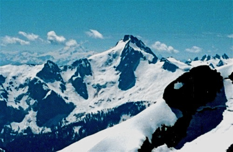
Bacon Peak
 Photo: Walter Siegmund (talk), CC BY-SA 3.0 (via Wikimedia Commons)
At a glance
Bacon Peak is a summit in Whatcom County, Washington, inside North Cascades National Park and the Stephen Mather Wilderness, both managed by the National Park Service. The nearest town is Portage, about 8 miles away. The peak lies entirely within designated wilderness, so any trip here is a backcountry outing in one of the core protected areas of the North Cascades. Several other destinations sit within a few miles. Noisy Creek and Bacon Creek offer canoeing nearby. Upper Anderson Lake Boot Trail is about 3 miles away, and Shannon Creek Campground, roughly 6.5 miles off, gives you a place to stay overnight.
- summit
- 7,011 ft
- managed by
- National Park Service
Where it is: Stephen Mather Wilderness · North Cascades National Park
Near: Concrete
Been here? Tell people how it was.
We don't know of a mapped trail or route to the summit of Bacon Peak. Plan the approach with local maps, a guidebook or a local guide, and check conditions before you go.
- Sauk Mountain5,541 ft · Washington2 routes10 mi away
 Lookout Mountain5,703 ft · Washington1 route12 mi awayPhoto: Martin Bravenboer, CC BY 2.0 (via Wikimedia Commons)
- Ruth Mountain7,106 ft · Washington1 route14 mi away
- Panorama Dome5,041 ft · Washington1 route15 mi away
 Table Mountain5,740 ft · Washington3 routes15 mi awayPhoto: Ron Clausen, CC BY-SA 4.0 (via Wikimedia Commons)
- Grant Peak10,777 ft · Washington2 routes16 mi away
- Noisy CreekCanoeing2.8 mi
 Upper Anderson Lake Boot TrailHikingPhoto: U.S. Forest Service- Pacific Northwest Region, Public domain (via Wikimedia Commons)3.2 mi
- Bacon CreekCanoeing3.4 mi
- Anderson Lakes TrailHikingPhoto: U.S. Forest Service- Pacific Northwest Region, Public domain (via Wikimedia Commons)3.6 mi
- Anderson Butte TrailHikingPhoto: U.S. Forest Service- Pacific Northwest Region, Public domain (via Wikimedia Commons)4 mi
 Shannon Creek CampgroundCampingPhoto: Recreation.gov (RIDB) / public domain6.5 mi
- Maple Grove CampgroundCamping6.6 mi
- North CascadesRock climbing8.7 mi
 Hagan MountainSummitPhoto: jaisril, CC BY 2.0 (via Wikimedia Commons)~7 min drive
 Mount BlumSummitPhoto: Ron Clausen, CC BY-SA 4.0 (via Wikimedia Commons)~11 min drive
 Helen ButtesSummitPhoto: Ron Clausen, CC BY-SA 4.0 (via Wikimedia Commons)~12 min drive
 Mount TriumphSummitPhoto: Walter Siegmund, CC BY 2.5 (via Wikimedia Commons)~14 min drive
 Seahpo PeakSummitPhoto: Ron Clausen, CC BY-SA 4.0 (via Wikimedia Commons)~19 min drive
 Mount ShuksanSummitPhoto: Frank Kovalchek from Anchorage, Alaska, USA, CC BY 2.0 (via Wikimedia Commons)~21 min drive
 Nooksack TowerSummitPhoto: Ron Clausen, CC BY-SA 4.0 (via Wikimedia Commons)~21 min drive
 Mount TerrorSummitPhoto: Alex Ford, CC BY-SA 2.0 (via Wikimedia Commons)~22 min drive
 Mount RossSummitPhoto: Ron Clausen, CC BY-SA 4.0 (via Wikimedia Commons)~22 min drive
 Mineral MountainSummitPhoto: Martin Bravenboer, CC BY 2.0 (via Wikimedia Commons)~24 min drive
Conditions and forecast
Daily highs and lows, wind and the chance of precipitation at the summit for the next 7 days, from the Open-Meteo model.
Questions about Bacon Peak
How tall is Bacon Peak?
7,011 ft (2,137 m).
Is there a trail to the top of Bacon Peak?
We don't know of a mapped trail or route to the summit. Plan the approach with local maps, a guidebook or a local guide.
Ask about this place
Questions about Bacon Peak: conditions, access, timing. Answers say when something isn't known.
