Aspen Mountain
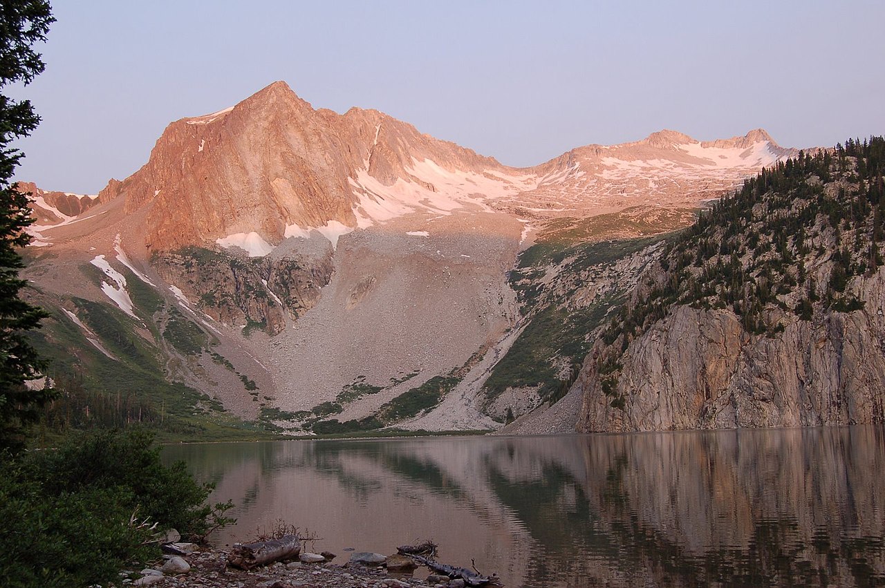
 Photo: CC BY-SA 3.0 (via Wikimedia Commons)
At a glance
Aspen Mountain is a summit of 10,702 feet in the Aspen Ranger District of White River National Forest in Colorado, about 2.3 miles from the town of Aspen. Summer is the most comfortable time to go. Typical averages from a nearby weather station show July highs around 73°F with lows near 39°F, and September highs around 62°F. That station sits roughly 1,000 feet below the summit, so temperatures up top run cooler. The Cherry Trail starts just 0.4 miles away, and the Congo Trail is about 1.2 miles off. For an overnight stay, Difficult Group Campground is about 3.2 miles away, and Silver Bar Campground is about 3.7 miles away.
- summit
- 10,702 ft
- best months
- Late May–late Sep
Where it is: Aspen Ranger District · White River National Forest
Near: Aspen · 2.3 mi
Best weeks to go
Late May to late September is usually best for the summit here.
Typical highs of 61–73°F and lows of 30°F or warmer in those weeks. Rain falls on about 40% of days at the wettest of them, so plan around showers.
Typical weather: NOAA 1991–2020 normals at Sugarloaf Rsvr, CO, 25 mi away. Not a forecast.
Typical weather by monthBest time to visit Aspen Mountain
Best months: June–September. Best months are the ones mostly made of the best weeks for the summit: typical temperatures in its comfortable range, few snowy days and not usually wet, judged with the same limits as our good-day forecasts.
Jan
31°
3°
8 wet
Feb
33°
3°
8 wet
Mar
39°
9°
8 wet
Apr
44°
18°
8 wet
May
55°
27°
9 wet
Jun
68°
34°
9 wet
Jul
73°
39°
12 wet
Aug
70°
38°
12 wet
Sep
62°
31°
8 wet
Oct
51°
23°
6 wet
Nov
39°
14°
7 wet
Dec
31°
6°
7 wet
Typical high / low (°F) and days with rain or snow, 1991–2020. Measured at Sugarloaf Rsvr, CO, 25.2 mi away at 9,738 ft. The station sits about 1,000 ft lower than this place, so expect it a little cooler here. This station doesn't record snowfall. Source: NOAA NCEI U.S. Climate Normals 1991–2020.
Been here? Tell people how it was.
We don't know of a mapped trail or route to the summit of Aspen Mountain. Plan the approach with local maps, a guidebook or a local guide, and check conditions before you go.
- Red Butte8,304 ft · Colorado1 route3.3 mi away
- Cozy Point8,500 ft · Colorado4 routes5.7 mi away
 Cathedral Peak13,941 ft · Colorado1 route9.0 mi awayPhoto: John Sowell, CC BY-SA 4.0 (via Wikimedia Commons)
 Pyramid Peak14,009 ft · Colorado1 route9.1 mi awayPhoto: EE One, CC BY-SA 3.0 (via Wikimedia Commons)
- Willoughby Mountain13,139 ft · Colorado1 route9.1 mi away
 Malemute Peak13,308 ft · Colorado1 route9.8 mi awayPhoto: Jeremiah LaRocco, CC BY-SA 2.0 (via Wikimedia Commons)
 Cherry TrailHikingPhoto: Baker Pics and Whatnot, CC BY-SA 2.0 (via Flickr)0.4 mi
 Congo TrailHikingPhoto: randomduck, CC BY-SA 2.0 (via Flickr)1.2 mi
- Maroon CreekCanoeing2.9 mi
- Difficult Group CampgroundCamping3.2 mi
- Castle CreekCanoeing3.5 mi
- Silver Bar CampgroundCamping3.7 mi
 East FaceRock climbingPhoto: David Leo Veksler, CC BY-SA 2.0 (via Flickr)3.8 mi
- West Side - Lower ButtressRock climbingPhoto: David Leo Veksler, CC BY-SA 2.0 (via Flickr)3.8 mi
 Hayden PeakSummitPhoto: Wolfgang Moroder, CC BY-SA 3.0 (via Wikimedia Commons)~12 min drive
 Hunter PeakSummitPhoto: Jeremiah LaRocco, CC BY-SA 2.0 (via Wikimedia Commons)~15 min drive
- Cathedral PeakSummitPhoto: John Sowell, CC BY-SA 4.0 (via Wikimedia Commons)~15 min drive
- Pyramid PeakSummitPhoto: EE One, CC BY-SA 3.0 (via Wikimedia Commons)~16 min drive
- Malemute PeakSummitPhoto: Jeremiah LaRocco, CC BY-SA 2.0 (via Wikimedia Commons)~17 min drive
 Pearl MountainSummitPhoto: Jeremiah LaRocco, CC BY-SA 2.0 (via Wikimedia Commons)~21 min drive
 Star PeakSummitPhoto: Jeremiah LaRocco, CC BY-SA 2.0 (via Wikimedia Commons)~22 min drive
 Snowmass PeakSummitPhoto: Mike D Lewis, CC BY-SA 3.0 (via Wikimedia Commons)~22 min drive
 Hagerman PeakSummitPhoto: Nelsestu at English Wikipedia, Public domain (via Wikimedia Commons)~22 min drive
 Star MountainSummitPhoto: Rick Kimpel, CC BY-SA 2.0 (via Wikimedia Commons)~30 min drive
Conditions and forecast
Caution at last checkAgency alerts are in effect for this areaUSFS · checked 14 h agoDaily highs and lows, wind and the chance of precipitation at the summit for the next 7 days, from the Open-Meteo model.
Questions about Aspen Mountain
How tall is Aspen Mountain?
10,702 ft (3,262 m).
Is there a trail to the top of Aspen Mountain?
We don't know of a mapped trail or route to the summit. Plan the approach with local maps, a guidebook or a local guide.

Ask about this place
Questions about Aspen Mountain: conditions, access, timing. Answers say when something isn't known.
