Heart River
 Photo: NPS, Public domain (via Wikimedia Commons)
- 4.6 mi
- distance
- 7,458 ft
- high point
- Jun–Aug
- best months
Is Heart River open right now?
Closure in the area
There's a closure order in Yellowstone National Park. It doesn't name Heart River, so check the source for the area it covers (2 listed).
Most Park Roads Closed to All Vehicles
Park closure covering Yellowstone National Park · NPS · Yellowstone National Park
Biscuit Basin Closed Due to Hydrothermal Explosion
Park closure covering Yellowstone National Park · NPS · Yellowstone National Park
As of · Source: NPS · Yellowstone National Park. Agencies don't list every closure — check before you go.
Heart River is a 4.6-mile paddling stretch near Yellowstone National Park in Wyoming, flowing year-round on land managed by the National Park Service. Its average flow is about 101 cubic feet per second, and its gradient averages roughly 39.9 feet per mile. Summer is the most comfortable time to paddle. Typical July averages from a nearby weather station run to a high of 77°F and a low of 38°F, and the station sits about 576 feet lower than the river. Winters are severe, with January highs typically around 26°F. A fee is charged for paddling on this stretch of the river. Several trails lie within a few miles, including the Heart River Trail at 1.8 miles and the 8J6 Campsite Spur Trail at 1.7 miles. The Snake River Canyon Trail is about 4.2 miles away. Coulter Creek, another paddling option, is about 9.7 miles off.
- 8J6 Campsite Spur TrailHiking1.7 mi
- Heart River TrailHiking1.8 mi
- Basin Creek Cutoff TrailHiking2.4 mi
- 8J1 Campsite Spur TrailHiking3.7 mi
- Fox Creek TrailHiking4.2 mi
- Snake River Canyon TrailHiking4.2 mi
 Mount Sheridan TrailHikingPhoto: Greg Willis from Denver, CO, usa, CC BY-SA 2.0 (via Wikimedia Commons)4.6 mi
- Coulter CreekCanoeing9.7 mi
Source: Roamze catalog (indexable pages within 10 miles, PostGIS distance)
 Lewis RiverCanoeing · ~18 min drivePhoto: Jan Kronsell, Public domain (via Wikimedia Commons)
- Yellowstone South Entrance Boat LaunchBoat launch · ~20 min drive
 Fall RiverCanoeing · ~36 min drivePhoto: Unknown author, Public domain (via Wikimedia Commons)
- Grant Marina Boat LaunchBoat launch · ~21 min drive
 Firehole RiverCanoeing · ~39 min drivePhoto: Wing-Chi Poon, CC BY-SA 2.5 (via Wikimedia Commons)
- Flagg Ranch Boat LaunchBoat launch · ~23 min drive
 Little Firehole RiverCanoeing · ~48 min drivePhoto: Yellowstone National Park, Public domain (via Wikimedia Commons)
- Bridge Bay Boat Launch RampBoat launch · ~36 min drive
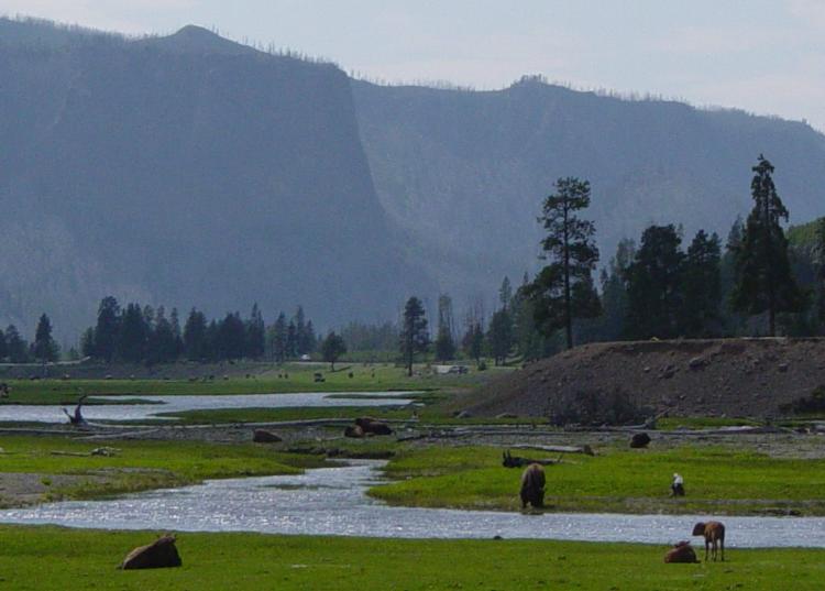 Gibbon RiverCanoeing · ~1h drivePhoto: Daniel Mayer, CC BY-SA 3.0 (via Wikimedia Commons)
- Two Ocean Lake Canoe / Kayak AccessBoat launch · ~39 min drive
Also worth it near here
- Heart LakeLake fishing · ~7 min drive
- Mount Sheridan TrailHiking · ~8 min drivePhoto: Greg Willis from Denver, CO, usa, CC BY-SA 2.0 (via Wikimedia Commons)
 Barlow PeakSummit · ~9 min drivePhoto: J. D. Love, Public domain (via Wikimedia Commons)
 Lewis Lake CampgroundCamping · ~15 min drivePhoto: Yellowstone National Park from Yellowstone NP, USA, Public domain (via Wikimedia Commons)
Best time to visit Heart River
Best months: June–August. Best months have typical highs of 55–85 °F, lows of 30 °F or warmer (32 °F where the station doesn't record snow), at most one snowy day and no more than 12 wet days.
Jan
26° / 1°
18 wet
Feb
30° / 3°
15 wet
Mar
39° / 11°
15 wet
Apr
45° / 20°
14 wet
May
56° / 28°
13 wet
Jun
66° / 34°
12 wet
Jul
77° / 38°
10 wet
Aug
76° / 35°
9 wet
Sep
66° / 28°
9 wet
Oct
51° / 21°
10 wet
Nov
35° / 11°
15 wet
Dec
25° / 2°
19 wet
Typical high / low (°F) and days with rain or snow, 1991–2020. Measured at Snake Rvr, WY, 11.9 mi away at 6,882 ft. The station sits about 600 ft lower than this place, so expect it a little cooler here. This station doesn't record snowfall. Source: NOAA NCEI U.S. Climate Normals 1991–2020.
