Cattlemans Bridge
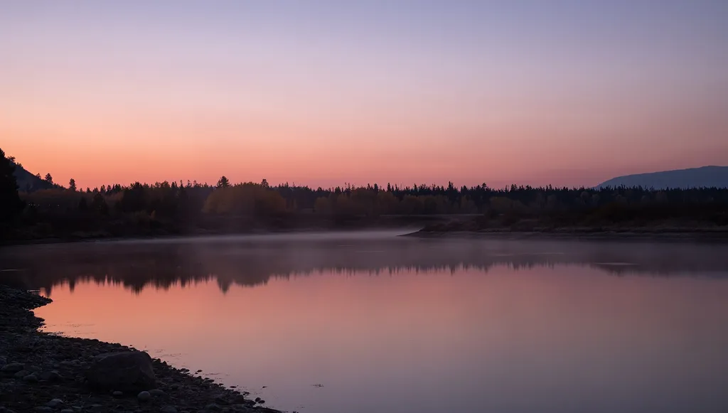 Photo: Eric Kilby — Wikimedia Commons (CC BY-SA 2.0)
- Jun–Sep
- best months
Is Cattlemans Bridge open right now?
Closure in the area
There's a closure order in Grand Teton National Park. It doesn't name Cattlemans Bridge, so check the source for the area it covers.
Death Canyon Trailhead Construction Closure
Park closure covering Grand Teton National Park · NPS · Grand Teton National Park
Construction in the South End of the Park
Park alert covering Grand Teton National Park · NPS · Grand Teton National Park
Construction on HWY 26/89/191
Park alert covering Grand Teton National Park · NPS · Grand Teton National Park
As of · Source: NPS · Grand Teton National Park. Agencies don't list every closure — check before you go.
Once a crossing for ranchers moving cattle, Cattlemans Bridge is no longer a bridge, but now a scenic view of the Snake River. This location is a mile down a dirt road from US Highway 89/191/287. While it is possible to put hand-powered boating vessels into the water, nearby Pacific Creek Landing and Jackson Lake Dam Launch provide easier and safery river access points. Please make sure to pack out trash, not trample vegetation, never leave scented items unattended, and follow pet regulations. Wildlife can frequent this area. Restrooms are available at Pacific Creek Landing or Jackson Lake Dam. Make sure you have what you need to get out on the water. Learn more about being bear-aware in the park. Review park pet regulations. Name Origin In the past, ranchers grazed cattle west of the Snake River near the potholes. Cattlemen would take their cattle over the bridge that once spanned the Snake River to get them to market.
Local outfitters
- Swift Creek Outfitters7 mi away
- The Virginian RV Park29 mi away
Not on Roamze yet. Their page has how to reach them.
Best time to go · Jun–Sep
Best time to visit Cattlemans Bridge
Best months: June–September. Best months have typical highs of 55–85 °F, lows of 30 °F or warmer (32 °F where the station doesn't record snow), at most one snowy day and no more than 12 wet days.
Jan
24° / 1°
14 wet · 14 snow
Feb
30° / 4°
12 wet · 11 snow
Mar
39° / 12°
12 wet · 9 snow
Apr
46° / 21°
12 wet · 6 snow
May
56° / 31°
12 wet · 2 snow
Jun
67° / 37°
10 wet
Jul
77° / 42°
8 wet
Aug
76° / 40°
8 wet
Sep
66° / 34°
8 wet
Oct
51° / 25°
9 wet · 3 snow
Nov
35° / 14°
12 wet · 9 snow
Dec
24° / 4°
15 wet · 14 snow
Typical high / low (°F) and days with rain or snow, 1991–2020. Measured at Moran 5wnw, WY, 1.8 mi away at 6,805 ft. Source: NOAA NCEI U.S. Climate Normals 1991–2020.
Keep exploring — more trails worth the drive
HIKE
Oxbow Bend Turnout
~1 min drive
While there are countless breathtaking views of the Teton Range throughout the park, Oxbow Bend is one of the most iconic. A channel of the Snake River "bends" towards the turnout with the water often reflecting the towering Mount Moran in the background. Year-round, this…
 Photo: Anton Molodtsov, CC BY-SA 3.0 (via Wikimedia Commons)
Oxbow Bend Trail
~2 min drive
Easy 1.63-mile out-and-back riverside walk with excellent wildlife viewing.
 Photo: Anton Molodtsov, CC BY-SA 3.0 (via Wikimedia Commons)
Signal Mountain Trail
~5 min drive
Moderate out-and-back summit hike with expansive views in Wyoming.
 Photo: inkknife_2000 (7.5 million views +), CC BY-SA 2.0 (via Wikimedia Commons)
Hermitage Point Trail
~7 min drive
Remote 13.5-mile out-and-back hike through Wyoming backcountry.
HIKE
Emma Matilda Loop Trail
~4 min drive
Moderate 9.15-mile out-and-back trail with scenic mountain views.
 Photo: inkknife_2000 (7.5 million views +), CC BY-SA 2.0 (via Wikimedia Commons)
Signal Mountain
~1 min drive
On a clear day, the sweeping view from the summit of Signal Mountain captures five mountain ranges surrounding the Jackson Hole valley. The Teton Range rises to the west, the Snake River Range to the southwest, the Gros Ventre Range to the southeast, the Absarokas to the…
Photo: Anton Molodtsov, CC BY-SA 3.0 (via Wikimedia Commons)Lookout Rock Cutoff Trail
~2 min drive
Quick out-and-back hike to scenic overlook views in Wyoming.
 Photo: inkknife_2000 (7.5 million views +), CC BY-SA 2.0 (via Wikimedia Commons)
Grand View Point Trail
~5 min drive
3.4-mile out-and-back trail in Wyoming with 1,218 ft elevation gain
HIKE
Lunch Tree Hill
~3 min drive
Destination Easy walk from Jackson Lake Lodge to the top of a hill overlooking Willow Flats. A great vantage point for views of the northern Teton Range. This hilltop is rumored to be the site where Horace Albright (Superintendent of Yellowstone NP) and John D. Rockefeller…
 Photo: Michael Gäbler, CC BY 3.0 (via Wikimedia Commons)
Willow Flats Trail
~3 min drive
Easy out-and-back hike through Wyoming's willow flats and meadows.
