Free — you'll pick up right here.
Watch this trail
Sign up to watch it — saving subscribes you to gate, closure and report changes.
Wyoming
Cascade Creek Trail
1.7 mi
Distance
324 ft
Gain
43 min
Time
No verdict for this trail
We won't guess. Here is exactly what we do and don't know.
What we do know
Inside Yellowstone National Park
National Park unit boundary is mapped — agency alerts for it feed this page automatically.
Boundary data
What's missing
No access route mapped
We don't yet know which road reaches this trailhead, so we can't tell you if it's gated.
Nobody's filed a report here yet — be the first.
Why you'll love it
Here's your day, mapped
Cascade Creek Trail
AI-suggested draft · review before you go
Meals
Gear for the day
Elevation & route
- Distance
- 1.7 mi
- Elevation gain
- 324 ft
- Elevation loss
- 324 ft
- Highest point
- 7,979 ft
- Lowest point
- 7,891 ft
Photos
Directions & GPX
Permits & access
- Managing agency
- National Park Service
About this trail
Cascade Creek Trail is a scenic out-and-back hike in Wyoming that follows the gentle course of Cascade Creek through forested terrain. This short, accessible trail offers a peaceful walk alongside flowing water with opportunities to enjoy riparian vegetation and the soothing sounds of the creek. The out-and-back route makes it easy to turn back at any point, making it ideal for families and those seeking a quick nature escape.
Add to a trip & share
Keep exploring — more trails worth the drive
Cascade Lake Trailhead (4K5)
~2 min drive
From this trailhead you can embark on the following trails: Cascade Lake Trail Observation Peak Trail There is a dedicated parking lot at this trailhead. The nearest restrooms are location to the east at the Cascade Lake Picnic Area. Cascade Lake Trail A moderate 4.4-mile…
Grand Canyon of the Yellowstone - Lookout Point
~2 min drive
Scientists think the oldest Grand Canyon of the Yellowstone formed in rock and sediments about 160,000 to 140,000 years ago. This canyon was not as deep, wide, or long as today’s canyon. Past and current hydrothermal activity altered and weakened the rhyolite, making the…
North Rim Trail
~2 min drive
Easy out-and-back rim hike with scenic views near North Rim.
Mount Washburn Spur Trail
~3 min drive
16.89-mile out-and-back trail with 2,347 ft gain on Mount Washburn Spur Trail in Wyoming.
Wapiti Lake Trail
~3 min drive
Scenic 16.32-mile out-and-back to alpine Wapiti Lake in Wyoming.
Canyon Rim Trail
~1 min drive
Short out-and-back rim walk with canyon views in Wyoming.
Hayden Valley at Alum Creek
~7 min drive
Hayden Valley, is one of the best places in the park to view a wide variety of large mammals. Grizzly bears and black bears are often seen in the spring and early summer. Large herds of bison may be seen in the spring, early summer, and during the rut in August. Coyotes can…
Observation Peak Trail
~2 min drive
9.37-mile out-and-back trail in Wyoming with 1,452 ft gain, reaching 9,402 ft.
Howard Eaton Trail: Fishing Bridge-Canyon
~3 min drive
Moderate out-and-back hike from Fishing Bridge to Canyon through thermal landscapes.
Grandview Point Trail
~2 min drive
Easy out-and-back hike to scenic viewpoint with expansive Wyoming vistas.
Also worth it near here
 Photo: Miguel Hermoso Cuesta, CC BY-SA 4.0 (via Wikimedia Commons)
Lower Falls of the Yellowstone River
~2 min drive
 Photo: daveynin, CC BY 2.0 (via Flickr)
Glacial Boulder
~3 min drive
 Photo: Dirtsc, CC BY-SA 3.0 (via Wikimedia Commons)
Hedges Peak
~5 min drive
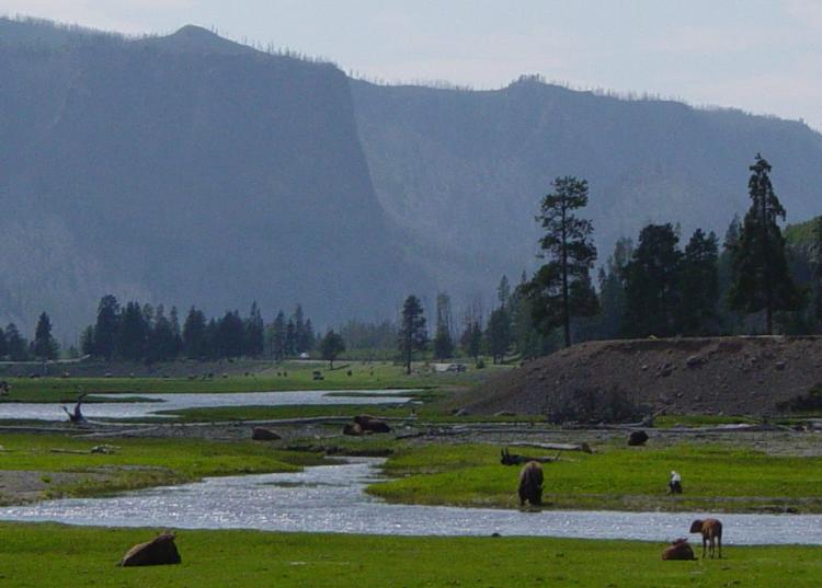 Photo: Daniel Mayer, CC BY-SA 3.0 (via Wikimedia Commons)
Gibbon River
~15 min drive
 Photo: Yellowstone National Park from Yellowstone NP, USA, Public domain (via Wikimedia Commons)
Fishing Bridge RV Park
~23 min drive
