Bacon Creek Trail
- 1.9 mi
- round trip
- 998 ft
- climb
- 9,085 ft
- high point
- Out and back
- route
- Jun–Aug
- best months
Is Bacon Creek Trail open right now?
No closures listed
The Forest Service lists no closures for Bridger-Teton National Forest.
As of · Source: USFS · Bridger-Teton National Forest. Agencies don't list every closure — check before you go.
Bacon Creek Trail is an easy out-and-back hike in the Pinedale Ranger District of Bridger-Teton National Forest in Wyoming, managed by the Forest Service. The trail is about 1.88 miles long, with a total climb of 998 feet from the low point at 8,659 feet to the high at 9,085 feet. The steepest stretch comes at about 1.4 miles, where the grade reaches 15 percent. Summer is the most comfortable time to go. Typical averages from a nearby weather station at Darwin run to highs around 72°F in July, with lows near 35°F. That station sits about 900 feet lower than the trail's high point, so temperatures on the trail run cooler. Bacon Creek is about 1.1 miles away, and the Gros Ventre River Trail is about 2.3 miles off. South Fork Fish Creek and Dude Creek Trail are both within about 2.7 miles.
Local outfitters
- The Virginian RV Park33 mi away
- Swift Creek Outfitters36 mi away
Not on Roamze yet. Their page has how to reach them.
- Bacon CreekHiking1.1 mi
- Gros Ventre River TrailHiking2.3 mi
- South Fork Fish CreekHiking2.6 mi
- Dude Creek TrailHiking2.7 mi
- Bang Creek TrailHiking3.3 mi
 Gros Ventre RiverCanoeingPhoto: Daniel Mayer, CC BY-SA 3.0 (via Wikimedia Commons)5.2 mi
- Fish CreekCanoeing7.8 mi
- Tosi CreekCanoeing9.7 mi
Source: Roamze catalog (indexable pages within 10 miles, PostGIS distance)
- Bacon CreekHiking · ~2 min drive
- Gros Ventre River TrailHiking · ~4 min drive
- Gros Ventre River TrailHiking · ~5 min drive
- Bacon Creek TrailHiking · ~3 min drive
- Gros Ventre River TrailHiking · ~5 min drive
- Dry Fork (Brewster Lake)Hiking · ~8 min drive
- Dude Creek TrailHiking · ~5 min drive
- Kinky to Gv River ConnectorHiking · ~8 min drive
- Big Cow CreekHiking · ~10 min drive
- Bang Creek TrailHiking · ~6 min drive
Also worth it near here
- Gros Ventre RiverCanoeing · ~9 min drivePhoto: Daniel Mayer, CC BY-SA 3.0 (via Wikimedia Commons)
- Ouzel FallsWaterfall · ~10 min drive
- CDT ConnectorMountain biking · ~19 min drive
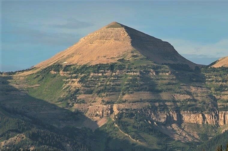 Hodges PeakSummit · ~21 min drivePhoto: Intermountain Forest Service, USDA Region 4 Photography, Public domain (via Wikimedia Commons)
Best time to visit Bacon Creek Trail
Best months: June–August. Best months have typical highs of 55–85 °F, lows of 30 °F or warmer (32 °F where the station doesn't record snow), at most one snowy day and no more than 12 wet days.
Jan
26° / -6°
9 wet
Feb
29° / -4°
9 wet
Mar
36° / 5°
10 wet
Apr
43° / 16°
10 wet
May
54° / 26°
11 wet
Jun
64° / 32°
10 wet
Jul
72° / 35°
8 wet
Aug
71° / 34°
9 wet
Sep
62° / 28°
8 wet
Oct
48° / 19°
8 wet
Nov
35° / 6°
9 wet
Dec
25° / -5°
10 wet
Typical high / low (°F) and days with rain or snow, 1991–2020. Measured at Darwin Rch, WY, 4.2 mi away at 8,190 ft. The station sits about 900 ft lower than this place, so expect it a little cooler here. This station doesn't record snowfall. Source: NOAA NCEI U.S. Climate Normals 1991–2020.
Map and trail data © OpenStreetMap contributors
