Arizona Creek Trail
- 2.2 mi
- round trip
- 1,407 ft
- climb
- 7,655 ft
- high point
- Out and back
- route
- Jun–Aug
- best months
Is Arizona Creek Trail open right now?
Alert in the area
The National Park Service lists 2 alerts for Grand Teton National Park.
Construction in the South End of the Park
Park alert covering Grand Teton National Park · NPS · Grand Teton National Park
Construction on HWY 26/89/191
Park alert covering Grand Teton National Park · NPS · Grand Teton National Park
As of · Source: NPS · Grand Teton National Park. Agencies don't list every closure — check before you go.
Arizona Creek Trail is a 4.4-mile out-and-back hike in Grand Teton National Park in Wyoming, managed by the National Park Service. The trail starts at about 6,858 feet and climbs steadily to a high point of 7,655 feet, with a total elevation gain of 1,407 feet over the round trip. The steepest stretch comes at about 1.4 miles in, where the grade reaches 22 percent. Summer is the most comfortable time to go. Typical averages from a nearby weather station show July highs around 77°F with lows near 38°F, while winter highs stay in the mid-20s. The hike takes about two hours. Bailey Creek lies about 1.4 miles away, and Arizona Meadows Turnout is about 2 miles off. For an overnight stay, Sheffield Campground is roughly 6.9 miles away.
Local outfitters
- Swift Creek Outfitters10 mi away
- The Virginian RV Park37 mi away
Not on Roamze yet. Their page has how to reach them.
 Bailey CreekHikingPhoto: inkknife_2000 (7.5 million views +), CC BY-SA 2.0 (via Wikimedia Commons)1.4 mi
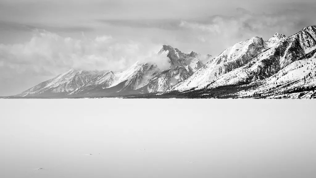 A Patchwork of HabitatsHikingPhoto: Romain Guy from San Francisco, USA — Wikimedia Commons (CC0)2 mi
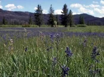 Arizona Meadows TurnoutHikingPhoto: NPS / public domain2 mi
 Webb Canyon TrailHikingPhoto: Don Graham from Redlands, CA, USA - God bless it!, CC BY-SA 2.0 (via Wikimedia Commons)4 mi
- Pilgrim CreekCanoeing5.4 mi
- Sheffield CampgroundCamping6.9 mi
- Moose CreekCanoeing7.3 mi
- Coulter CreekCanoeing9.5 mi
Source: Roamze catalog (indexable pages within 10 miles, PostGIS distance)
- Bailey Creek TrailHiking · ~2 min drivePhoto: inkknife_2000 (7.5 million views +), CC BY-SA 2.0 (via Wikimedia Commons)
- Bailey CreekHiking · ~2 min drivePhoto: inkknife_2000 (7.5 million views +), CC BY-SA 2.0 (via Wikimedia Commons)
- A Patchwork of HabitatsHiking · ~3 min drive
 Grand View Point TrailHiking · ~14 min drivePhoto: inkknife_2000 (7.5 million views +), CC BY-SA 2.0 (via Wikimedia Commons)
- Arizona Meadows TurnoutHiking · ~3 min drive
- Webb Canyon TrailHiking · ~7 min drivePhoto: Don Graham from Redlands, CA, USA - God bless it!, CC BY-SA 2.0 (via Wikimedia Commons)
- Grand Teton North Boundary TurnoutHiking · ~7 min drive
- Glade Creek TrailHiking · ~8 min drive
- Hermitage Point TrailheadHiking · ~12 min drive
 Hermitage Point TrailHiking · ~14 min drivePhoto: inkknife_2000 (7.5 million views +), CC BY-SA 2.0 (via Wikimedia Commons)
Best time to visit Arizona Creek Trail
Best months: June–August. Best months have typical highs of 55–85 °F, lows of 30 °F or warmer (32 °F where the station doesn't record snow), at most one snowy day and no more than 12 wet days.
Jan
26° / 1°
18 wet
Feb
30° / 3°
15 wet
Mar
39° / 11°
15 wet
Apr
45° / 20°
14 wet
May
56° / 28°
13 wet
Jun
66° / 34°
12 wet
Jul
77° / 38°
10 wet
Aug
76° / 35°
9 wet
Sep
66° / 28°
9 wet
Oct
51° / 21°
10 wet
Nov
35° / 11°
15 wet
Dec
25° / 2°
19 wet
Typical high / low (°F) and days with rain or snow, 1991–2020. Measured at Snake Rvr, WY, 9.4 mi away at 6,882 ft. The station sits about 800 ft lower than this place, so expect it a little cooler here. This station doesn't record snowfall. Source: NOAA NCEI U.S. Climate Normals 1991–2020.
Map and trail data © OpenStreetMap contributors
