U.p. 160
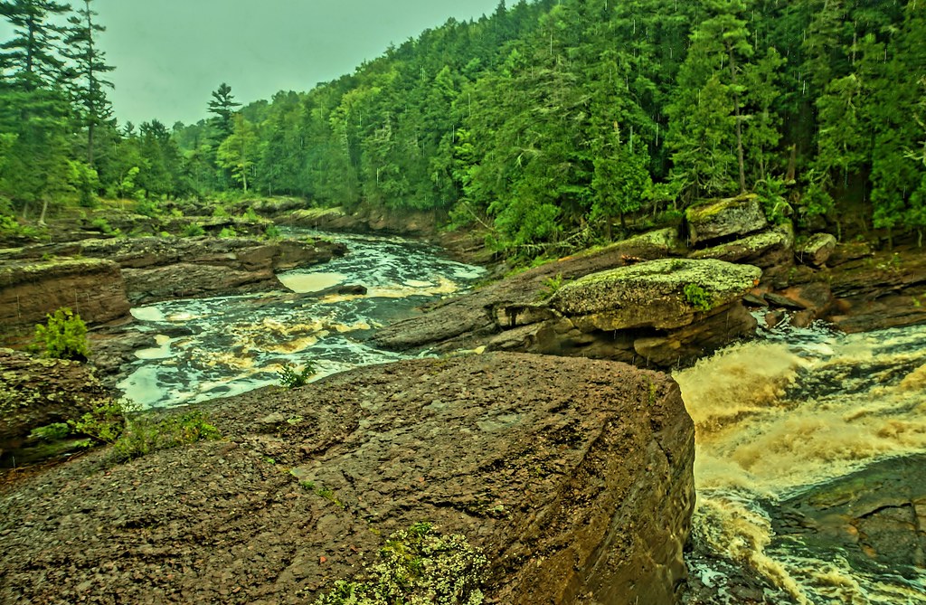
 Photo: Ian Shackleford, CC BY 3.0 (via Wikimedia Commons)
- 2.3 mi
- round trip
- 668 ft
- climb
- 1,023 ft
- high point
- Out and back
- route
- May–Oct
- best months
U.P. 160 is an easy hike in northern Wisconsin, about 3 miles from the town of Saxon. The trail is an out-and-back route that starts and ends at roughly 1,000 feet, with a total climb of about 670 feet over the round trip. The steepest stretch comes early, at about 7% grade, and the trail is roughly 4.6 miles long. Summer is the most comfortable time to go. Typical averages from a nearby weather station in Saxon show July highs around 78°F with lows near 56°F, while winter brings highs in the 20s and regular snow days from December through February. The trail is open to both bikes and horses. Powers Vista Trail lies just 0.1 mile away, and the Uller Trail, Krankkala Spur and Uller Trail - Yellow Loop are all within about 8 miles and are used for cross-country skiing.
- Powers Vista TrailHikingPhoto: Ian Shackleford, CC BY 3.0 (via Wikimedia Commons)0.1 mi
- Uller TrailCross-country skiing7.4 mi
- Krankkala SpurCross-country skiing7.4 mi
- Uller Trail - Yellow LoopCross-country skiing8.2 mi
- Uller Trail - Orange LoopCross-country skiing8.3 mi
- Uller Trail - Blue LoopCross-country skiing8.8 mi
Source: Roamze catalog (indexable pages within 10 miles, PostGIS distance)
 Iron County ForestHiking · ~19 min drivePhoto: Ian Shackleford, CC BY 3.0 (via Wikimedia Commons)
 Potowatomi FallsHiking · ~30 min drivePhoto: chumlee10, CC BY-SA 2.0 (via Flickr)
 Porcupine Mountains State Park - Lake Superior TrailHiking · ~40 min drivePhoto: Curtis Abert, CC BY 2.0 (via Flickr)
- Copper Falls State ParkHiking · ~30 min drive
- North Country National Scenic Trail (Wi)Hiking · ~28 min drive
 BoardwalkHiking · ~39 min drivePhoto: jondejong, CC BY 2.0 (via Flickr)
 North Country Trail_Iron Belle TrailHiking · ~40 min drivePhoto: Curtis Abert, CC BY 2.0 (via Flickr)
- Porcupine Mountains State Park - West River Trail_North Country Trail_Iron Belle TrailHiking · ~39 min drive
- Lagoon Ridge TrailHiking · ~40 min drivePhoto: jondejong, CC BY 2.0 (via Flickr)
- Ironwood to Bessemer State TrailHiking · ~20 min drive
Best time to visit U.P. 160
Best months: May–October. Best months have typical highs of 55–85 °F, lows of 30 °F or warmer (32 °F where the station doesn't record snow), at most one snowy day and no more than 12 wet days.
Jan
21° / 5°
11 wet · 10 snow
Feb
26° / 6°
8 wet · 8 snow
Mar
37° / 16°
8 wet · 6 snow
Apr
49° / 29°
9 wet · 3 snow
May
64° / 41°
10 wet · 1 snow
Jun
73° / 51°
11 wet
Jul
78° / 56°
10 wet
Aug
76° / 55°
9 wet
Sep
68° / 48°
10 wet
Oct
55° / 36°
11 wet · 1 snow
Nov
39° / 25°
10 wet · 5 snow
Dec
27° / 12°
11 wet · 9 snow
Typical high / low (°F) and days with rain or snow, 1991–2020. Measured at Saxon 1wsw, WI, 4.2 mi away at 1,165 ft. Source: NOAA NCEI U.S. Climate Normals 1991–2020.
