Powers Vista Trail
7.77-mile out-and-back hike in Wisconsin with 797 ft elevation gain.
 Photo: Ian Shackleford, CC BY 3.0 (via Wikimedia Commons)
- 7.8 mi
- round trip
- 1,191 ft
- climb
- 1,317 ft
- high point
- Out and back
- route
Best time to visit Powers Vista Trail
Best months: May–October. Best months have typical highs of 55–85 °F, lows of 30 °F or warmer (32 °F where the station doesn't record snow), at most one snowy day and no more than 12 wet days.
Jan
21° / 5°
11 wet · 10 snow
Feb
26° / 6°
8 wet · 8 snow
Mar
37° / 16°
8 wet · 6 snow
Apr
49° / 29°
9 wet · 3 snow
May
64° / 41°
10 wet · 1 snow
Jun
73° / 51°
11 wet
Jul
78° / 56°
10 wet
Aug
76° / 55°
9 wet
Sep
68° / 48°
10 wet
Oct
55° / 36°
11 wet · 1 snow
Nov
39° / 25°
10 wet · 5 snow
Dec
27° / 12°
11 wet · 9 snow
Typical high / low (°F) and days with rain or snow, 1991–2020. Measured at Saxon 1wsw, WI, 4.2 mi away at 1,165 ft. Source: NOAA NCEI U.S. Climate Normals 1991–2020.
Powers Vista Trail is a 7.77-mile moderate hike in northern Wisconsin, about 3 miles from the town of Saxon. The trail is an out-and-back route that reaches a high point of 1,317 feet, with a total climb of 1,191 feet over the round trip. The steepest stretch comes at about 4.8 miles, where the grade reaches 11 percent. Summer is the most comfortable time to go. Typical averages from a nearby weather station in Saxon show July highs around 78°F with lows near 56°F, while winter brings highs in the low 20s and regular snow days from December through February. The trail is open to both bikes and horses. U.P. 160 starts just 0.1 mile away. For winter visits, the Uller Trail and Krankkala Spur are about 7 miles off, and the Uller Trail - Yellow Loop is roughly 8 miles away.
Keep exploring — more trails worth the drive
 Photo: Ian Shackleford, CC BY 3.0 (via Wikimedia Commons)
Iron County Forest
~19 min drive
9.91-mile out-and-back trail in Iron County Forest, Wisconsin with 973 ft elevation gain.
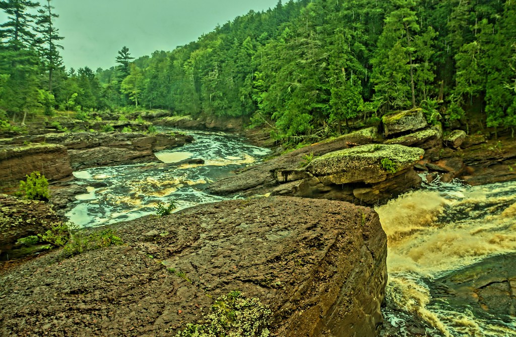 Photo: chumlee10, CC BY-SA 2.0 (via Flickr)
Potowatomi Falls
~30 min drive
Easy out-and-back trail to a scenic waterfall in Michigan's UP.
 Photo: Curtis Abert, CC BY 2.0 (via Flickr)
Porcupine Mountains State Park - Lake Superior Trail
~40 min drive
10.81-mile out-and-back hike in Porcupine Mountains State Park, Michigan with 705 ft gain
Copper Falls State Park
~30 min drive
4.94-mile out-and-back trail in Wisconsin with 646 ft gain.
North Country National Scenic Trail (Wi)
~28 min drive
209-mile point-to-point Wisconsin section of the national scenic trail.
Photo: chumlee10, CC BY-SA 2.0 (via Flickr)Sandstone Falls
~31 min drive
0.37-mile out-and-back trail to Sandstone Falls in Michigan.
 Photo: Curtis Abert, CC BY 2.0 (via Flickr)
North Country Trail_Iron Belle Trail
~40 min drive
14.47-mile out-and-back trail in Michigan with 1,112 ft elevation gain
Porcupine Mountains State Park - West River Trail_North Country Trail_Iron Belle Trail
~39 min drive
5.51-mile out-and-back trail in Michigan with 564 ft gain and 999 ft max elevation.
 Photo: jondejong, CC BY 2.0 (via Flickr)
Boardwalk
~39 min drive
1.51-mile point-to-point trail in Minnesota with 154 ft elevation loss.
Ironwood to Bessemer State Trail
~20 min drive
11.70-mile out-and-back trail from Ironwood to Bessemer in Michigan with 255 ft of elevation gain.
Route details
- Distance
- 7.8 mi round trip
- Climbing
- About 1,191 ft
- Summit
- 1,319 ft
- Difficulty
- Moderate
- Time
- About 3 hours
Questions about this route
How long is the Powers Vista Trail on Bald Mountain?
About 7.8 mi round trip.
How much elevation gain is on the Powers Vista Trail?
About 1,191 ft of climbing round trip.
How hard is the Powers Vista Trail?
It is rated moderate.
How long does the Powers Vista Trail take?
About 3 hours round trip.
Conditions and forecast on Bald Mountain
Daily highs and lows, wind and the chance of precipitation at the summit and route start for the next 7 days, from the Open-Meteo model.
