Sandstone Falls
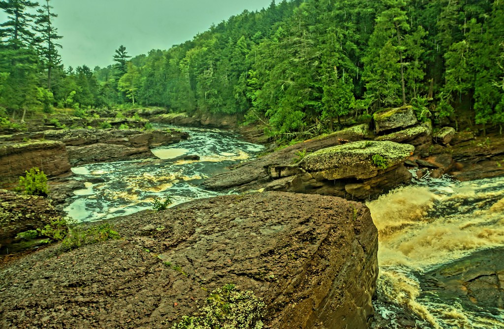 Photo: chumlee10, CC BY-SA 2.0 (via Flickr)
- 0.4 mi
- round trip
- 389 ft
- climb
- 881 ft
- high point
- Out and back
- route
- May–Sep
- best months
Is Sandstone Falls open right now?
Closure in the area
There's a closure order in Ottawa National Forest. It doesn't name Sandstone Falls, so check the source for the area it covers.
Temporary Road Closures
Agency closure covering Ottawa National Forest · Order 09-07-00-26-01 · USFS · Ottawa National Forest
Spring Road Conditions
Agency alert covering Ottawa National Forest · USFS · Ottawa National Forest
Unmanned Aircraft Systems (UAS)
Agency alert covering Ottawa National Forest · USFS · Ottawa National Forest
As of · Source: USFS · Ottawa National Forest. Agencies don't list every closure — check before you go.
Sandstone Falls is a short, easy out-and-back hike in Michigan's Ottawa National Forest, within the Bessemer Ranger District. The trail is about 0.37 miles long, with a total elevation gain of 389 feet, and it reaches a high point of 881 feet. The route is natural-surfaced and open to both horses and bikes, and it is not an accessible trail. Summer is the most comfortable time to visit. Typical July averages from a nearby weather station in Ironwood run to a high of 77°F and a low of 55°F, and the trail is open year-round. Potowatomi Falls and the Black River, both about 0.8 miles away, make good additions to a visit. Black River Harbor Campground and Black River Harbor Pavilion are about 1.4 miles off.
Best time to go · May–Sep
Best time to visit Sandstone Falls
Best months: May–September. Best months have typical highs of 55–85 °F, lows of 30 °F or warmer (32 °F where the station doesn't record snow), at most one snowy day and no more than 12 wet days.
Jan
20° / 2°
Feb
26° / 4°
Mar
37° / 14°
Apr
49° / 27°
May
64° / 40°
Jun
73° / 50°
Jul
77° / 55°
Aug
76° / 52°
Sep
68° / 46°
Oct
53° / 34°
Nov
38° / 23°
Dec
26° / 11°
Typical high / low (°F) and days with rain or snow, 1991–2020. Measured at Ironwood #2, MI, 13.4 mi away at 1,520 ft. The station sits about 600 ft higher than this place, so expect it a little warmer here. This station doesn't record snowfall. Source: NOAA NCEI U.S. Climate Normals 1991–2020.
Keep exploring — more trails worth the drive
Photo: chumlee10, CC BY-SA 2.0 (via Flickr)Potowatomi Falls
~1 min drive
Easy out-and-back trail to a scenic waterfall in Michigan's UP.
 Photo: Curtis Abert, CC BY 2.0 (via Flickr)
North Country Trail_Iron Belle Trail
~9 min drive
14.47-mile out-and-back trail in Michigan with 1,112 ft elevation gain
 Photo: Curtis Abert, CC BY 2.0 (via Flickr)
Big Carp River Trail
~19 min drive
8.5-mile out-and-back hike on Big Carp River Trail in Michigan with 1,016 ft gain.
 Photo: Ian Shackleford, CC BY 3.0 (via Wikimedia Commons)
Iron County Forest
~48 min drive
9.91-mile out-and-back trail in Iron County Forest, Wisconsin with 973 ft elevation gain.
HIKE
Wolf Mountain
~34 min drive
0.7-mile out-and-back trail at Wolf Mountain in Michigan with 239 ft of elevation gain.
 Photo: Curtis Abert, CC BY 2.0 (via Flickr)
Porcupine Mountains State Park - Nature Trail
~13 min drive
0.34-mile out-and-back trail in Porcupine Mountains State Park, Michigan.
 Photo: Curtis Abert, CC BY 2.0 (via Flickr)
Porcupine Mountains State Park - Lake Superior Trail
~9 min drive
10.81-mile out-and-back hike in Porcupine Mountains State Park, Michigan with 705 ft gain
 Photo: Ian Shackleford, CC BY 3.0 (via Wikimedia Commons)
Powers Vista Trail
~31 min drive
7.77-mile out-and-back hike in Wisconsin with 797 ft elevation gain.
HIKE
Ottawa National Forest
~49 min drive
24.73-mile out-and-back trail in Ottawa National Forest, Michigan with 3,782 ft elevation gain.
 Photo: Jim Sorbie, CC BY 2.0 (via Flickr)
Porcupine Mountains State Park - Pinkerton Trail
~15 min drive
Pinkerton Trail is a 2.43-mile out-and-back hike in Porcupine Mountains State Park, Michigan.

