Blaisdell Hwt
- 2.7 mi
- loop
- 21 ft
- climb
- 1,438 ft
- high point
- Loop
- route
- May–Sep
- best months
Is Blaisdell Hwt open right now?
Closure in the area
There's a closure order in Chequamegon-Nicolet National Forest. It doesn't name Blaisdell Hwt, so check the source for the area it covers (2 listed).
Forest Lodge Occupancy and Use Prohibitions
Agency closure covering Chequamegon-Nicolet National Forest · Order 09-13-00-26-02 · USFS · Chequamegon-Nicolet National Forest
Forest Order 09-13-25-02 General Occupancy and Use Restrictions
Agency closure covering Chequamegon-Nicolet National Forest · Order 09-13-25-02 · USFS · Chequamegon-Nicolet National Forest
As of · Source: USFS · Chequamegon-Nicolet National Forest. Agencies don't list every closure — check before you go.
Blaisdell Hwt is an easy hike of about 2.7 miles in the Great Divide Ranger District of the Chequamegon-Nicolet National Forest in Wisconsin. The Forest Service manages the land, and the route gains about 21 feet in elevation, with the high point at 1,438 feet and the low at 1,402 feet. The trail is on natural ground, and it is open from May 1 through November 30, which makes it a year-round option except in the depths of winter. Summer is the most comfortable time to go. Typical averages from a nearby weather station in Winter, WI, put July highs around 78°F with lows near 55°F, while January highs average only 20°F and snow falls on about nine days that month. The trail is accessible to horses and bikes. It is not an accessible trail, so plan accordingly if you need mobility equipment. The Camp Loretta Connector lies about 1.6 miles away. Dead Horse Run is roughly 4.8 miles off. For camping, Black Lake and Moose Lake are both within about 10 miles.
- Camp Loretta ConnectorHiking1.6 mi
- Dead Horse RunHiking4.8 mi
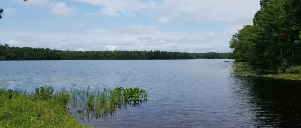 Black LakeCampingPhoto: Recreation.gov (RIDB) / public domain4.9 mi
 Moose LakeCampingPhoto: Recreation.gov (RIDB) / public domain9.4 mi
 Chippewa RiverCanoeingPhoto: Tim Kiser (w:User:Malepheasant), CC BY-SA 3.0 us (via Wikimedia Commons)9.9 mi
Source: Roamze catalog (indexable pages within 10 miles, PostGIS distance)
- Camp Loretta ConnectorHiking · ~3 min drive
- Dead Horse RunHiking · ~8 min drive
- Two Axe HwtHiking · ~17 min drive
- Black LakeHiking · ~9 min drive
- Little Moose River HwtHiking · ~21 min drive
- Dead Horse Run "D"Hiking · ~19 min drive
- Sanguine S HwtHiking · ~19 min drive
- Rock Lake BikeHiking · ~39 min drive
- Little Moos River HwtHiking · ~20 min drive
- Ghost Creek HwtHiking · ~28 min drive
Best time to visit Blaisdell Hwt
Best months: May–September. Best months have typical highs of 55–85 °F, lows of 30 °F or warmer (32 °F where the station doesn't record snow), at most one snowy day and no more than 12 wet days.
Jan
20° / 2°
9 wet · 9 snow
Feb
26° / 5°
7 wet · 7 snow
Mar
38° / 18°
8 wet · 5 snow
Apr
51° / 30°
10 wet · 2 snow
May
65° / 42°
12 wet
Jun
74° / 51°
12 wet
Jul
78° / 55°
11 wet
Aug
76° / 54°
10 wet
Sep
68° / 46°
11 wet
Oct
54° / 35°
11 wet · 1 snow
Nov
38° / 23°
9 wet · 5 snow
Dec
25° / 10°
10 wet · 9 snow
Typical high / low (°F) and days with rain or snow, 1991–2020. Measured at Winter, WI, 10.3 mi away at 1,355 ft. Source: NOAA NCEI U.S. Climate Normals 1991–2020.
