Green Mountain
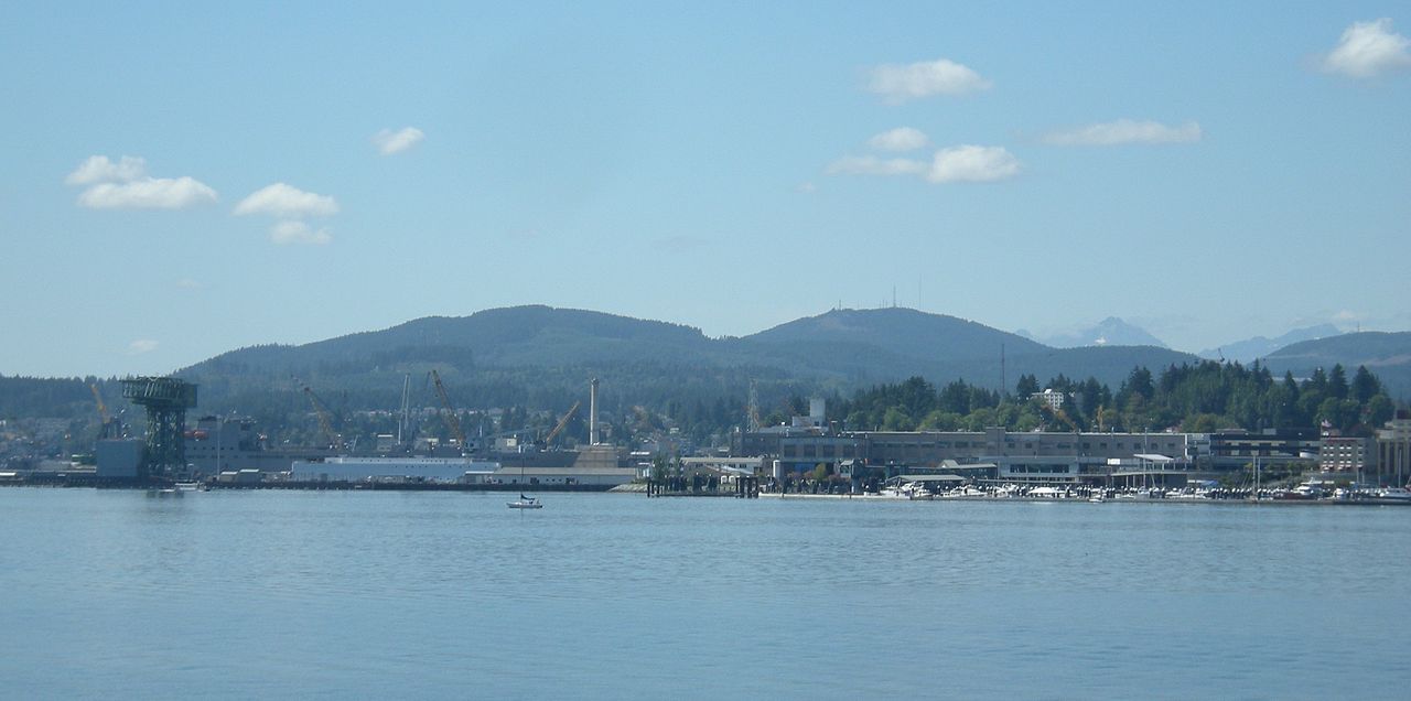 Photo: Joe Mabel, CC BY-SA 3.0 (via Wikimedia Commons)
- 1,707 ft
- summit
- 1
- way up
- Jun–Sep
- best months
Green Mountain is a summit in Washington, rising to 1,707 feet about 4.5 miles from the town of Bremerton. It sits in a cluster of trails and climbing, with several routes starting within a few tenths of a mile. Summer is the most comfortable time to visit. Typical averages from a nearby weather station in Bremerton show July and August highs around 77°F with only about six wet days a month, while winter brings highs in the mid-40s and rain on most days. That station sits well below the summit, so temperatures on top run cooler. The Vista Trail and Beaver Pond Trail both start about 0.3 miles away, and the Eagle Rock (a.k.a. School Rock) climbing area is the same distance off. Mountain bikers can head to the Wildcat Trail, about 0.4 miles away.
Conditions and forecast
Daily highs and lows, wind and the chance of precipitation at the summit and route start for the next 7 days, from the Open-Meteo model.
- Summit elevation
- 1,707 ft
Elevation from USGS 3D Elevation Program terrain data (about 10 m resolution).
Map © Mapbox © OpenStreetMap contributors Questions about Green Mountain
How tall is Green Mountain?
1,707 ft (520 m).
How many routes go to the summit of Green Mountain?
One: Vista Trail.
 Mount Jupiter5,692 ft · Washington1 route15 mi awayPhoto: Ron Clausen, CC BY-SA 4.0 (via Wikimedia Commons)
- Mount Walker2,806 ft · Washington2 routes16 mi away
 Mount Washington6,240 ft · Washington1 route21 mi awayPhoto: Gregg M. Erickson (talk · contribs), CC BY 3.0 (via Wikimedia Commons)
- Mount Ellinor5,939 ft · Washington1 route21 mi awayPhoto: Gregg M. Erickson (talk · contribs), CC BY 3.0 (via Wikimedia Commons)
- Mount Rose4,290 ft · Washington1 route23 mi away
 Mount Townsend6,279 ft · Washington1 route24 mi awayPhoto: Dan Ust, CC BY-SA 4.0 (via Wikimedia Commons)
- Vista TrailHiking0.3 mi
- Beaver Pond TrailHiking0.3 mi
- Eagle Rock (a.k.a School Rock)Rock climbing0.3 mi
- Wildcat TrailMountain biking0.4 mi
- Plummer TrailMountain biking0.5 mi
- GM-6Mountain biking0.6 mi
- Tahuya River Horse CampCamping9.1 mi
 Tahuya RiverCanoeingPhoto: Taylordw, CC BY-SA 4.0 (via Wikimedia Commons)9.2 mi
Source: Roamze catalog (indexable pages within 10 miles, PostGIS distance)
- Gold MountainSummit · ~2 min drivePhoto: Joe Mabel, CC BY-SA 3.0 (via Wikimedia Commons)
- Mount JupiterSummit · ~26 min drivePhoto: Ron Clausen, CC BY-SA 4.0 (via Wikimedia Commons)
 The BrothersSummit · ~29 min drivePhoto: Stevekuo, CC BY-SA 3.0 (via Wikimedia Commons)
 Mount ConstanceSummit · ~36 min drivePhoto: BlueCanoe, CC BY-SA 3.0 (via Wikimedia Commons)
- Mount EllinorSummit · ~37 min drivePhoto: Gregg M. Erickson (talk · contribs), CC BY 3.0 (via Wikimedia Commons)
 Warrior PeakSummit · ~37 min drivePhoto: National Park Service, Public domain (via Wikimedia Commons)
 Mount StoneSummit · ~37 min drivePhoto: CC BY-SA 4.0 (via Wikimedia Commons)
 Mount SkokomishSummit · ~39 min drivePhoto: Ron Clausen, CC BY-SA 4.0 (via Wikimedia Commons)
 Buckhorn MountainSummit · ~40 min drivePhoto: BlueCanoe at English Wikipedia, CC BY-SA 2.5 (via Wikimedia Commons)
 Mount LaCrosseSummit · ~43 min drivePhoto: Kirk, Ruth W. National Park Service, Public domain (via Wikimedia Commons)
Best time to visit Green Mountain
Best months: June–September. Best months have typical highs of 55–85 °F, lows of 30 °F or warmer (32 °F where the station doesn't record snow), at most one snowy day and no more than 12 wet days.
Jan
47° / 36°
19 wet
Feb
49° / 35°
16 wet
Mar
54° / 38°
19 wet
Apr
59° / 41°
16 wet
May
66° / 46°
13 wet
Jun
70° / 51°
10 wet
Jul
77° / 55°
6 wet
Aug
77° / 55°
6 wet
Sep
72° / 51°
9 wet
Oct
61° / 45°
15 wet
Nov
51° / 39°
18 wet
Dec
46° / 35°
20 wet
Typical high / low (°F) and days with rain or snow, 1991–2020. Measured at Bremerton, WA, 5.9 mi away at 110 ft. The station sits about 1,600 ft lower than this place, so expect it a little cooler here. Source: NOAA NCEI U.S. Climate Normals 1991–2020.
