Thomas Lake Campsites
Campground
Campground · 3.5 mi from the trail
Alert in the area
The Forest Service lists 6 alerts for Gifford Pinchot National Forest.
Fire Restrictions
Agency alert covering Gifford Pinchot National Forest · USFS · Gifford Pinchot National Forest
Seasonal Road Closures
Agency alert covering Gifford Pinchot National Forest · USFS · Gifford Pinchot National Forest
Road Repairs & Road Closures in 2026
Agency alert covering Gifford Pinchot National Forest · USFS · Gifford Pinchot National Forest
Washout on Forest Road 93
Agency alert covering Gifford Pinchot National Forest · USFS · Gifford Pinchot National Forest
Upper State Route 504 closed at milepost 45.2 due to large slide
Agency alert covering Gifford Pinchot National Forest · USFS · Gifford Pinchot National Forest
As of · Source: USFS · Gifford Pinchot National Forest. Agencies don't list every closure — check before you go.
Snofoot Trail #148C is a short, easy cross-country ski route in Washington's Mount St. Helens National Volcanic Monument, within the Gifford Pinchot National Forest. The Forest Service manages the land, and the trail is an out-and-back that covers about a mile, with a total elevation gain of 118 feet from the low point at 2,857 feet to the high at 2,898 feet. The climb is gentle, with the steepest stretch at about 0.44 miles, where the grade reaches 6 percent. The trail is best suited to skiers looking for a brief outing rather than a long day on the snow. Winter is the natural season for this route. Typical averages from a nearby weather station show January highs around 39°F and lows near 26°F, while July and August average highs of 84°F. That station sits well below the trail, so temperatures on the route run cooler. Several other routes start close by. Ski Loops West and the Hard Time Loop are each about 0.1 mile away, and the Winding Trail is about 0.4 mile off. For paddling, Rush Creek is about 2.2 miles away.
Thomas Lake Campsites
Campground
Trout Lake Hall
Restaurant
Carson Art Garage
Gallery
Places © OpenStreetMap contributors
More in Trout LakeSource: Roamze catalog (indexable pages within 10 miles, PostGIS distance)
Also worth it near here
 Mcclellan Meadows WinterMountain biking · ~2 min drivePhoto: U.S. Forest Service- Pacific Northwest Region, Public domain (via Wikimedia Commons)
 Chenamus LakeHiking · ~8 min drivePhoto: U.S. Forest Service- Pacific Northwest Region, Public domain (via Wikimedia Commons)
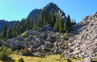 Lemei RockSummit · ~11 min drivePhoto: FizzyUnicorn, CC BY-SA 3.0 (via Wikimedia Commons)
Best months: April–October. Best months have typical highs of 55–85 °F, lows of 30 °F or warmer (32 °F where the station doesn't record snow), at most one snowy day and no more than 12 wet days.
Jan
39° / 26°
Feb
43° / 27°
Mar
49° / 29°
Apr
58° / 33°
May
68° / 40°
Jun
74° / 45°
Jul
84° / 50°
Aug
84° / 49°
Sep
75° / 42°
Oct
60° / 35°
Nov
45° / 30°
Dec
37° / 25°
Typical high / low (°F) and days with rain or snow, 1991–2020. Measured at Mt Adams Rs, WA, 17.3 mi away at 1,950 ft. The station sits about 900 ft lower than this place, so expect it a little cooler here. This station doesn't record snowfall. Source: NOAA NCEI U.S. Climate Normals 1991–2020.
Map and trail data © OpenStreetMap contributors
