Middle Fork Campground
Campground
Campground · 1.6 mi from the trail
Closure in the area
There's a closure order in Mt. Baker-Snoqualmie National Forest. It doesn't name Quartz Mountain, so check the source for the area it covers (3 listed).
Grand Park 2 Fire Closure Update
Agency closure covering Mt. Baker-Snoqualmie National Forest · Order 06-05-26-16 · USFS · Mt. Baker-Snoqualmie National Forest
Grand Park 2 Fire Closure
Agency closure covering Snoqualmie Ranger District · Order 06-05-26-13 · USFS · Snoqualmie Ranger District
Bell Creek Bridge Damaged
Agency closure covering Mt. Baker-Snoqualmie National Forest · USFS · Mt. Baker-Snoqualmie National Forest
Rescission of Shooting Restrictions
Agency alert covering Mt. Baker-Snoqualmie National Forest · USFS · Mt. Baker-Snoqualmie National Forest
Electric Fire Closure Order
Agency alert covering Mt. Baker-Snoqualmie National Forest · Order 06-05-26-19 · USFS · Mt. Baker-Snoqualmie National Forest
As of · Source: USFS · Mt. Baker-Snoqualmie National Forest. Agencies don't list every closure — check before you go.
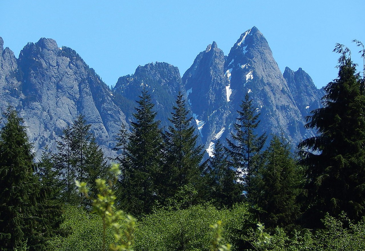
Quartz Mountain is a Washington climbing destination offering rock climbing on quartz-based formations. The crag provides a variety of climbing experiences suited to different skill levels and styles. Its unique geology and setting make it a distinctive option for climbers exploring Washington's diverse climbing areas.
Middle Fork Campground
Campground
 If it rainsShakespeare at English Wikipedia, CC BY-SA 3.0 · Wikimedia Commons
Railway station in Snoqualmie, the United States of America
Places © OpenStreetMap contributors · Photos: Shakespeare at English Wikipedia, CC BY-SA 3.0 (commons)
More in Gold BarBest months: July–August. Best months have typical highs of 55–85 °F, lows of 30 °F or warmer (32 °F where the station doesn't record snow), at most one snowy day and no more than 12 wet days.
Jan
41° / 33°
22 wet · 5 snow
Feb
43° / 33°
19 wet · 4 snow
Mar
46° / 34°
23 wet · 4 snow
Apr
52° / 37°
21 wet · 2 snow
May
61° / 43°
18 wet
Jun
65° / 49°
15 wet
Jul
72° / 54°
10 wet
Aug
72° / 54°
9 wet
Sep
66° / 50°
13 wet
Oct
55° / 43°
18 wet
Nov
45° / 36°
21 wet · 2 snow
Dec
40° / 32°
22 wet · 4 snow
Typical high / low (°F) and days with rain or snow, 1991–2020. Measured at Tolt S Fk Rsvr, WA, 11.2 mi away at 2,000 ft. The station sits about 1,100 ft lower than this place, so expect it a little cooler here. Source: NOAA NCEI U.S. Climate Normals 1991–2020.
Campfire Ban in Effect Forest-wide
Mt. Baker-Snoqualmie National Forest · Order dated July 21, 2026; seen Aug 23, 2026 → lifted Sep 15, 2026 · Forest Service
No routes catalogued here yet
We have this crag's location and access details, but not its individual climbs. Routes appear here as our sources add them.
The map shows other climbing nearby, or browse more crags.
 Photo: Wilderness trespasser, CC BY-SA 4.0 (via Wikimedia Commons)
Chair Peak
~15 min drive
Scenic Washington climbing with solid rock and varied pitches.
 Photo: bgreenlee, CC BY 2.0 (via Flickr)
(c) Slabbage Patch
~16 min drive
Slabbage Patch in Washington has 6 sport climbing routes across 3 difficulty grades.
Photo: bgreenlee, CC BY 2.0 (via Flickr)(b) Motherland
~16 min drive
(b) Motherland is a Washington climbing area with 13 sport routes on 7 difficulty grades.
 Photo: bgreenlee, CC BY 2.0 (via Flickr)
Overhaul Area
~16 min drive
Overhaul Area in Washington has 2 sport climbing routes.
Photo: bgreenlee, CC BY 2.0 (via Flickr)Rhino Boulders
~16 min drive
Rhino Boulders in Washington has 5 bouldering routes across 4 grades.
Photo: bgreenlee, CC BY 2.0 (via Flickr)The Bow Boulder
~16 min drive
Bow Boulder, The in Washington has 8 bouldering routes rated on 4 difficulty grades.
CLIMB
West Quartz Camp
~1 min drive
Quartz climbing in Washington with varied routes for multiple skill levels.
CLIMB
Quartz Camp
~1 min drive
Washington quartz climbing with varied routes for multiple skill levels.
CLIMB
East Quartz Camp
~1 min drive
Quartz climbing in Washington with varied routes for multiple skill levels.
CLIMB
Golden Hour Wall
~2 min drive
Washington climbing crag with varied routes and accessible terrain.
Map and trail data © OpenStreetMap contributors