Foggy Dew Campground
Campground
Campground · 3.5 mi from the trail
Caution today
Agency alerts are in effect for this area; weather is good · USFS, OpenWeather · checked just now
Closure in the area
There's a closure order in Okanogan-Wenatchee National Forest. It doesn't name Gold Creek, so check the source for the area it covers (3 listed).
Little Giant Fire Closure Superseding
Agency closure covering Okanogan-Wenatchee National Forest · Order 06-17-07-2026-48 · USFS · Okanogan-Wenatchee National Forest
Railroad and Preston Creek Road Closure
Agency closure covering Okanogan-Wenatchee National Forest · Order 06-17-05-26-04 · USFS · Okanogan-Wenatchee National Forest
MVRD Storm Damaged Roads
Agency closure covering Methow Valley Ranger District · Order 06-17-04-26-09 · USFS · Methow Valley Ranger District
Cle Elum River Restoration Area Closure on the Cle Elum Ranger District
Agency alert covering Okanogan-Wenatchee National Forest · USFS · Okanogan-Wenatchee National Forest
Storm Damaged Roads Closure on Methow Valley District
Agency alert covering Methow Valley Ranger District · Order 06-17-04-26-18 · USFS · Methow Valley Ranger District
As of · Source: USFS · Okanogan-Wenatchee National Forest. Agencies don't list every closure — check before you go.
Gold Creek is a 3.4-mile paddling stretch near Carlton, Washington, within the Methow Valley Ranger District of the Okanogan-Wenatchee National Forest. The creek flows year-round, with USGS models estimating an average flow of about 44 cubic feet per second and a gradient of about 132.5 feet per mile. For comfortable paddling, late spring and early fall are the sweet spots. Typical averages from a nearby weather station show May highs around 73°F and September highs around 79°F, while July and August climb to the upper 80s. North Fork Gold Creek is a hike about 2.5 miles away, and Foggy Dew Campground is about 3.5 miles off. Bryan Butte Trail lies about 4.6 miles away, and Crater Creek Campground is roughly 6.9 miles from the creek.
Foggy Dew Campground
Campground
Methow Valley Interpretive Center
Museum
Places © OpenStreetMap contributors, Places © Overture Maps Foundation
More in WinthropNot on Roamze yet. Their page has how to reach them.
Source: Roamze catalog (indexable pages within 10 miles, PostGIS distance)
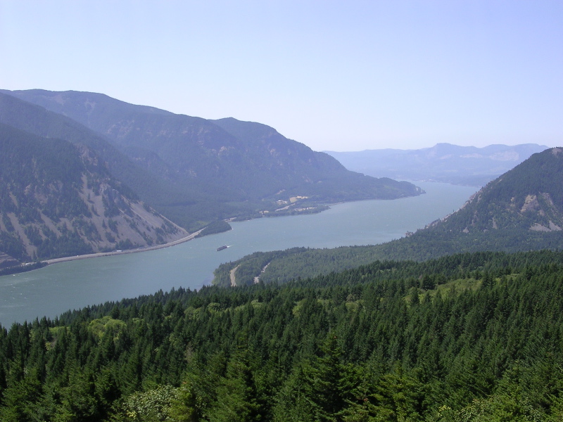 Columbia RiverCanoeing · ~35 min drivePhoto: The original uploader was Cacophony at English Wikipedia., CC BY-SA 3.0 (via Wikimedia Commons)
 Stehekin RiverCanoeing · ~1h 2m drivePhoto: Orygun, CC BY 3.0 (via Wikimedia Commons)
 Agnes CreekCanoeing · ~1h 3m drivePhoto: NPS Staff, Public domain (via Wikimedia Commons)
 Methow RiverCanoeing · ~1h 6m drivePhoto: Benjamin Cody, CC BY-SA 3.0 (via Wikimedia Commons)
 Suiattle RiverCanoeing · ~1h 13m drivePhoto: Jason Hollinger, CC BY 2.0 (via Wikimedia Commons)
Best months: April–June and September–October. Best months have typical highs of 55–85 °F, lows of 30 °F or warmer (32 °F where the station doesn't record snow), at most one snowy day and no more than 12 wet days.
Jan
33° / 22°
Feb
40° / 25°
Mar
53° / 32°
Apr
64° / 38°
May
73° / 46°
Jun
80° / 52°
Jul
89° / 57°
Aug
88° / 56°
Sep
79° / 48°
Oct
62° / 38°
Nov
44° / 30°
Dec
32° / 22°
Typical high / low (°F) and days with rain or snow, 1991–2020. Measured at Methow 2 S, WA, 7.8 mi away at 1,135 ft. The station sits about 600 ft lower than this place, so expect it a little cooler here. This station doesn't record snowfall. Source: NOAA NCEI U.S. Climate Normals 1991–2020.
Gold Creek Restoration Project Area Closure on Cle Elum Ranger District
Okanogan-Wenatchee National Forest · Order dated June 23, 2026; seen Aug 23, 2026, no lift recorded · Forest Service
