Maple Creek Loop Trail
- 1.2 mi
- loop
- 465 ft
- climb
- 918 ft
- high point
- Loop
- route
- Jun–Sep
- best months
Clear today
Weather is good · OpenWeather · checked just now
Maple Creek Loop Trail is an easy hike in Maple Creek Park, on county land in Washington, about 1.2 miles long and with a total elevation gain of 465 feet. The route rises from a starting point at about 726 feet to a high point of 918 feet, then descends a little past the top, with the steepest stretch coming around 0.8 miles in at about 13%. Summer is the most comfortable time to go. Typical averages from a nearby weather station in Clearbrook put July and August highs in the mid-70s and wet days in the low single digits, though that station sits well below the trail, so temperatures on the higher ground run cooler. The trip takes about half an hour. The Bay to Baker Trail starts just 0.2 miles away, and Maple Creek offers canoeing about 0.7 miles off. Douglas Fir Campground is about 7.7 miles away.
Local outfitters
- WHATCOM MEADOWS21 mi away
- Lutherwood Camp & Retreat Center24 mi away
Not on Roamze yet. Their page has how to reach them.
- Bay to Baker TrailHiking0.2 mi
- Maple CreekCanoeing0.7 mi
- Campground Connector TrailHiking2.9 mi
- Boulder CreekCanoeing3.2 mi
- Canopy Loop TrailHiking3.3 mi
- Skull TrailHiking4.3 mi
- Hedrick CreekCanoeing5 mi
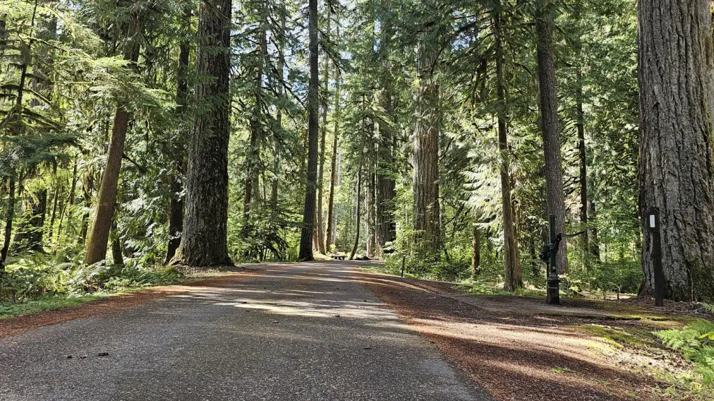 Douglas Fir CampgroundCampingPhoto: Recreation.gov (RIDB) / public domain7.7 mi
Source: Roamze catalog (indexable pages within 10 miles, PostGIS distance)
 Ridge TrailHiking · ~8 min drivePhoto: Melissa Wright, CC BY-SA 3.0 (via Wikimedia Commons)
- The New TrailHiking · ~8 min drivePhoto: Melissa Wright, CC BY-SA 3.0 (via Wikimedia Commons)
- Frosst Creek Falls TrailHiking · ~10 min drive
- Canyon Lake LoopHiking · ~12 min drive
- Church Mountain TrailHiking · ~17 min drive
- Ridge TrailHiking · ~13 min drivePhoto: Melissa Wright, CC BY-SA 3.0 (via Wikimedia Commons)
- Bay to Baker TrailHiking · Next door
- Lakeside TrailHiking · ~18 min drive
- Skyline Divide TrailHiking · ~17 min drive
 Deadhorse Camp TrailHiking · ~20 min drivePhoto: Walter Siegmund, CC BY 2.5 (via Wikimedia Commons)
Best time to visit Maple Creek Loop Trail
Best months: June–September. Best months have typical highs of 55–85 °F, lows of 30 °F or warmer (32 °F where the station doesn't record snow), at most one snowy day and no more than 12 wet days.
Jan
43° / 32°
18 wet
Feb
48° / 33°
16 wet
Mar
53° / 36°
18 wet
Apr
59° / 39°
16 wet
May
66° / 45°
13 wet
Jun
70° / 49°
11 wet
Jul
76° / 51°
7 wet
Aug
77° / 50°
6 wet
Sep
71° / 47°
10 wet
Oct
59° / 42°
15 wet
Nov
49° / 36°
19 wet
Dec
43° / 32°
19 wet
Typical high / low (°F) and days with rain or snow, 1991–2020. Measured at Clearbrook, WA, 11.8 mi away at 64 ft. The station sits about 900 ft lower than this place, so expect it a little cooler here. This station doesn't record snowfall. Source: NOAA NCEI U.S. Climate Normals 1991–2020.
Map and trail data © OpenStreetMap contributors
