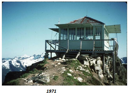
Buck Creek Trail
- 1.1 mi
- round trip
- 1,116 ft
- climb
- 1,852 ft
- high point
- Out and back
- route
- Apr–Oct
- best months
Is Buck Creek Trail open right now?
Closure in the area
There's a closure order in Darrington Ranger District. It doesn't name Buck Creek Trail, so check the source for the area it covers (4 listed).
Miners Fire Closure
Agency closure covering Darrington Ranger District · Order 06-05-26-17 · USFS · Darrington Ranger District
Miner’s Fire Closure Order
Agency closure covering Darrington Ranger District · USFS · Darrington Ranger District
Grand Park 2 Fire Closure Update
Agency closure covering Mt. Baker-Snoqualmie National Forest · Order 06-05-26-16 · USFS · Mt. Baker-Snoqualmie National Forest
Bell Creek Bridge Damaged
Agency closure covering Mt. Baker-Snoqualmie National Forest · USFS · Mt. Baker-Snoqualmie National Forest
Rescission of Shooting Restrictions
Agency alert covering Mt. Baker-Snoqualmie National Forest · USFS · Mt. Baker-Snoqualmie National Forest
As of · Source: USFS · Darrington Ranger District. Agencies don't list every closure — check before you go.
Buck Creek Trail is a short, moderate hike in the Darrington Ranger District of Mt. Baker-Snoqualmie National Forest, managed by the Forest Service. It runs about 1.1 miles one way, an out-and-back of roughly 2.1 miles round trip. The route starts at about 1,340 feet and tops out near 1,850 feet. The climb is about 800 feet one way, or about 1,100 feet of gain over the full round trip. Most of the work comes early. The steepest pitch, around 20 percent, hits about two-thirds of a mile in, so expect a stiff push in the first half before the grade eases toward the high point. The return is the same climb in reverse, all downhill. Summer is the most comfortable time to go. Typical averages from the nearby Darrington weather station show July and August highs near 78 to 79°F, but that station sits about 1,300 feet below the trailhead, so temperatures on the trail run cooler. Buck Creek Campground is just 0.2 miles away, and Suiattle Guard Station is under a mile off. For more hiking, Huckleberry Mountain Trail #780 and Boulder Lake Trail are each within about 3.5 miles.
Local outfitters
- Triangle Recreation Camp18 mi away
- Cascade Views RV Resort34 mi away
Not on Roamze yet. Their page has how to reach them.
 Buck Creek CampgroundCampingPhoto: Recreation.gov (RIDB) / public domain0.2 mi
- Suiattle Guard StationCamping0.8 mi
- Huckleberry Mountain Trail #780Hiking2.9 mi
- Boulder Lake TrailHiking3.4 mi
- BOULDER LAKEHiking3.5 mi
- Buck CreekCanoeing4 mi
- All CreekCanoeing5.1 mi
- White Chuck River Boulders (D-Ton)Rock climbing6.8 mi
Source: Roamze catalog (indexable pages within 10 miles, PostGIS distance)
 FROG LAKEHiking · ~20 min drivePhoto: Leslie Seaton from Seattle, WA, USA, CC BY 2.0 (via Wikimedia Commons)
- OLD SAUK TRAILHiking · ~19 min drivePhoto: Leslie Seaton from Seattle, WA, USA, CC BY 2.0 (via Wikimedia Commons)
- Huckleberry Mountain Trail #780Hiking · ~5 min drive
- BOULDER LAKEHiking · ~6 min drive
- Sulphur Mountain Trail #794Hiking · ~12 min drive
- CIRCLE PEAKHiking · ~7 min drive
- Green Mountain Trail #782Hiking · ~7 min drive
- Old Green Mountain TrailHiking · ~7 min drive
- Round Lake TrailHiking · ~18 min drive
- DOWNEY CREEKHiking · ~9 min drive
Best time to visit Buck Creek Trail
Best months: April–October. Best months have typical highs of 55–85 °F, lows of 30 °F or warmer (32 °F where the station doesn't record snow), at most one snowy day and no more than 12 wet days.
Jan
40° / 30°
Feb
45° / 31°
Mar
51° / 34°
Apr
59° / 38°
May
67° / 44°
Jun
71° / 49°
Jul
78° / 53°
Aug
79° / 54°
Sep
72° / 47°
Oct
58° / 40°
Nov
46° / 35°
Dec
39° / 30°
Typical high / low (°F) and days with rain or snow, 1991–2020. Measured at Darrington Rs, WA, 12.6 mi away at 550 ft. The station sits about 1,300 ft lower than this place, so expect it a little cooler here. This station doesn't record snowfall. Source: NOAA NCEI U.S. Climate Normals 1991–2020.
Closures we've recorded since August 2026
Campfire Ban in Effect Forest-wide
Mt. Baker-Snoqualmie National Forest · Order dated July 21, 2026; seen Aug 23, 2026 → lifted Sep 15, 2026 · Forest Service