The Falls
- 1,256 ft
- elevation
- Mar–Jun, Sep–Nov
- best months
The Falls is a waterfall in Virginia, sitting at about 1,256 feet in elevation roughly 3 miles from the town of Lovingston. It is a simple destination, a waterfall with no trail or climb to plan around, so it works well as a short stop on a day spent exploring the surrounding area. Spring and fall are the most comfortable times to visit. Typical averages from a nearby weather station show October highs around 71°F with lows near 45°F, and April is similar at about 70°F by day and 43°F at night. That station sits several hundred feet lower than the falls, so temperatures at the waterfall run a little cooler. The closest neighbor is the Fortune's Cove Yellow Trail, about a mile away. The Rockfish Valley Birding Trail and the Rockfish River Trail are both a little over 6 miles off. For an overnight stay, Sherando Lake Recreation Area is about 10 miles away.
- Elevation
- 1,256 ft
Elevation from USGS 3D Elevation Program terrain data (about 10 m resolution).
- Fortune's Cove Yellow TrailHiking1 mi
- Rockfish Valley Birding TrailHiking6.2 mi
- Rockfish River TrailHiking6.3 mi
- Piney Hive BoulderRock climbing7.7 mi
- Mossy WallRock climbing7.8 mi
- Trail side boulderingRock climbing8.2 mi
- Sherando Lake Recreation AreaCamping9.7 mi
- Piney RiverCanoeing9.8 mi
Source: Roamze catalog (indexable pages within 10 miles, PostGIS distance)
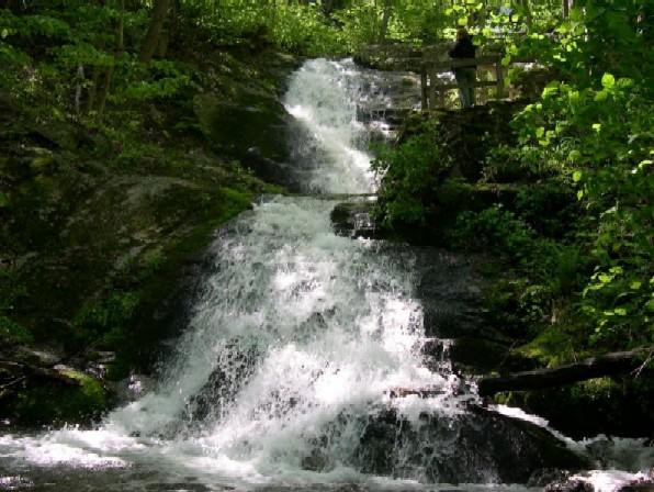 Crabtree FallsWaterfall · ~17 min drivePhoto: Public domain (via Wikimedia Commons)
- Glenn FallsWaterfall · ~31 min drive
- Statons Creek FallsWaterfall · ~32 min drive
- Gibbs FallsWaterfall · ~39 min drive
- Jones Run FallsWaterfall · ~55 min drive
- Apple Orchard FallsWaterfall · ~1h 7m drive
- Cedar FallsWaterfall · ~1h 19m drive
- South River FallsWaterfall · ~1h 20m drive
- Dry Run FallsWaterfall · ~1h 20m drive
- Panther FallsWaterfall · ~37 min drive
Also worth it near here
Best time to visit The Falls
Best months: March–June and September–November. Best months have typical highs of 55–85 °F, lows of 30 °F or warmer (32 °F where the station doesn't record snow), at most one snowy day and no more than 12 wet days.
Jan
48° / 25°
7 wet
Feb
52° / 28°
7 wet
Mar
60° / 34°
8 wet
Apr
70° / 43°
8 wet
May
76° / 52°
9 wet
Jun
84° / 61°
8 wet
Jul
87° / 66°
8 wet
Aug
86° / 64°
8 wet
Sep
80° / 57°
6 wet
Oct
71° / 45°
6 wet
Nov
61° / 35°
6 wet
Dec
51° / 29°
7 wet
Typical high / low (°F) and days with rain or snow, 1991–2020. Measured at Tye Rvr 1 Se, VA, 10.6 mi away at 720 ft. The station sits about 500 ft lower than this place, so expect it a little cooler here. This station doesn't record snowfall. Source: NOAA NCEI U.S. Climate Normals 1991–2020.


