Crabtree Falls Campgound
Campground
Campground · 0.9 mi from the trail
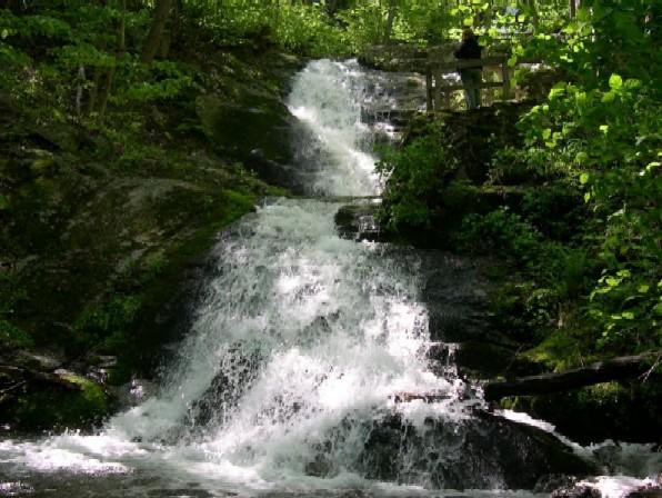 Photo: Public domain (via Wikimedia Commons)
Closure in the area
There's a closure order in George Washington and Jefferson National Forest. It doesn't name Crabtree Falls, so check the source for the area it covers (2 listed).
Enchanted Creek Road (National Forest System Road 1881) will be closed for repairs until 12/31/27
Agency closure covering George Washington and Jefferson National Forest · USFS · George Washington and Jefferson National Forest
Bolar Mountain Recreation Area - Twin Ridge Road Closure
Agency closure covering George Washington and Jefferson National Forest · USFS · George Washington and Jefferson National Forest
Prescribed Fire Operations Mount Rogers National Recreation Area- Porter and Little Mountain
Agency alert covering George Washington and Jefferson National Forest · USFS · George Washington and Jefferson National Forest
Road Closures James River and Warm Springs Ranger District
Agency alert covering George Washington and Jefferson National Forest · USFS · George Washington and Jefferson National Forest
Virginia Creeper National Recreation Trail Closure Update
Agency alert covering George Washington and Jefferson National Forest · USFS · George Washington and Jefferson National Forest
As of · Source: USFS · George Washington and Jefferson National Forest. Agencies don't list every closure — check before you go.
Crabtree Falls is a waterfall in the Glenwood and Pedlar Ranger Districts of the George Washington and Jefferson National Forest in Virginia, about 9 miles from the town of Wintergreen. It sits at roughly 2,700 feet. Late spring and early fall are the most comfortable times to visit. Typical averages from a nearby weather station show May highs around 71°F and September highs around 75°F, with lows near 50°F in both months. Crabtree Meadows, a hike, starts just 0.1 mile away. Pinnacle Ridge and Pirate Crags, two climbing areas, are within a mile. For an overnight stay, Sherando Lake Group Campground is about 6 miles off.
Crabtree Falls Campgound
Campground
 If it rainsCarol M. Highsmith, Public domain · Wikimedia Commons
Stonewall Jackson House
Museum
Places © OpenStreetMap contributors, Places © Overture Maps Foundation · Photos: Carol M. Highsmith, Public domain (commons)
More in StauntonElevation from USGS 3D Elevation Program terrain data (about 10 m resolution).
 Sherando Lake Group CampgroundCampingPhoto: Idawriter, CC BY-SA 3.0 (via Wikimedia Commons)6.1 mi
 Sherando Lake Recreation Area Family CampingCampingPhoto: Recreation.gov (RIDB) / public domain6.3 mi
Source: Roamze catalog (indexable pages within 10 miles, PostGIS distance)
Best months: April–October. Best months have typical highs of 55–85 °F, lows of 30 °F or warmer (32 °F where the station doesn't record snow), at most one snowy day and no more than 12 wet days.
Jan
41° / 19°
Feb
45° / 20°
Mar
52° / 25°
Apr
64° / 36°
May
71° / 46°
Jun
80° / 56°
Jul
83° / 60°
Aug
81° / 58°
Sep
75° / 51°
Oct
65° / 39°
Nov
53° / 29°
Dec
44° / 24°
Typical high / low (°F) and days with rain or snow, 1991–2020. Measured at Montebello Fish Cultural Stn, VA, 3.1 mi away at 2,667 ft. This station doesn't record snowfall. Source: NOAA NCEI U.S. Climate Normals 1991–2020.


